Ruhr Area: Germany's Industrial Heart and Urban Metropolis
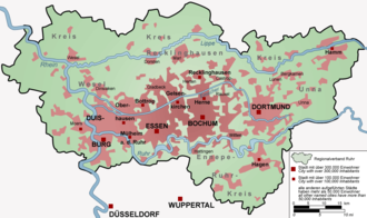
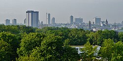
The Ruhr area (known in German as Ruhrgebiet or colloquially as the Ruhrpott) is a massive polycentric urban area located in North Rhine-Westphalia, Germany. As the largest urban area in Germany and the third largest in the European Union, it serves as a powerhouse of industry, education, and culture. The region is defined by its unique geography, bordered by the Ruhr River to the south, the Rhine to the west, and the Lippe to the north.
The Ruhr is a central component of the broader Rhine-Ruhr metropolitan region, which houses over 10 million people, making it the third largest metropolitan area in Western Europe, trailing only London and Paris.
Key Facts
- Population: Over 5 million in the city area; over 10.6 million in the wider metro region (2022).
- Economic Power: Urban GDP reached €180.467 billion in 2021.
- Urban Density: 1,160 people per square kilometer.
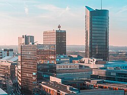
- Major Cities: Dortmund, Essen, and Duisburg are the most populous hubs.
- Education: Highest density of higher education institutions in Germany, with 22 universities and colleges.
Geography and Geological Foundations
The development of the Ruhr area was dictated by its geology. The region is characterized by coal-bearing layers from the upper Carboniferous period. These coal seams reach the surface along the Ruhr River and dip downward toward the north; beneath the Lippe River, these seams are found at depths of 600 to 800 meters. The thickness of these layers, ranging from one to three meters, provided the essential raw materials that fueled the region's industrial ascent.
Historical Evolution
The Industrial Revolution
During the 19th century, the Ruhr underwent a dramatic transformation. Small towns of 2,000 to 5,000 residents exploded into cities of over 100,000. This growth was driven by the recruitment of skilled mineworkers and a massive influx of unskilled labor. From 1860, a significant migration of Polish speakers from Silesia, Pomerania, East Prussia, and Posen occurred, creating a community known as the Ruhrpolen.
By 1870, the region had become Europe's largest industrial zone, with over 3 million residents. Mining firms often constructed "miners' colonies" to house their skilled workforce.
World Wars and Reconstruction
During World War I, the Ruhr served as Germany's primary weapons factory. Companies like F. Krupp A.G. in Essen saw their workforce triple, utilizing women and forced laborers. World War II brought devastation; between 1940 and 1944, bombing raids destroyed 30% of the region's plants and equipment. Dortmund, in particular, suffered a record-breaking raid on March 12, 1945, when over 1,100 aircraft dropped more than 4,800 tons of bombs on the city.
Post-War Economic Shift
The 1973 global economic crisis and soaring oil prices triggered a sharp decline in the Ruhr's traditional industries. As easy-to-reach coal seams were exhausted and cheaper imports from Japan undercut the steel industry, unemployment surged from 300,000 in 1973 to 1.1 million by 1975. This forced the region to pivot toward high-profit specialty items and a service-oriented economy.
Urban Centers and Demographics
The Ruhr is a collection of interconnected cities rather than a single metropolis. From west to east, these include Duisburg, Oberhausen, Bottrop, Mülheim an der Ruhr, Essen, Gelsenkirchen, Bochum, Herne, Witten, Hagen, Dortmund, and Hamm.
| Rank | City | Population | Area (km²) | Density (Pop/km²) |
|---|---|---|---|---|
| 1 | Dortmund | 587,696 | 280.37 | 2,071 |
| 2 | Essen | 582,415 | 210.38 | 2,733 |
| 3 | Duisburg | 495,885 | 232.81 | 2,154 |
| 4 | Bochum | 364,454 | 145.43 | 2,652 |
| 5 | Gelsenkirchen | 259,105 | 104.86 | 2,557 |
| 6 | Oberhausen | 209,566 | 77.04 | 2,841 |
| 7 | Hagen | 188,687 | 160.36 | 1,228 |
| 8 | Hamm | 178,967 | 226.24 | 814 |
| 9 | Mülheim an der Ruhr | 170,921 | 91.28 | 1,872 |
| 10 | Herne | 156,940 | 51.41 | 3,100 |
Culture and Education
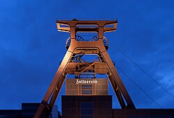
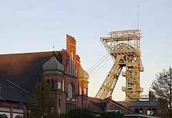
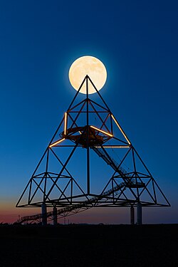
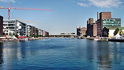
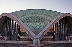
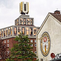
The region has successfully transitioned its industrial heritage into cultural assets. The Zollverein Coal Mine Industrial Complex in Essen is a UNESCO World Heritage site, symbolizing this shift. Other notable landmarks include the Gasometer Oberhausen, the German Mining Museum in Bochum, and the German Football Museum in Dortmund.
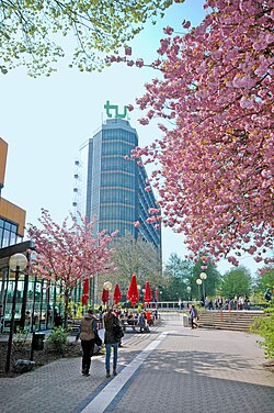
The Ruhr is also a premier educational hub. With 22 universities and colleges and over 250,000 students, it boasts the highest density of higher education institutions in Germany. Key institutions include the Ruhr University Bochum, the University of Duisburg-Essen, and the Technical University of Dortmund.
Infrastructure and Transport
To support its massive population and industrial output, the Ruhr possesses one of Europe's densest motorway networks. The system is organized in a grid with four primary east-west routes (A2, A40, A42, A44) and seven north-south routes (A1, A3, A43, A45, A52, A57, A59). While the A1, A2, and A3 handle through traffic, the remaining autobahns serve regional needs. Air travel is facilitated by Dortmund Airport in the east.
Frequently Asked Questions
What is the Ruhr area?
The Ruhr area is a polycentric urban region in North Rhine-Westphalia, Germany, known for its historical coal mining and steel industries. It is the largest urban area in Germany.
Which are the largest cities in the Ruhr?
The most populous cities are Dortmund, Essen, and Duisburg.
Why is the region called the "Ruhrpott"?
"Ruhrpott" is a colloquial German term for the Ruhrgebiet, reflecting the local identity and the region's industrial heritage.
What is the significance of the Zollverein Coal Mine?
The Zollverein Coal Mine Industrial Complex in Essen is a UNESCO World Heritage Site that represents the region's industrial history and its transition into a cultural landscape.
How is the education system in the Ruhr?
The region has the highest density of higher education establishments in Germany, featuring 22 universities and colleges, including five major universities and 17 universities of applied sciences.