Rocky Mountain National Park: A High-Altitude Wilderness Sanctuary
Established on January 26, 1915, Rocky Mountain National Park is a breathtaking expanse of federal land in Colorado, spanning Larimer, Grand, and Boulder counties. Covering 265,461 acres, the park is a sanctuary of rugged peaks, glacial lakes, and diverse ecosystems. With over 4 million visitors in 2025, it remains one of the most iconic destinations for those seeking the raw beauty of the American West.
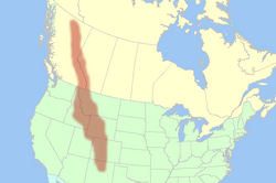
The park's geography is defined by the Continental Divide, which runs north-south through its center. This geological boundary dictates the flow of water across the continent: streams on the western side flow toward the Pacific Ocean, while those on the eastern side head toward the Atlantic. Notably, the headwaters of the Colorado River originate in the park's northwestern region.
Key Facts
- Total Area: 265,461 acres of national park land, with an additional 253,059 acres of adjoining U.S. Forest Service wilderness.
- Elevation Range: From 7,860 feet to 14,259 feet.
- Highest Point: Longs Peak.
- Water Features: Approximately 450 miles of rivers and streams and 150 lakes.
- Infrastructure: 350 miles of trails and the highest continuously paved highway in the U.S., Trail Ridge Road.
Geography and Geological Features
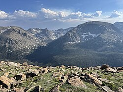
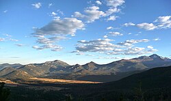
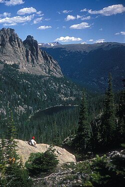
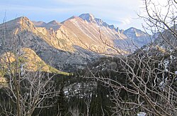
The park is characterized by its extreme verticality. Sixty mountain peaks exceed 12,000 feet, providing sweeping vistas of the surrounding landscape. In the north, the Mummy Range features several "thirteeners" (peaks over 13,000 feet), including Hagues Peak, Mummy Mountain, Fairchild Mountain, Ypsilon Mountain, and Mount Chiquita.
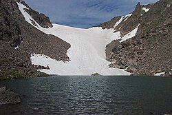
The landscape has been heavily sculpted by glaciation, leaving behind high mountain cirques—bowl-shaped depressions—where small glaciers and permanent snowfields still exist today.
The High-Altitude Highway
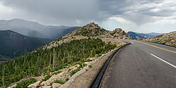
Trail Ridge Road serves as a primary artery for visitors, offering access to some of the highest points in the park. It is recognized as the highest continuously paved highway in the United States, providing views of the "parks"—meadows formed when ancient glacial lakes drained.
Climate and Environmental Trends
Under the Köppen climate classification, the park is categorized as having a Subarctic climate (Dfc), characterized by cool summers and precipitation throughout the year. Temperatures vary wildly based on elevation. For instance, the Beaver Meadows Visitor Center (7,825 ft) experiences milder conditions than the Bear Lake Ranger Station (9,492 ft), where average annual extreme minimums can drop to -15.2°F.
| Location | Elevation | Mean Daily Max (Year) | Mean Daily Min (Year) | Annual Precipitation |
|---|---|---|---|---|
| Beaver Meadows | 7,877 ft | 55.0°F (12.8°C) | 29.3°F (-1.5°C) | 18.95 in (481 mm) |
| Bear Lake | 9,583 ft | 47.7°F (8.7°C) | 25.7°F (-3.5°C) | 34.41 in (874 mm) |
Recent studies indicate a warming trend within the park. Data from the National Park Service suggests a temperature increase of 3.4°F (1.9°C) over the last century (1905–2010), while Montana State University reports an increase of 2.5°F (1.4°C) over a similar period.
Diverse Ecosystems and Wildlife
The park is divided into several distinct ecological zones, each supporting unique flora and fauna.
Montane and Subalpine Zones
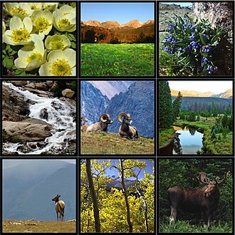
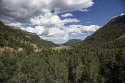
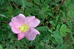
The Montane zone consists of forested slopes and grasslands. Moving higher, the Subalpine zone is dominated by Western Spruce and Fir, as well as Pine and Douglas fir forests. In these regions, wild roses (Rosa acicularis) bloom frequently.
Alpine Tundra and Riparian Zones
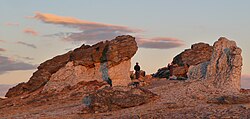
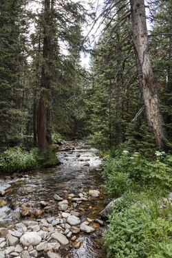
Above the treeline lies the Alpine tundra, a barren but resilient landscape of low-growing plants. Complementing these are Riparian ecosystems—the lush areas surrounding mountain streams and rivers that provide critical water sources for wildlife.
Wildlife and Biodiversity
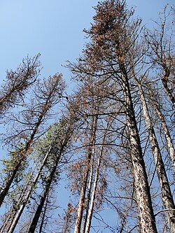
The park is home to a variety of ungulates, most notably the elk, as well as mule deer. These herbivores are balanced by various predators. However, the ecosystem faces challenges; for example, mountain pine beetles have caused significant tree mortality in certain areas.

Visitor Safety and Hazards
While the park offers immense beauty, the terrain is hazardous. The high-altitude environment includes Class 4/5 terrain, where a single misstep can be fatal. Between 2007 and 2024, the National Park Service recorded 77 fatalities, the majority resulting from accidental falls during hiking or climbing.
Other risks include falling rocks and wildfires. Notable incidents occurred in 1993, 2007, 2015, and 2018 involving rockfalls. Visitors are encouraged to remain vigilant and follow safety guidelines when navigating steep cliffs.
Frequently Asked Questions
What is the highest point in Rocky Mountain National Park?
The highest point in the park is Longs Peak, reaching an elevation of 14,259 feet.
What is the Continental Divide?
The Continental Divide is a hydrological boundary running north-south through the park; water falling to the west flows toward the Pacific Ocean, and water falling to the east flows toward the Atlantic.
What is Trail Ridge Road?
Trail Ridge Road is the highest continuously paved highway in the United States, providing visitors access to high-altitude vistas and alpine meadows.
What are the primary ecological zones in the park?
The park encompasses the montane zone (forested slopes), the subalpine zone (spruce and fir forests), the alpine tundra (above the treeline), and riparian zones (areas along streams).
How has the climate in the park changed over the last century?
Temperature records indicate a warming trend, with estimates of an increase between 2.5°F and 3.4°F over the past century.