Colorado historyRocky MountainsDenver ColoradoColorado statehoodColorado geography

Colorado: The Centennial State's Geography, History, and Culture

Colorado: The Centennial State's Geography, History, and Culture Known as the Centennial State, Colorado is a land of dramatic contrasts, ranging from the high-altitude peaks of the Rocky...

Colorado: The Centennial State's Geography, History, and Culture

Known as the Centennial State, Colorado is a land of dramatic contrasts, ranging from the high-altitude peaks of the Rocky Mountains to the vast, arid expanses of the eastern plains. Admitted to the Union on August 1, 1876, Colorado has evolved from a rugged territory into a modern hub of economic activity, diverse culture, and breathtaking natural beauty.

Whether you are drawn to the bustling urban energy of Denver, the historic mining towns of the mountains, or the expansive landscapes of the high desert, Colorado offers a unique tapestry of experiences shaped by its complex history and varied geography.
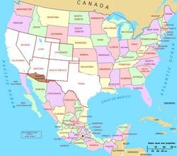
Map of the Mexican Cession, with the white representing the territory the United States received from Mexico (plus land ceded to the Republic of Texas) after the Mexican–American War. Well over half of Colorado was received from this treaty.

Key Facts

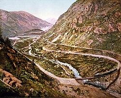
The Georgetown Loop of the Colorado Central Railroad as photographed by William Henry Jackson in 1899
  • Statehood: Admitted to the Union on August 1, 1876.
  • Capital: Denver.
  • Highest Point: Mount Elbert (14,440 feet).
  • Total Area: 104,185 square miles.
  • Population: Approximately 6,012,561 (2025 estimate).
  • Motto: Nil sine numine (Nothing without providence).

History and Statehood
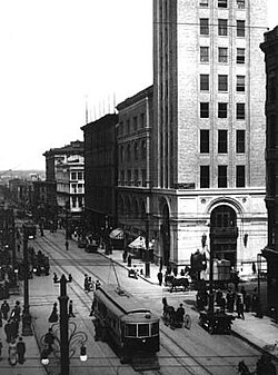
16th Street in Denver in 1912

The foundations of modern Colorado were laid through significant territorial shifts. Much of the state's current landmass was acquired through the Mexican Cession following the Mexican–American War.
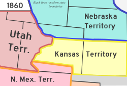
The territories of New Mexico, Utah, Kansas, and Nebraska before the creation of the Territory of Colorado

Before achieving statehood, the region existed as the Colorado Territory. The path to becoming the 38th state was marked by periods of intense conflict and rapid growth. Historical records note significant events such as the Sand Creek Massacre, involving the 3rd Colorado Cavalry, which remains a somber chapter in the state's development.
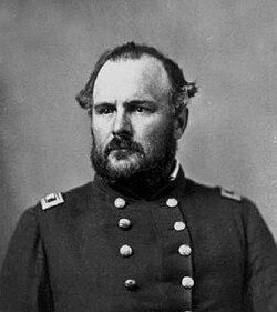
John Chivington, commander of the 3rd Colorado Cavalry at the Sand Creek Massacre.

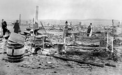
As the 20th century progressed, Colorado's identity continued to shift through industrialization, the expansion of mining, and the development of major urban centers. From the early influence of figures like John Evans to the labor struggles seen in the aftermath of the Ludlow massacre, the state's social fabric has been constantly rewoven.
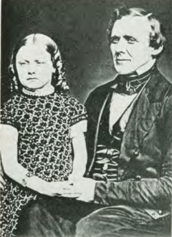
John Evans with daughter Josephine, c. 1859
The ruins of the Ludlow Colony in the aftermath of the 1914 massacre.

Geography and Natural Wonders

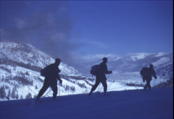
Three 10th Mountain Division skitroopers above Camp Hale in February 1944

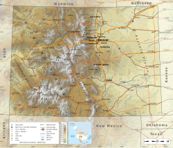
Colorado's geography is defined by its massive elevation changes. The state is split by the Continental Divide, a mountain ridge that separates river systems flowing toward the Atlantic and Pacific Oceans.
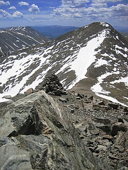
Grays Peak, at 14,278 feet (4,352 m), is the highest point on the Continental Divide in North America.

The Rocky Mountains and Front Range

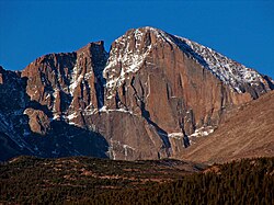
The Front Range provides a stunning backdrop to many of the state's most populated areas. The mountains are home to iconic peaks and diverse ecosystems, including the high-altitude environments of the Rocky Mountain National Park.
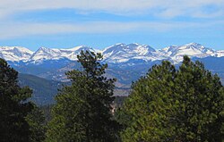
Front Range Peaks west of Denver
Longs Peak in Rocky Mountain National Park.

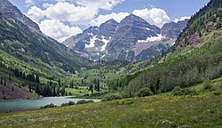
Among the most famous landmarks are the Maroon Bells, located within the White River National Forest, and the towering summit of Mount Elbert, the highest point in the state.
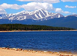
Mount Elbert at 14,440 feet (4,401.2 m) is the highest summit of the Rocky Mountains and Colorado.
Maroon Bells, at 14,163 ft (4,317 m), is part of White River National Forest and a tourist destination

Plains, Deserts, and Valleys

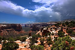
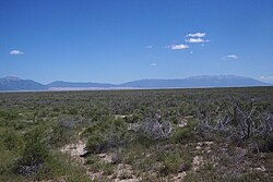
Moving away from the mountains, the landscape transitions into the arid high plains of the southeast and the unique high desert lands of the San Luis Valley. The Colorado National Monument offers a different perspective with its sandstone rock formations and deep canyons.
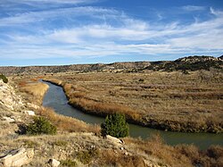
The arid high plains in Southeastern Colorado
The high desert lands that make up the San Luis Valley in Southern Colorado
The Colorado National Monument near Grand Junction is made up of high desert canyons and sandstone rock formations.

Climate and Environment

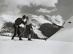
Skiers on Aspen Mountain in 1961

Colorado experiences a wide range of climates, often categorized by the Köppen climate classification system. The weather can be extreme, with significant temperature swings between summer and winter months.
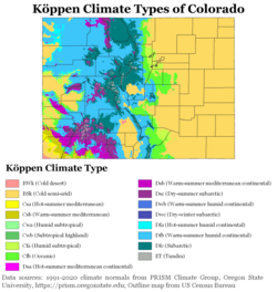
Köppen climate types of Colorado, using 1991–2020 climate normals

Record temperatures in the state have seen lows as extreme as -61°F and highs reaching 115°F. This variability influences everything from agriculture in the plains to the popularity of winter sports in the mountains.
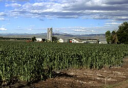
Corn growing in Larimer County
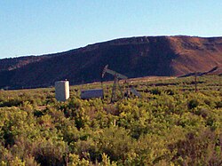
An oil well in western Colorado

Demographics and Society

ภาพประกอบบทความ
ภาพประกอบจากบทความต้นฉบับ

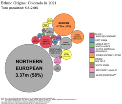
As of 2025, Colorado's population is estimated at over 6 million people. The state is characterized by a diverse demographic profile, with significant Hispanic or Latino populations and a growing variety of ethnic origins across its many counties.
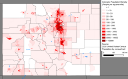
Colorado population density map
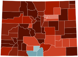
Ethnic origins in ColoradoLargest alone or in any combination ethnic origin by county in Colorado, per the 2020 census
Map of counties in Colorado by racial plurality, per the 2020 U.S. census Legend Non-Hispanic White 40–50% 50–60% 60–70% 70–80% 80–90% Hispanic or Latino 40–50% 50–60%

The population is concentrated heavily in urban and metropolitan areas, particularly around the Denver metro region, while large unincorporated communities like Highlands Ranch also contribute significantly to the state's population density.
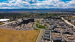
Highlands Ranch, Colorado.

Economy, Infrastructure, and Sports

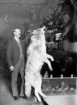
Photo of Breckenridge naturalist Edwin Carter standing next to a taxidermied gray wolf killed in the Colorado Rockies, c. 1890–1900
Breckenridge naturalist Edwin Carter with a mounted gray wolf killed in the Colorado Rockies, c. 1890–1900

Colorado's economy is multifaceted, supported by agriculture, natural resources, and a robust service sector. Major transportation hubs, such as Denver International Airport, connect the state to the rest of the world, while the rail and highway systems facilitate movement through the rugged terrain.
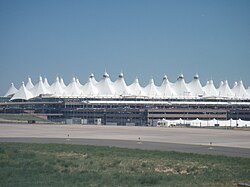

The main terminal of Denver International Airport evokes the peaks of the Front Range.
A Regional Transportation District A Line train at Denver Union Station.
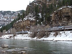
The westbound and eastbound California Zephyrs meet in the Glenwood Canyon.

The state is also a major center for professional sports. From the Denver Broncos in football to the Colorado Avalanche in ice hockey, sports culture is a vital part of the Colorado lifestyle.
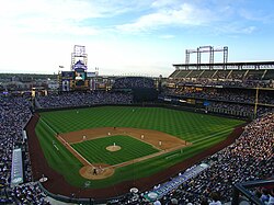
The Colorado Rockies baseball club at Coors Field
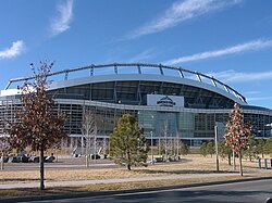
Empower Field at Mile High in Denver, home field of the Denver Broncos and the Denver Outlaws
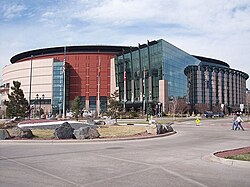
Ball Arena, home of the Denver Nuggets, the Colorado Avalanche, and the Colorado Mammoth

Summary of State Profile

Colorado State Overview
Category Details
Capital City Denver
Total Area 104,185 sq mi
Highest Elevation 14,440 ft (Mount Elbert)
Median Household Income $92,900 (2023)
Primary Time Zone Mountain Standard Time (MST)

Frequently Asked Questions

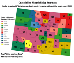
Largest Non-Hispanic Native American ancestry by county and numbers of people reporting "Native American Alone"
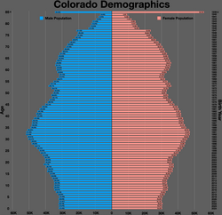
Colorado population pyramid
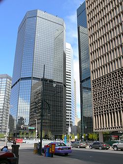
Denver Energy Center lies in the Denver financial district along 17th Street, known as the "Wall Street of the West"
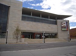
History Colorado Center in Denver
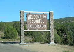
A Colorado state welcome sign
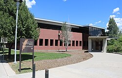
The Southern Ute Tribal Administration Building
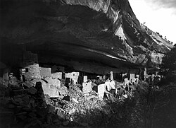
The ruins of the Cliff Palace of Mesa Verde, photographed by Gustaf Nordenskiöld in 1891
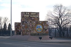
Fort Carson
Fort Carson
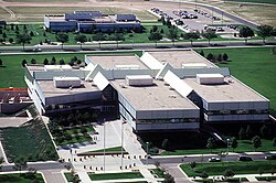
Peterson Space Force Base
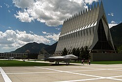
United States Air Force Academy
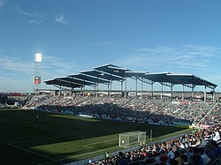
Dick's Sporting Goods Park, home of the Colorado Rapids
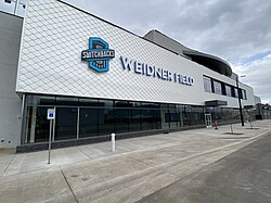
Weidner Field in Colorado Springs, home of the Colorado Springs Switchbacks FC

What is the highest mountain in Colorado?

The highest mountain in Colorado is Mount Elbert, which reaches an elevation of 14,440 feet (4,401.2 m).

When did Colorado become a state?

Colorado was admitted to the Union on August 1, 1876, earning it the nickname "The Centennial State."

What are the major cities in Colorado?

The largest cities include Denver (the capital), Colorado Springs, Aurora, Fort Collins, and Lakewood.

What is the climate like in Colorado?

Colorado features diverse climates, including mountain climates, high deserts, and semi-arid plains. It is known for significant temperature variations and extreme weather records.

Which professional sports teams are based in Colorado?

Colorado is home to several professional teams, including the Denver Broncos (NFL), Denver Nuggets (NBA), Colorado Avalanche (NHL), and the Colorado Rockies (MLB).

References

  1. Elevation adjusted to North American Vertical Datum of 1988
  2. /ˌkɒləˈræd, -ˈrɑːd/ KOL-ə-RAD-oh, -⁠RAH-doh,[9][10] other variants;[11] Spanish: [koloˈɾaðo]
  3. One of the wounded students, Anne Marie Hochhalter, died of her injuries in 2025.[64]
  4. The official Four Corners Monument is located at 36°59'56.31608″N, 109°2'42.62075"W, 574 feet (175 m) southeast of the 37°N, 109°02′48″W location Congress originally designated.
  5. the U.S. Census Bureau Quick facts reference link here has all northwestern counties in Colorado. It shows the Population density, which is low for each county, meaning that Northwestern Colorado is sparsely populated.[95]