Columbine, Colorado: A Profile of the Jefferson and Arapahoe County Community
Located within the Denver metropolitan area, Columbine is a census-designated place (CDP)—a concentration of population defined by the U.S. Census Bureau for statistical purposes—that spans both Jefferson and Arapahoe counties. Situated primarily in Jefferson County just south of Denver, this community serves as a residential hub within the Front Range Urban Corridor.
Key Facts
- Location: Spans Jefferson and Arapahoe counties, Colorado.
- Population: 25,229 residents (as of the 2020 Census).
- Total Area: Approximately 6.753 square miles.
- Elevation: 5,542 feet (1,689 meters).
- Primary ZIP Codes: 80123 and 80128.
Geography and Land Use
The Columbine CDP covers a total area of 4,322 acres, which includes 79 acres of water. Geographically, the community is positioned on the eastern edge of Jefferson County, with a portion extending into Arapahoe County. It is bordered by Littleton and Columbine Valley to the east, and Ken Caryl to the west. The northern boundary sits just 0.3 miles from the Denver city limits, while the southern extent reaches the Chatfield Reservoir dam.
Some observers have characterized the area as a collection of residential developments, shopping centers, and strip malls. Author Ralph W. Larkin noted in 2007 that the region lacks a singular collective identity, functioning largely as a series of suburban developments.
Historical Context
Columbine experienced significant growth between 1958 and 1968, driven by the Space Race era and the construction of the Martin Company missile facility in Waterton Canyon. This period of expansion led to the population surpassing 20,000 for the first time in 1980.
The area's history also includes notable and tragic events. It was the site of the 1927 Columbine Mine massacre during labor disputes, and more recently, the 1999 Columbine High School massacre involving Eric Harris and Dylan Klebold.
Demographics and Population Trends
Since its initial definition by the U.S. Census Bureau in 1980, Columbine has seen steady population growth. The 2020 census recorded a population of 25,229, representing a 3.9% increase from 2010.
| Census Year | Total Population | Percentage Change |
|---|---|---|
| 1980 | 23,523 | — |
| 1990 | 23,969 | +1.9% |
| 2000 | 24,095 | +0.5% |
| 2010 | 24,280 | +0.8% |
| 2020 | 25,229 | +3.9% |
Community Composition
As of 2020, the median age in Columbine was 44.0 years. The demographic breakdown shows that 21.4% of residents are under 18, while 21.5% are 65 or older. The community is entirely urban, with 100% of residents living in urban areas.
The racial composition of the CDP is as follows:
- White: 83.8%
- Hispanic or Latino (of any race): 10.9%
- Two or more races: 9.8%
- Asian: 2.5%
- Some other race: 2.5%
- Black or African American: 0.8%
- American Indian and Alaska Native: 0.7%
- Native Hawaiian and Other Pacific Islander: 0.0%
Education and Public Services
Education services in Columbine are divided between two school districts based on county lines.
Jefferson County Schools
The portion of Columbine in Jefferson County is served by Jefferson County Public Schools. This includes:
- Elementary Schools: Columbine Hills, Dutch Creek, Leawood, and Normandy.
- Middle School: Ken Caryl Middle School.
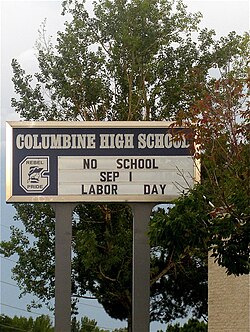
- High School: Columbine High School.
Arapahoe County Schools
The portion located in Arapahoe County is served by Littleton Public Schools, which includes:
- Elementary School: Wilder Elementary School.
- Middle School: Goddard Middle School.
- High School: Heritage High School.
For local literacy and community resources, the Jefferson County Public Library operates the Columbine Library, which underwent expansion and renovation in 2017.
Frequently Asked Questions
What is a census-designated place (CDP)?
A census-designated place is a concentration of population identified by the U.S. Census Bureau for statistical purposes. It is not a legally incorporated municipality but serves as a way to track demographic data for a specific community.
Which counties is Columbine located in?
Columbine is located within both Jefferson and Arapahoe counties in Colorado.
What is the total area of the Columbine CDP?
The total area is 6.753 square miles (17.491 km), which includes 6.631 square miles of land and 0.123 square miles of water.
What are the main ZIP codes for Columbine?
The primary ZIP codes serving the Columbine area are 80123 and 80128.
How many people live in Columbine?
According to the 2020 census, the population of the Columbine CDP was 25,229.