Nazca Lines: The Ancient Geoglyphs of the Peruvian Desert
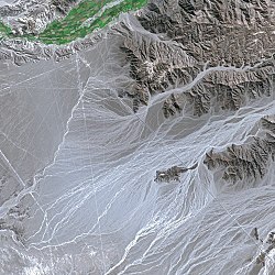
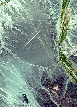
Etched into the arid landscape of southern Peru, the Nazca Lines are among the most enigmatic archaeological wonders of the ancient world. These massive geoglyphs—large designs produced on the ground—stretch across the Nazca Desert, creating a vast open-air gallery of straight lines, geometric shapes, and intricate animal figures that are best appreciated from the sky.
Created between 500 BC and 500 AD, these works were crafted by ancient peoples who removed the top layer of reddish-brown, ferric oxide-coated pebbles to reveal the lighter yellow-grey subsoil beneath. This simple yet effective technique created a stark color contrast that has endured for millennia.
Key Facts
- Location: Southern Peru, specifically the high arid plateau between Nazca and Palpa.
- Timeframe: Created between 500 BC and 500 AD.
- Scale: Total line length exceeds 1,300 km (800 mi), covering an area of approximately 50 km (19 sq mi).
- UNESCO Status: Inscribed as a World Heritage Site in 1994.
- Preservation: Maintained by a dry, windless, and stable climate.
The Construction and Phases of the Lines
The creation of the Nazca Lines occurred in two primary archaeological stages. The Paracas phase took place from 400 to 200 BC, followed by the Nazca phase, which spanned from 200 BC to 500 AD. The lines themselves are typically shallow, ranging from 10 to 15 cm (4–6 in) deep.
While the width of the lines varies, more than half are slightly wider than 33 cm (13 in), with some reaching up to 1.8 m (6 ft). Most of the designs consist of a single continuous line, with the largest figures spanning nearly 370 m (1,200 ft) in length.
Notable Figures and Dimensions
While many of the lines are straight, the most famous geoglyphs are the figurative designs of plants and animals. These shapes are often invisible from the ground, becoming clear only at altitudes of around 500 m (1,600 ft).
Some of the most iconic figures include:
- The Hummingbird: 93 m (305 ft) long.
- The Condor: 134 m (440 ft) long.
- The Monkey: 93 by 58 m (305 by 190 ft).
- The Spider: 47 m (154 ft) long.
Other recognized glyphs include the Whale, the Dog, the Heron, the Parrot, the Lizard, and a figure known as "the Astronaut."
Summary of Site Specifications
| Feature | Detail |
|---|---|
| Total Area | 75,358.47 ha (186,214.8 acres) |
| Total Line Length | >1,300 km (800 mi) |
| Depth of Incisions | 10 to 15 cm (4–6 in) |
| Primary Materials | Ferric oxide pebbles / Yellow-grey subsoil |
| Coordinates | 14°41′51″S 75°08′06″W |
Modern Discoveries and Preservation
The study of the Nazca Lines is an ongoing process. Since 2006, a Japanese team from Yamagata University has conducted extensive fieldwork, discovering approximately 100 new geoglyphs by 2012, including a figure resembling a human head. In the 21st century, the use of drones and AI-assisted surveys has further accelerated discoveries, revealing several hundred new figures.
Despite their natural resilience, the lines face modern threats. Deterioration has been linked to the influx of squatters and accidental damage from vehicles. In 2025, a controversial decision by the Ministry of Culture to reduce the reserve area from 5,600 to 3,200 square kilometers was reversed following concerns over informal mining.
Frequently Asked Questions
How were the Nazca Lines made?
They were created by removing the top layer of reddish-brown pebbles coated in ferric oxide, which exposed the lighter-colored yellow-grey soil underneath.
Why are the lines so well-preserved?
The lines have been preserved naturally due to the extreme isolation and the dry, windless, and stable climate of the Peruvian plateau.
Can you see the lines from the ground?
While some are visible from surrounding foothills and high places, the most complex figurative shapes are best seen from the air at an altitude of approximately 500 meters.
Who created the Nazca Lines?
They were created by the people of the Paracas and Nazca cultures between 500 BC and 500 AD.
Are new lines still being found?
Yes. Through the use of drones and AI technology, archaeologists continue to find new geoglyphs, with hundreds of new figures identified in recent years.