Millstone River: A Vital Waterway of Central New Jersey
The Millstone River is a significant 38.6-mile (62.1 km) tributary of the Raritan River, winding through the heart of central New Jersey. Serving as both a critical environmental resource and a historical corridor for commerce, the river traverses several counties and plays a pivotal role in the region's water supply and recreational landscape.
From its headwaters in western Monmouth County to its confluence with the Raritan River in Manville, the Millstone River shapes the geography of the area. Notably, nearly three-quarters of its length is paralleled by the Delaware and Raritan Canal, creating a dual-waterway system that has defined the region's development for centuries.
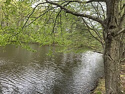
Key Facts
- Total Length: 38.6 miles (62.1 km).
- Course: Flows through Monmouth, Mercer, Middlesex, and Somerset counties.
- Primary Mouth: Drains into the Raritan River at Manville.
- Key Infrastructure: Paralleled largely by the Delaware and Raritan Canal.
- Water Utility: Provides drinking water to tens of thousands of households via New Jersey American Water.
The Course of the Millstone River
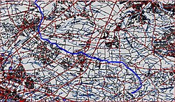
The river begins its journey near Stage Coach Road (CR-524) in western Monmouth County. It initially flows northeast and then turns north, crossing several local roads and the watershed of the Cranbury Brook before shifting westward.
As it progresses, the river crosses the New Jersey Turnpike and moves through the East Windsor Open Space Acquisition. After receiving Rocky Brook, the river turns northwest, crossing various local roads including Old Trenton Road and Southfield Road. It eventually receives Cranbury Brook and Bear Brook before crossing US-1 (Brunswick Pike) and flowing into Carnegie Lake, a man-made reservoir used for rowing and recreation.
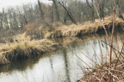
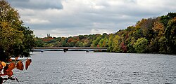
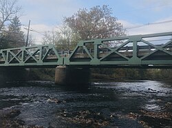
After exiting Carnegie Lake, the river enters the D&R Canal State Park and turns north. It receives several tributaries, including Harrys Brook, Beden Brook, and Simonson Brook. In its final stretch, it receives Ten Mile Run and Six Mile Run before passing the Somerset Christian College and finally joining the Raritan River.
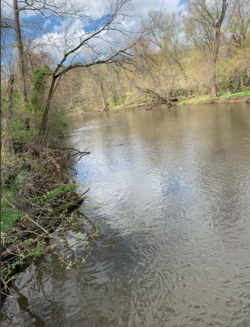
Major Tributaries
The Millstone River is fed by a complex network of streams. Key left-bank tributaries include Rocky Brook, Bear Brook, Stony Brook, Harrys Brook, Beden Brook, and Royce Brook. Right-bank tributaries include Cranbury Brook, Devils Brook, Heathcote Brook, Simonson Brook, Ten Mile Run, and Six Mile Run.
Commercial History and the D&R Canal
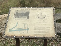
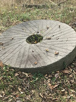
In early colonial times, commerce between New York City and Philadelphia relied on stagecoaches traveling a direct route from South Amboy to Bordentown. However, as the economy grew, the need for heavy shipping led to the development of canals, which required level land typically found along riverbeds.
The Delaware and Raritan Canal was constructed to follow the Millstone River's path, providing a vital north-south waterway. This system allowed goods to move from the Delaware River in Trenton to the Raritan Bay, and subsequently to New York Harbor. This infrastructure was essential for connecting the Great Lakes and Western Pennsylvania to the Atlantic coast.
Environmental Challenges and Water Supply
The Millstone River is a primary source of drinking water for tens of thousands of residents and businesses in Central New Jersey. A water intake pumping station located at the confluence of the Millstone and Raritan Rivers allows New Jersey American Water to purify and distribute the resource.
Flooding Risks
The river basin is prone to severe flooding. Major events include Hurricane Floyd (1999) and Hurricane Irene (2011), with the "Lost Valley" section of Manville being particularly vulnerable due to its location on a floodplain between the Millstone and Raritan rivers.
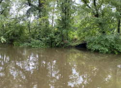
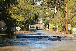
In 2016, a joint feasibility study by the U.S. Army Corps of Engineers and the New Jersey Department of Environmental Protection examined flood mitigation for Manville. The study concluded that proposed improvements were not economically feasible, resulting in a recommendation against federal action.
River Summary Table
| Feature | Details |
|---|---|
| Length | 38.6 miles (62.1 km) |
| Source | Monmouth County, NJ |
| Mouth | Raritan River at Manville, NJ |
| Counties Served | Hunterdon, Mercer, Middlesex, Monmouth, Somerset |
| Elevation at Mouth | 20 ft (6.1 m) |
| Primary Use | Drinking water, Recreation, Historical Transport |
Frequently Asked Questions
Where does the Millstone River end?
The Millstone River ends where it joins the Raritan River in Manville, New Jersey.
What is the relationship between the Millstone River and the D&R Canal?
The Delaware and Raritan Canal parallels the Millstone River for nearly three-quarters of its length, utilizing the river's level valley to create a shipping route between Philadelphia and New York.
How is the Millstone River used for public utilities?
The river provides drinking water to tens of thousands of households and businesses in Central New Jersey via a pumping station at the confluence of the Millstone and Raritan Rivers, managed by New Jersey American Water.
Which areas are most susceptible to flooding in the basin?
The "Lost Valley" section of Manville is considered at the highest risk because it sits on a floodplain between the Millstone and Raritan rivers.
What is Carnegie Lake?
Carnegie Lake is a body of water along the Millstone River's course in Princeton, used extensively for rowing and other recreational activities.