Tulkarm: A Historic Hub of Trade and Culture in the West Bank
Strategically positioned on the western edge of the northern West Bank, Tulkarm serves as a vital link between the coastal plains and the mountainous interior. Its unique geography has historically transformed it into a bustling caravan station and a commercial center, facilitating trade and movement between Egypt and the Levant (al-Sham). Today, it remains a significant urban center known for its resilience, educational institutions, and deep historical roots.
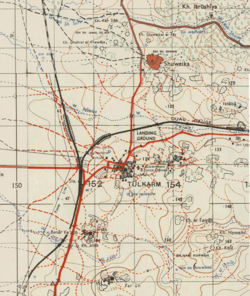
Key Facts
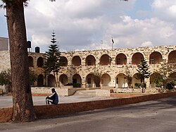
- Founded: Late 12th century.
- Population: 64,532 (as of 2017).
- Total Area: 28.8 square kilometers.
- Climate: Mediterranean and subtropical.
- Key Institutions: Palestine Technical University – Kadoorie and An-Najah National University (Tulkarm branch).
Historical Evolution
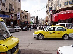
Ayyubid and Mamluk Eras
Tulkarm's early history is closely tied to religious endowments known as waqf (religious trusts). During the Ayyubid and Mamluk periods (1260–1517), much of the land supported the al-Farisiyya Madrasa, an Islamic school in Jerusalem. By 1354, two-thirds of the village's farmlands were confirmed as part of this trust. This era also saw an influx of Arab immigrants from North Africa and Nablus, who bolstered the local economy through agriculture and animal husbandry, specifically supplying hides to coastal leather merchants.
The Ottoman Period
Incorporated into the Ottoman Empire in 1517, Tulkarm saw its waqf transferred to the al-Jawhariyya Madrasa. Residents paid a tax called qasm (a third of their harvest) to support the trust. The town was organized into five neighborhoods centered around the "Old Mosque" (Shaykh Ali al-Jazri al-Mughrabi Mosque). Local elite families, such as the Zaydan and Tarabay, exercised significant autonomy, with the Zaydan serving as mutassalim (tax collectors) for the central authorities.
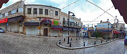
British Mandate and Jordanian Rule
By 1945, Tulkarm had grown to a population of 8,090, with an economy heavily reliant on citrus, bananas, and cereals. Following the 1948 Arab–Israeli War, the city was occupied by the Iraqi Army and later annexed by Jordan. However, the 1949 Armistice Agreements resulted in the loss of approximately 30,000 dunams of agricultural land to Israeli territory, prompting many residents to migrate.
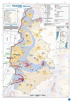
In 1950, UNRWA established the Tulkarm Camp to house refugees from Jaffa, Caesarea, and Haifa. This camp has since grown to become the second largest Palestinian refugee camp in the West Bank.
Contemporary Era
Under the 1993 Oslo Accords, control of Tulkarm was transferred to the Palestinian National Authority (PNA) on December 10, 1995. Although the city experienced temporary reoccupation by Israeli forces during the Second Intifada, full control was returned to the PNA in 2005.
Geography and Climate
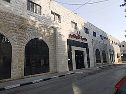
Tulkarm is located approximately 15 kilometers west of Nablus and 15 kilometers east of Netanya. Its position between the mountains and the plain provides a moderating sea breeze that influences its Mediterranean and subtropical climate.
Rainfall is concentrated in the winter, with the rainy season spanning from October to May. The city receives an average of 538.3 to 642 millimeters of rain annually, with the heaviest precipitation occurring between December and February.
| Month | Max Temp (°C) | Min Temp (°C) | Precipitation (mm) |
|---|---|---|---|
| January | 17.0 | 8.9 | 124.9 |
| April | 23.9 | 13.6 | 23.6 |
| July | 29.0 | 23.0 | 2.2 |
| October | 26.0 | 18.5 | 28.0 |
Demographics and Society
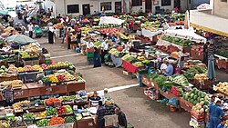
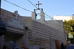
Tulkarm has experienced steady population growth, rising from roughly 1,000 residents in the 16th century to over 64,000 by 2017. While the population is now almost entirely Muslim, the city historically hosted a diverse community, including Jews, Samaritans, and Christians. A Greek Orthodox church dedicated to St. George, built in the early 19th century, remains active today.
Education and Infrastructure
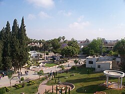
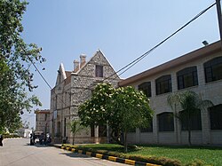
The city is a regional center for learning, hosting prominent institutions such as the Palestine Technical University – Kadoorie and the Tulkarm branch of An-Najah National University.
Frequently Asked Questions
What is the significance of the waqf in Tulkarm's history?
The waqf, or religious trust, meant that Tulkarm's lands were dedicated to supporting Islamic schools (madrasas) in Jerusalem. This arrangement influenced the city's economic structure and allowed local elite families to gain social status by administering these trusts.
How did the 1949 Armistice Agreements affect the city?
The agreements left about 30,000 dunams of Tulkarm's agricultural land within Israeli territory, which severely impacted the local economy and led to the emigration of many residents.
What is the Tulkarm Camp?
Established by UNRWA in 1950, the Tulkarm Camp provides housing for Palestinian refugees, primarily those displaced from Jaffa, Caesarea, and Haifa. It is currently the second largest refugee camp in the West Bank.
What is the climate like in Tulkarm?
Tulkarm has a Mediterranean climate characterized by mild, rainy winters and warm, dry summers. The proximity to the coast provides a sea breeze that helps moderate summer temperatures.
Which educational institutions are located in Tulkarm?
The city is home to the Palestine Technical University – Kadoorie and a branch of An-Najah National University, making it an important educational hub in the region.