State Highway Systems Around the World
Across the globe, road networks are organized into hierarchical systems to ensure efficient travel and clear navigation. While national highways often handle long-distance transit, state highways (or their provincial and prefectural equivalents) serve as the critical connective tissue between local roads and national arteries. These subnational systems vary significantly in their administration, numbering, and signage depending on the country's political structure.
Key Facts
- Administration: Most state highways are managed by regional governments, though some countries, like Italy, use a national agency (ANAS) for state-level roads.
- Signage: Markers often use distinct colors or shapes, such as blue shields in Australia or white circles in the U.S. default system.
- Hierarchy: In many regions, state roads act as "feeders" to the primary federal or national highway networks.
- Historical Roots: Some modern state highways, particularly in Italy, follow the paths of ancient Roman consular roads.
Oceania: Australia and New Zealand
In Australia, the State Route system covers important urban and inter-regional routes not included in the National Highway or National Route systems. These are identified by blue shield markers. While most states are transitioning to alphanumeric routes, Victoria still uses state route numbers within Melbourne's Metropolitan Route Numbering Scheme. Western Australia remains a notable exception, continuing to rely heavily on State Routes for major transit across the state.

New Zealand uses the term "state highway" to refer to national highways managed by the NZ Transport Agency. This network spans both the North and South Islands, with State Highway 1 running the length of both. Most of these roads have a speed limit of 100 km/h, which is reduced in densely populated areas.

North America: United States, Canada, and Mexico
The United States employs a diverse mix of primary and secondary state highways, some of which are full freeways. While the Manual on Uniform Traffic Control Devices (MUTCD) suggests a default white circle marker, most states design their own unique shields, often incorporating the state's outline. Montana Highway 200 holds the title of the longest state highway in the U.S.

Canada's network is primarily composed of provincial and territorial highways. A unique aspect of the Canadian system is the Trans-Canada Highway; while it is a national system, it often lacks a uniform numeric designation and is frequently co-signed with provincial markers. In western provinces, however, the Trans-Canada routes are consistently numbered as Highways 1 and 16.
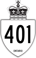
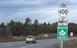
In Mexico, state highways serve as a feeder system for the federal highway network. Each state (excluding the Federal District) operates its own network, marked by white shields containing the state's abbreviated name and the route number.
Europe: Italy, Germany, and Turkey
Italy's Strade Statali (SS) is a vast national network of approximately 25,000 km maintained by ANAS. Many of these routes, such as the SS1 Via Aurelia and SS7 Via Appia, are derived from ancient Roman roads. These highways are categorized by type: extra-urban (Type B and C) or urban (Type D and E), with jurisdiction shifting to municipalities in towns with over 10,000 inhabitants.
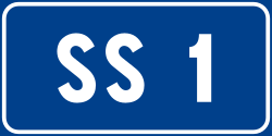
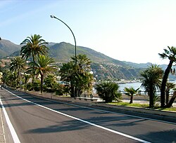
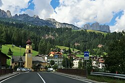
Germany classifies state roads as Landesstraßen (marked with 'L') or Staatsstraßen (marked with 'S'), the latter being used specifically in Saxony and Bavaria. These roads rank below the federal Bundesstraßen network, with planning and maintenance handled by the individual federal states.
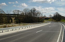
Turkey distinguishes between state roads (devlet yolu), which are primary roads marked with a 'D' and a three-digit number, and provincial roads (İl yolu). Provincial roads are secondary routes marked by four-digit numbers, where the first pair indicates the province's license number.

Asia: India, Japan, and South Korea
In India, state highways are numbered routes constructed and maintained by the respective state governments, with specific markers used for urban stretches.


Japan's prefectural roads are managed by prefectural governments. As of 2011, these made up 10.7% of public roads, yet they handled over 30% of all traffic volume as of 2007.
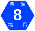
South Korea utilizes local highways (Jibangdo) as the secondary tier below national highways. These are identified by two, three, or four-digit numbers, with two-digit routes designated as state-funded local highways.
South America: Brazil
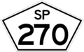
Brazil also utilizes a state-based highway system. An example is the state of São Paulo, where the Rodovia Raposo Tavares is designated as SP-270 and SP-295.
Summary of Global State Highway Characteristics
| Country | Primary Designation | Key Characteristic | Maintenance Authority |
|---|---|---|---|
| Australia | State Route | Blue shield markers; transitioning to alphanumeric | State Governments |
| Canada | Provincial Highway | Often co-signed with Trans-Canada Highway | Provinces/Territories |
| Italy | Strada Statale (SS) | Many based on ancient Roman roads | ANAS |
| USA | State Route/Highway | Diverse markers; Montana Hwy 200 is the longest | State Governments |
| Japan | Prefectural Road | High traffic volume relative to total length | Prefectures |
| Turkey | Devlet Yolu (D) | Three-digit numbering for primary state roads | KGM / Local Gov |
Frequently Asked Questions
What is the difference between a national highway and a state highway?
National highways are typically primary arteries for long-distance, cross-country travel, while state highways serve as secondary routes that connect smaller cities or act as feeders to the national network.
Why do some Italian state highways have names like Via Appia?
Many Italian Strade Statali follow the original paths of ancient Roman consular roads, preserving the historical names of these ancient routes.
How does the Trans-Canada Highway differ from provincial highways?
The Trans-Canada Highway is a national transcontinental system. Unlike provincial highways, it does not have a uniform numeric designation across the entire country and is often co-signed with existing provincial routes.
What is the default marker for state highways in the United States?
According to the MUTCD, the default marker is a white circle containing a black sans-serif number, though most states use their own unique designs.
How are provincial roads identified in Turkey?
Provincial roads in Turkey use a four-digit numbering system separated by a dash, where the first two digits represent the license number of the province.