Southwestern United States
The Southwestern United States, often referred to as the American Southwest, is a distinct geographic and cultural region characterized by its arid landscapes, rich indigenous history, and a blend of Spanish and American influences. While the core of the region consists of Arizona and New Mexico, its boundaries often extend to include portions of California, Colorado, Nevada, Oklahoma, Texas, and Utah.
From the neon lights of the Las Vegas Strip to the ancient ruins of Chaco Canyon, the Southwest is a land of extreme contrasts. It is defined by its vast deserts, towering mesas, and a complex political history that saw it transition from the dominion of New Spain and Mexico to the United States.
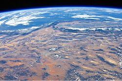
Key Facts
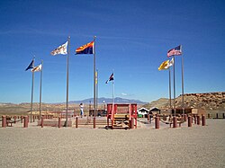
- Core States: Arizona and New Mexico.
- Largest City: Phoenix, Arizona.
- Major Deserts: Sonoran, Chihuahuan, and Mojave.
- Historical Transition: Acquired by the U.S. via the Treaty of Guadalupe Hidalgo (1848) and the Gadsden Purchase (1854).
- Statehood: New Mexico (Jan 6, 1912) and Arizona (Feb 14, 1912) were the last of the contiguous 48 states to join the Union.
Regional Geography and Ecology
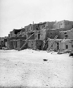
The geography of the Southwest is diverse, ranging from high-altitude plateaus to low-lying basins. The Learning Center of the American Southwest (LCAS) defines the region's physiographical traits within a specific coordinate box between 26° and 38° northern latitude and 98° 30' and 124° western longitude.
Terrain and Deserts
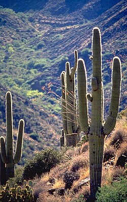
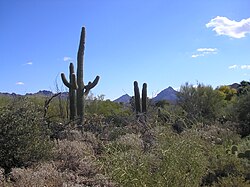
The region is dominated by three primary desert systems. The Sonoran Desert is famous for its iconic Saguaro cacti, while the Chihuahuan Desert typically consists of basins interrupted by small mountain ranges. The Mojave Desert is also a prominent feature of the landscape.
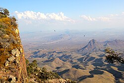
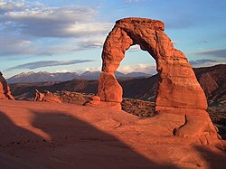
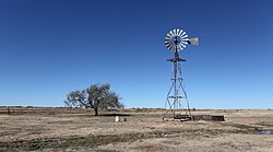
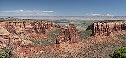
Other notable geological features include the Colorado Plateau, known for its dramatic erosional landforms like the Delicate Arch in Arches National Park, and the High Plains found in eastern New Mexico, Colorado, and Texas.
Flora and Fauna
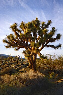
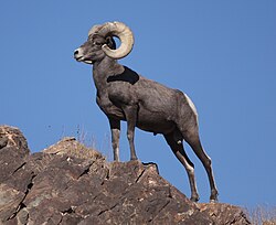
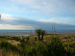
Vegetation is adapted to arid conditions, featuring species such as the Joshua tree (Yucca brevifolia) and desert willow. The wildlife is equally specialized, including the desert bighorn sheep and the Mexican wolf, the latter of which has seen population growth exceeding 200 individuals.
History and Evolution
Pre-European and Colonial Eras
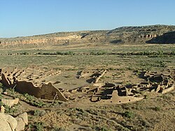
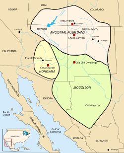
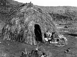
Long before European arrival, the region was home to various Native American tribes. The Ancestral Puebloans left behind significant architectural legacies, such as the ruins at Chaco Canyon. Other early cultures included the Hohokam, known for their sophisticated prehistoric engineering and canal systems, and the Mogollon.
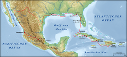
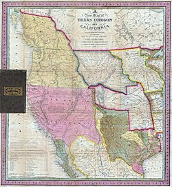
European influence began with Spanish exploration. In 1804, Spain created the province of Alta California, covering much of the modern Southwest. Following Mexico's independence from Spain in 1821, the area became part of the Mexican Alta California territory.
Integration into the United States
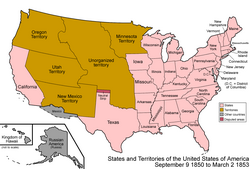
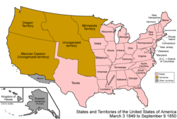
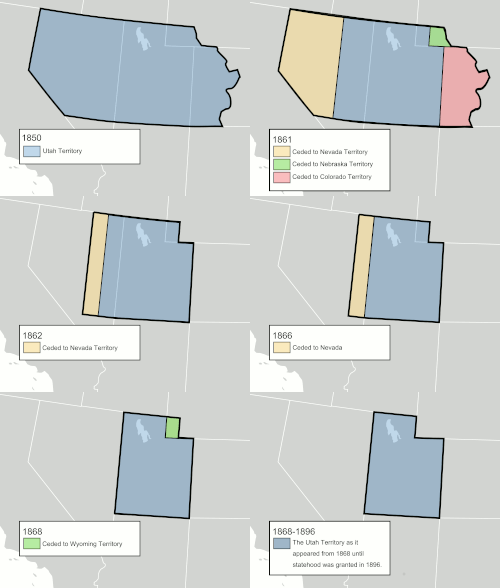
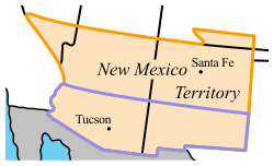
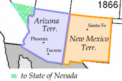
The United States acquired the majority of the region through the Treaty of Guadalupe Hidalgo in 1848, followed by the Gadsden Purchase in 1854. The transition to statehood was a gradual process involving several territories.
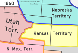
- Utah Territory: Created in 1850.
- Colorado Territory: Established amidst the gold rush.
- Arizona and New Mexico: These were the final territories to achieve statehood, joining the Union in early 1912.
Urban Centers and Demographics
Modern urbanization in the Southwest is concentrated in a few massive metropolitan hubs. Phoenix serves as the largest city and metropolitan area in the region.
The following table outlines the largest cities based on the 2020 census:
| Rank | City | State | City Population | Metro Population |
|---|---|---|---|---|
| 1 | Phoenix | Arizona | 1,608,139 | 4,845,832 |
| 2 | El Paso | Texas | 678,815 | 868,859 |
| 3 | Las Vegas | Nevada | 641,903 | 2,265,461 |
| 4 | Albuquerque | New Mexico | 564,559 | 916,528 |
| 5 | Tucson | Arizona | 542,629 | 1,043,433 |
Culture and Economy
The culture of the Southwest is a synthesis of Indigenous, Spanish, and Anglo-American traditions. This is evident in the Pueblo Revival architecture and the region's unique cuisine, such as the New Mexican breakfast burrito.
Economically, the region has diversified from mining and agriculture into tourism, professional sports, and a thriving ski industry in the mountainous areas of Colorado and New Mexico.
Frequently Asked Questions
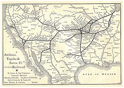
![Map of the Southwestern United States as defined by the Learning Center of the American Southwest[127]](/images/b5/21/b521ced1c8c630feabfe55b207ee05b6a633d9a44e64d2bf2368c043712d9cb5.jpg)




Which states are considered part of the American Southwest?
The core states are Arizona and New Mexico. Depending on the definition used, the region also includes parts of California, Colorado, Nevada, Oklahoma, Texas, and Utah.
When did Arizona and New Mexico become states?
New Mexico became the 47th state on January 6, 1912, and Arizona became the 48th contiguous state on February 14, 1912.
What are the primary deserts found in the Southwest?
The region is home to the Sonoran, Chihuahuan, and Mojave deserts, each with distinct terrain and vegetation.
How did the United States acquire this territory?
The U.S. acquired most of the region through the Treaty of Guadalupe Hidalgo in 1848 and later through the Gadsden Purchase in 1854.
What is the largest metropolitan area in the Southwest?
The Phoenix metropolitan area is the largest in the region, with a population exceeding 4.8 million people according to 2020 census data.