Southern Hemisphere Islands: A Geographic Survey of Subantarctic and Antarctic Lands
The vast expanse of the Southern Hemisphere is dotted with remote islands that serve as critical biological hubs and strategic geographic markers. From the temperate reaches of the subantarctic to the frozen fringes of the Antarctic continent, these landmasses are defined by their extreme isolation and unique political statuses.
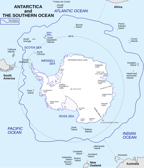
Many of these islands are categorized by their relationship to the Antarctic Convergence—a biological and climatic boundary where cold Antarctic waters meet warmer subantarctic waters. This boundary creates a distinct ecological divide, influencing everything from weather patterns to the species that can survive on these remote shores.
Key Facts
- Geographic Scope: The region encompasses islands ranging from the Equator down to the South Pole.
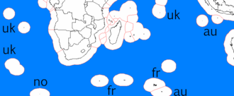
- Political Status: Most Southern Hemisphere lands fall within five southern nuclear-weapon-free zones (NWFZ), though certain islands like Bouvet and the Kerguelen Islands remain outside the Antarctic NWFZ.
- Regional Clusters: Major island groups include the South Shetland Islands, the Auckland Islands, and the Campbell Islands.
- Extreme Latitudes: Landmasses extend as far south as Deverall Island (81°28′S) and as far north as Amsterdam Island (37°49′S).
Regional Island Distributions
Subantarctic and Oceanic Islands
Between the Equator and the 60th parallel south, several isolated islands exist. Notable examples include Amsterdam Island (37°49′S 77°33′E) and the Auckland Islands group, which includes Auckland Island, Adams Island, Enderby Island, and Rose Island. Further south, the Campbell Island group consists of Campbell, Dent, and Jacquemart Islands.
Other significant landmasses in this zone include the Antipodes Islands (Antipodes and Bollons Islands) and the Crozet Islands, featuring islands such as Bird, Annenkov, and Saddle Island.
The South Shetland and South Georgia Regions
As we move closer to the Antarctic continent, the South Shetland Islands emerge as a prominent archipelago. This group includes Livingston Island, Deception Island, and Elephant Island. These islands are characterized by their rugged terrain and proximity to the Antarctic Peninsula.
Further east, the South Georgia and South Sandwich Islands represent a critical link in the South Atlantic, though they are categorized under the Latin American NWFZ.
Antarctic Continental Islands
The islands immediately surrounding the Antarctic mainland are often ice-covered and extremely remote. These include Drygalski Island (65°45′S 92°30′E) and Thurston Island (72°06′S 99°00′W). In the highest latitudes, islands like Deverall Island (81°28′S) and Brosnahan Island (79°28′S) mark the extreme edges of the habitable world.
Geographic Summary Table
| Island Name | Latitude | Longitude | Region/Group |
|---|---|---|---|
| Amsterdam Island | 37°49′S | 77°33′E | Oceanic |
| Auckland Island | 50°42′S | 166°05′E | Subantarctic |
| Campbell Island | 52°32.4′S | 169°8.7′E | Subantarctic |
| Livingston Island | 62°36′S | 60°30′W | South Shetland |
| Deverall Island | 81°28′S | 161°54′E | Antarctic |
Frequently Asked Questions
What is the Antarctic Convergence?
The Antarctic Convergence is the region where the cold, northward-flowing waters of the Antarctic meet the warmer waters of the subantarctic. This creates a sharp temperature gradient that acts as a biological barrier.
Which islands are outside the nuclear-weapon-free zones?
Oceanic islands between the Equator and 60°S (excluding East Timor and those in the five southern NWFZs) are generally outside these zones. Specifically, Bouvet Island and the Kerguelen Islands are Antarctic islands that fall outside the Antarctic NWFZ.
What are some of the most southern islands listed?
Some of the southernmost landmasses include Deverall Island at 81°28′S and Brosnahan Island at 79°28′S.
Which islands make up the Auckland group?
The Auckland group includes Auckland Island, Adams Island, Enderby Island, Ewing Island, Rose Island, and Disappointment Island.
Where is Deception Island located?
Deception Island is located at 62°57′S 60°36′W and is part of the South Shetland Islands archipelago.