Southern Ocean: The Earth's Fifth and Most Energetic Ocean
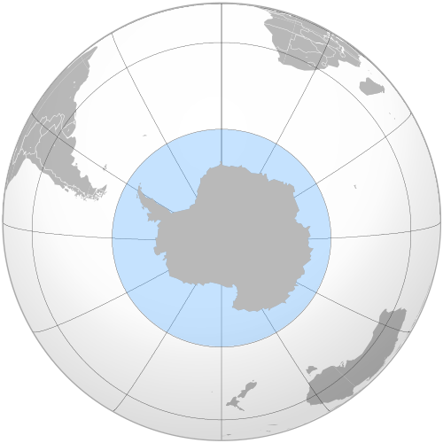
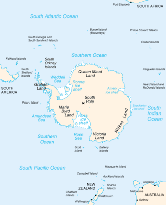
The Southern Ocean, also referred to as the Antarctic Ocean, comprises the southernmost waters of the World Ocean. Encircling the continent of Antarctica, it is generally defined as the body of water south of 60° S latitude. Spanning 21,960,000 km², it stands as the second-smallest of the five principal oceanic divisions—smaller than the Pacific, Atlantic, and Indian oceans, but larger than the Arctic Ocean.
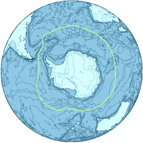
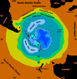
For centuries, the status of these waters was a subject of geographical debate. Some viewed them as the southern extensions of the three major oceans, while others defined them by the Antarctic Convergence—an oceanic zone where cold, northward-flowing Antarctic waters mix with warmer Subantarctic waters. In 2000, the International Hydrographic Organization (IHO) settled the debate, recognizing the Southern Ocean as a distinct entity based on the critical importance of its overturning circulation.
Key Facts
- Location: South of 60° S latitude, encircling Antarctica.
- Size: 21,960,000 km², making it the fourth largest ocean.
- Deepest Point: The Factorian Deep, reaching 7,434 metres (24,390 ft).
- Primary Current: The Antarctic Circumpolar Current (ACC), the world's longest ocean current.
- Key Species: Antarctic krill, which serve as a keystone species for the entire food web.
Defining the Southern Ocean
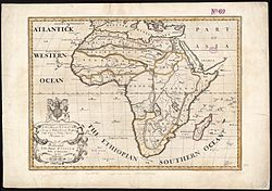
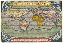
The delineation of the Southern Ocean has evolved significantly over time. Early historical maps, such as the 1564 Typus Orbis Terrarum by Abraham Ortelius, imagined links between Antarctica and South America long before the continent was officially sighted.
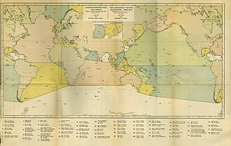
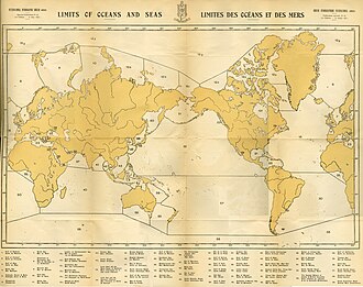
The IHO's official boundaries have shifted through various editions of its Limits of Oceans and Seas. The 1928 edition established an early boundary, which was later modified in 1937 to extend as far north as 40°S between Africa and Australia. By the 2002 draft delineation, the boundary was standardized to the 60th parallel south, ensuring that the Drake Passage and the Scotia Sea were included without interrupting the northern boundary.
![The International Hydrographic Organization's delineation of the "Southern Ocean" has moved steadily southward since the original 1928 edition of its Limits of Oceans and Seas.[5]](/images/79/c6/79c61ef49d4edd8d55046e54d31fb5159c3da94f1189edbdd3c00b6702a6e3d1.png)
The Australian Perspective
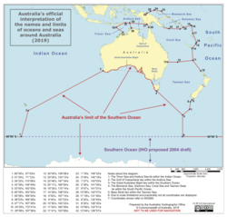
While international standards exist, some nations maintain their own interpretations. Australia, for instance, utilizes its own official interpretation of the names and limits of the seas surrounding its coastline.
History of Exploration
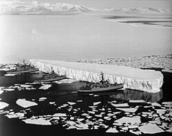
The understanding of the southern latitudes grew through the daring voyages of explorers. In the 1770s, Captain James Cook proved that waters completely encompassed the southern globe, debunking myths of a connected landmass.
![Famous official portrait of Captain James Cook who proved that waters encompassed the southern latitudes of the globe. "He holds his own chart of the Southern Ocean on the table and his right hand points to the east coast of Australia on it."[51]](/images/6c/25/6c251c72e718bc36e4fdffefc32acf990e48a72ace04b6c0661d1d31a13c9565.jpg)
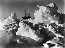
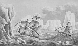
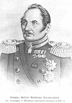
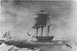
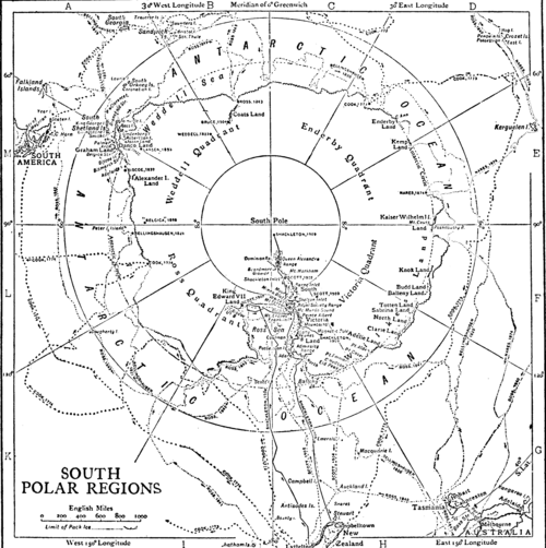
Subsequent expeditions by figures such as James Weddell in 1823, Admiral von Bellingshausen, and later explorers like Ernest Shackleton—whose ship Endurance became famously trapped in pack ice—further mapped the treacherous waters and the Antarctic coastline.
Geography and Bathymetry
The Southern Ocean is characterized by extreme depths, typically ranging between 4,000 and 5,000 metres. The Antarctic continental shelf is notably narrow and deeper than the global average, with edges reaching depths of 800 metres compared to the global mean of 133 metres.
In February 2019, the Five Deeps Expedition identified the deepest point of the ocean at 60° 28' 46"S, 025° 32' 32"W. Expedition leader Victor Vescovo proposed naming this 7,434-metre deep spot the Factorian Deep, after the submersible DSV Limiting Factor used to reach the bottom.
Major Subdivisions
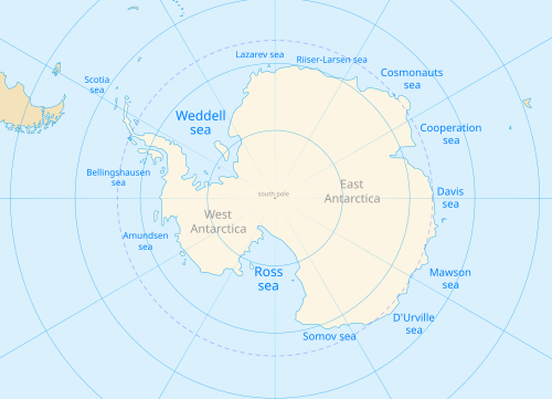
The Southern Ocean is divided into several significant seas, the largest of which is the Weddell Sea.
| Sea Name | Approximate Area (km²) |
|---|---|
| Weddell Sea | 2,800,000 |
| Somov Sea | 1,150,000 |
| Riiser-Larsen Sea | 1,138,000 |
| Lazarev Sea | 929,000 |
| Scotia Sea | 900,000 |
| Ross Sea | 637,000 |
Physical Oceanography and Climate
![Area inside the black line indicates the area constituting the Pacific Ocean prior to 2002; darker blue areas are its informal current borders following the recreation of the Southern Ocean and the reinclusion of marginal seas.[35]](/images/f8/1a/f81a6c34d702574b776a1cbe8b20b81206f942f12135a435fcfde67c9fd26c23.png)
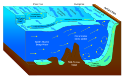
The most defining feature of this ocean is the Antarctic Circumpolar Current (ACC). Stretching 21,000 km, it is the longest current in the world, transporting 130 million cubic metres of water per second—roughly 100 times the flow of all the world's rivers combined.
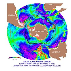
This current system facilitates upwelling, where deep, nutrient-rich waters rise to the surface, supporting a massive biological ecosystem. The ocean also plays a critical role in global climate regulation, acting as a powerful sink for both heat and carbon dioxide.
![Even under the most intense climate change scenario, which is currently considered unlikely,[91][92] the Southern Ocean would continue to function as a strong sink in the 21st century, and take up an increasing amount of carbon dioxide (left) and heat (middle). However, it would take up a smaller fraction of heat per every additional degree of warming than it does now (right),[93] as well as a smaller fraction of emissions.[94]](/images/9c/3e/9c3edabe80a89d886d629ac61871b889a323b0a49431db013337436c55c53c0d.png)
Biodiversity and Ecosystems
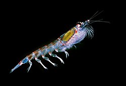
Despite the freezing temperatures, the Southern Ocean is teeming with life. Antarctic krill (Euphausia superba) are the keystone species, providing the primary food source for whales, seals, and penguins.
Specialized Marine Life
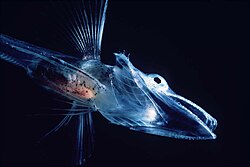
- Fish: The Notothenioidei suborder, including the icefish, are largely restricted to these waters.
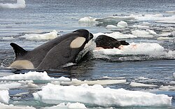
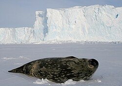
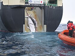
- Mammals: Weddell seals are the southernmost mammals, while Minke whales migrate through these regions.
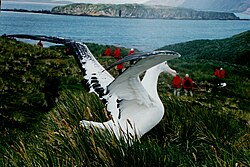
- Birds: The wandering albatross is a prominent avian resident of the subantarctic islands.
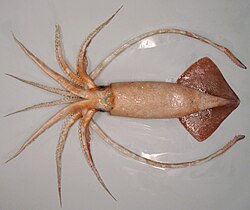
- Invertebrates: The waters host unique species such as the warty squid and various sponges.
Frequently Asked Questions
!["Terres Australes" [sic] label without any charted landmass](/images/c8/50/c8507096e7faa6724fd3483280b3d5261ede73fc57adefe104b1e57857c60b25.jpg)
![Since the 1970s, the upper cell of the circulation has strengthened, while the lower cell weakened.[89]](/images/46/e3/46e3f0993a055bcb3c2e04968aa8a254051e4383ea47660884c6d44051b281e0.png)
![Evidence suggests that the Antarctic bottom water requires a temperature range close to current conditions to be at full strength. During the Last Glacial Maximum (a cold period), it was too weak to flow out of the Weddell Sea and the overturning circulation was much weaker than now. It was also weaker during the periods warmer than now.[112]](/images/33/4f/334f5b3ae5f7622eac399fa7392a758abf6d4e65a2a92c1ed4d7db0e676f5108.png)
What is the difference between the Southern Ocean and the Antarctic Ocean?
The terms are used interchangeably to describe the southernmost waters of the World Ocean that encircle Antarctica.
How is the boundary of the Southern Ocean determined?
While some scientists use the Antarctic Convergence (where cold and warm waters mix), the International Hydrographic Organization generally defines it as the waters south of 60° S latitude.
What is the Factorian Deep?
The Factorian Deep is the deepest known point in the Southern Ocean, measured at 7,434 metres during the 2019 Five Deeps Expedition.
Why is the Antarctic Circumpolar Current important?
It is the world's longest current and links the Atlantic, Indian, and Pacific basins, playing a vital role in transporting heat, nutrients, and carbon around the globe.
Which species is most important to the Southern Ocean food web?
Antarctic krill are the keystone species, as they serve as the primary food source for most of the region's larger predators, including whales and seals.