South Georgia and the South Sandwich Islands
Located in the remote reaches of the southern Atlantic Ocean, South Georgia and the South Sandwich Islands (SGSSI) is a British Overseas Territory characterized by its inhospitable terrain and breathtaking isolation. This territory consists of the primary island of South Georgia and a distant chain of volcanic peaks known as the South Sandwich Islands. While largely uninhabited, the region serves as a critical hub for scientific research and a testament to the industrial history of the southern seas.
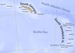
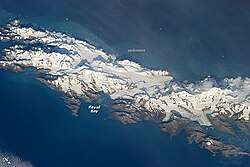
South Georgia is the dominant landmass, stretching 165 kilometers (103 mi) in length and 35 kilometers (22 mi) in width. Approximately 700 kilometers (430 mi) to the southeast lie the South Sandwich Islands. The territory is situated roughly 1,300 kilometers (810 mi) east of the Falkland Islands.
Key Facts
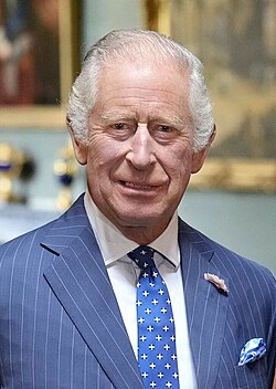
- Sovereignty: British Overseas Territory under the head of state King Charles III.
- Total Area: 3,903 square kilometers (1,507 sq mi).
- Population: No permanent residents; estimated 19 in winter and 22 in summer.
- Highest Point: Mount Paget, reaching 2,934 meters (9,626 ft).
- Capital: King Edward Point.
- Currency: Pound sterling and Falkland Islands pound (£).
Territorial History and Sovereignty
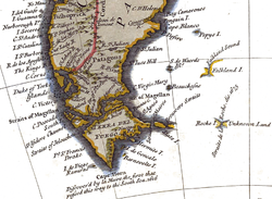
The United Kingdom first claimed sovereignty over South Georgia in 1775, followed by the South Sandwich Islands in 1908. For many years, these lands were managed as part of the Falkland Islands Dependencies until the formal creation of the separate territory on October 3, 1985.
The region has been a point of geopolitical contention. Argentina claimed South Georgia in 1927 and the South Sandwich Islands in 1938. This dispute culminated in the 1982 Falklands War, during which Argentine forces briefly occupied South Georgia. Argentina continues to claim the territory as part of its Tierra del Fuego, Antártida e Islas del Atlántico Sur Province.
The Legacy of Whaling in South Georgia
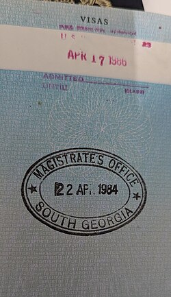
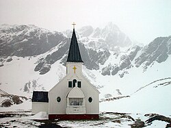
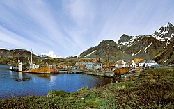
At the dawn of the 20th century, South Georgia became a global center for the whaling industry. In 1904, Carl Anton Larsen established the first permanent habitation and land-based whaling station at Grytviken through the Argentine Fishing Company.
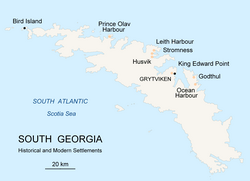
Between the west and east coasts, seven primary whaling stations operated under leases from the Governor of the Falkland Islands: Prince Olav Harbour, Leith Harbour, Stromness, Husvik, Grytviken, Godthul, and Ocean Harbour. These stations remained active until 1965, leaving behind a legacy of industrial ruins that now attract historians and tourists.
Geography and Natural Landscapes
The South Georgia Group
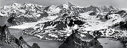
The South Georgia Group encompasses the main island and several surrounding islets. South Georgia Island is a mountainous, largely barren landscape featuring eleven peaks that exceed 2,000 meters. The Allardyce Range houses the territory's highest point, Mount Paget. The island is deeply scarred by glaciers, the largest of which is the Fortuna Glacier.
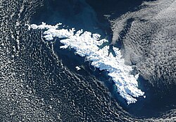
Surrounding the main island are various smaller landmasses, including Bird Island, Annenkov Island, and the Welcome Islands, as well as remote rocks such as Shag Rocks and Black Rock.
The South Sandwich Islands
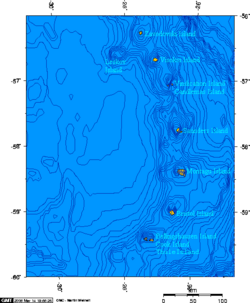
The South Sandwich Islands are a volcanic arc consisting of 11 primary islands. This chain includes Candlemas, Vindication, Saunders, Montagu, Bristol, Bellingshausen, Cook, and Thule. The highest point in this group is Mount Belinda on Montagu Island.
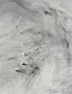
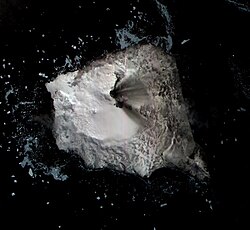
Notably, Mount Michael on Saunders Island features a persistent lava lake, a rare geological phenomenon found at only eight volcanoes worldwide.
Climate and Environment
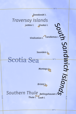
The climate varies significantly between the two groups. The South Sandwich Islands are considerably colder and more exposed to Antarctic air currents, often surrounded by sea ice from mid-May to late November. Temperatures on South Thule Island have been recorded as low as −29.8 °C.
South Georgia experiences a more moderate, though still harsh, subantarctic climate. Data from Bird Island and Grytviken show mean daily temperatures hovering near freezing for much of the year, with record highs reaching 28.8 °C in Grytviken.
| Feature | South Georgia Group | South Sandwich Islands |
|---|---|---|
| Primary Terrain | Mountainous, Glaciated | Volcanic Arc |
| Highest Peak | Mount Paget (2,934m) | Mount Belinda (1,370m) |
| Human Presence | Research Bases (BAS) | Uninhabited |
| Climate | Subantarctic | Extreme Antarctic/Polar |
Administration and Modern Presence
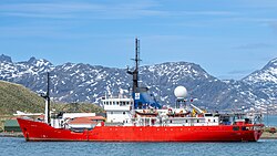
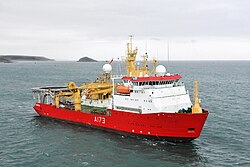
The territory is a directly administered dependency of the United Kingdom. It is governed by a Commissioner and overseen by a UK Minister. While there are no permanent residents, the British Antarctic Survey (BAS) maintains a presence at King Edward Point and Bird Island for long-term monitoring of marine mammals and seabirds.
Following the 1982 conflict, the UK maintained a military presence at King Edward Point until 2001, when the site transitioned fully to a research station.
Frequently Asked Questions
Who currently governs South Georgia and the South Sandwich Islands?
The territory is a British Overseas Territory under the sovereignty of the United Kingdom, with King Charles III as the head of state.
Is anyone living permanently on the islands?
No, there are no permanent residents. The population consists of rotating staff from the British Antarctic Survey and government officers.
What was the primary industry of South Georgia in the past?
The primary industry was whaling, with several land-based stations operating from the early 1900s until 1965.
What is unique about the South Sandwich Islands?
They are a volcanic island arc, and Mount Michael on Saunders Island is one of only eight volcanoes in the world with a persistent lava lake.
Does Argentina have a claim to these islands?
Yes, Argentina claims sovereignty over the territory as part of the Tierra del Fuego, Antártida e Islas del Atlántico Sur Province.