Saint Helena, Ascension and Tristan da Cunha
Stretching across the vast expanse of the South Atlantic Ocean, Saint Helena, Ascension and Tristan da Cunha is a unique British Overseas Territory. Comprising three distinct island groups, this territory spans thousands of kilometers, ranging from the warm, arid landscapes of the north to the cool, wet peaks of the south. From its history as a strategic naval outpost to its role as a place of exile for one of history's most famous figures, the territory remains one of the most remote inhabited regions on Earth.
Key Facts
- Sovereign State: United Kingdom (Constitutional Monarchy).
- Capital: Jamestown (Saint Helena).
- Total Area: 394 km² (152 sq mi).
- Highest Point: Queen Mary's Peak (2,062 m).
- Total Population: 5,633 (2016 census).
- Official Language: English.
- Currency: Saint Helena pound (SHP) and Pound sterling (GBP).
History and Colonization
All three island groups are of volcanic origin and were discovered by Portuguese explorers between 1502 and 1504. While the Portuguese used Saint Helena as a vital rendezvous point for voyages from Asia, they never established a permanent settlement.
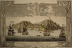
The English East India Company was granted a charter to govern Saint Helena in 1657. By 1659, the island was fortified and colonized, making it Britain's second oldest remaining colony after Bermuda. The town of Jamestown and James Fort were named in honor of the Duke of York, later King James II.
Saint Helena gained global notoriety in October 1815 when it became the place of exile for Napoleon Bonaparte, who remained there until his death in 1821. During the 19th century, the British expanded their presence in the region, garrisoning Ascension Island in 1815 as a naval coaling station and annexing Tristan da Cunha in 1816.

The political structure evolved over time. Ascension became a dependency of Saint Helena in 1922, and Tristan da Cunha followed in 1938. On September 1, 2009, a new constitution elevated Ascension and Tristan da Cunha to equal status with Saint Helena, forming the current unified territory.
Geography and Climate
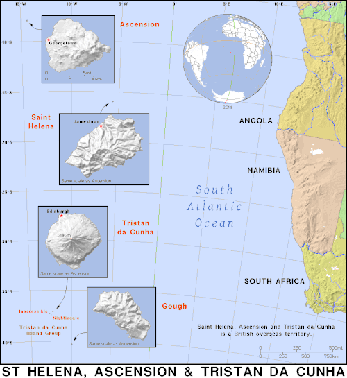
The territory covers a massive latitudinal range, from Ascension at 7° 56′ S to Gough Island at 40° 19′ S. The distance between the northernmost and southernmost points is approximately 3,642 kilometers (2,263 mi).
Due to this distance, the climate varies significantly:
- Ascension: Warm and arid, with temperatures consistently above 20 °C (68 °F).
- Saint Helena: Moderate climate, though more arid near the coastlines.
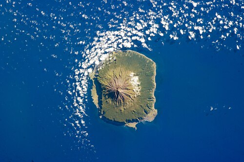
- Tristan da Cunha: Much cooler and wetter due to its proximity to the Antarctic Circle.
- Gough Island: The wettest of the group, experiencing freezing winter temperatures.
Territorial Waters and EEZ
The territory possesses an Exclusive Economic Zone (EEZ)—the area of sea over which a state has special rights regarding exploration and use of marine resources—that is larger than that of the United Kingdom itself. Ranking 21st globally by EEZ size, the territory's waters extend 200 nautical miles from the island baselines.
| Part | Area (km²) | Area (sq mi) |
|---|---|---|
| Ascension | 441,658 | 170,525 |
| Saint Helena | 444,916 | 171,783 |
| Tristan da Cunha | 754,720 | 291,400 |
| Total | 1,641,294 | 633,708 |
Governance and Administration
The territory is a self-governing dependency under a constitutional monarchy, with King Charles III as the head of state. The Governor of Saint Helena serves ex officio as the Governor for all three parts. Because of the extreme distances, Administrators are appointed for Ascension and Tristan da Cunha to represent the Governor locally.
Administrative Divisions
- Saint Helena: Centered in Jamestown, with Half Tree Hollow as its largest city.
- Ascension Island: Centered in Georgetown.
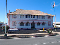
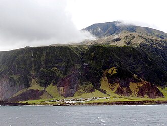
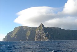
- Tristan da Cunha: Centered in Edinburgh of the Seven Seas. This group also includes the uninhabited Inaccessible Island, Nightingale Islands, and Gough Island.
Economy and Infrastructure
The territory uses two primary currencies. The Saint Helena pound (SHP) is used in Saint Helena and Ascension, while the Pound sterling (GBP) is used in Tristan da Cunha. The SHP is issued at par with sterling.
Transport and Connectivity
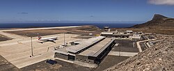
Air travel is limited but critical. Saint Helena Airport began scheduled commercial flights in 2017, connecting to Johannesburg. RAF Ascension Island also maintains a significant runway for military and commercial use.
Maritime transport remains the only way to reach Tristan da Cunha, as it lacks an airport. On land, traffic drives on the left in all three territories. Road networks vary, with Saint Helena having the most extensive system at 138 kilometers.
Communications
Telecommunications are provided by Sure South Atlantic. Saint Helena and Tristan da Cunha share the calling code +290, while Ascension Island uses +247. Each island group also has a unique UK postcode (STHL 1ZZ, ASCN 1ZZ, and TDCU 1ZZ).
Frequently Asked Questions
Who is the current head of state?
King Charles III is the head of state of Saint Helena, Ascension and Tristan da Cunha.
Which island is the most remote?
Tristan da Cunha is known as one of the most remote inhabited settlements in the world, accessible only by sea.
What is the significance of Napoleon Bonaparte to Saint Helena?
Saint Helena served as the place of Napoleon's final exile from 1815 until his death in 1821.
What currency is used in the territory?
The Saint Helena pound is used in Saint Helena and Ascension, while the British Pound sterling is used in Tristan da Cunha.
How do people travel to Saint Helena?
Since 2017, scheduled commercial flights operate from Johannesburg, South Africa, to Saint Helena Airport.