Southeast Region of Brazil: The Economic and Industrial Powerhouse
The Southeast Region is the most populous and economically influential area of Brazil. Comprising the states of São Paulo, Rio de Janeiro, Minas Gerais, and Espírito Santo, this region serves as the country's primary industrial, financial, and agricultural hub. With a high Human Development Index (HDI) and a densely populated urban landscape, the Southeast is central to Brazil's role in the global economy.
The region is characterized by a diverse geography and a climate that supports both massive urban centers and vast agricultural plantations. From the bustling streets of São Paulo to the mineral-rich mountains of Minas Gerais, the Southeast blends natural wealth with advanced industrialization.
![Climate classification for Southeastern Brazil, according to the Köppen criteria.[3]](/images/10/8e/108e3d08fea2b1b6ef33af0e2cb6851bceccb35cb3e91d49b951dff015b7e81c.webp)
Key Facts
- Largest City: São Paulo, the most populous city in Brazil.
- Population: Approximately 89 million people, the highest density in the country.
- Economic Weight: A total GDP of R$ 4.713 trillion (US$ 874.258 billion).
- Human Development: High HDI (0.795) with a life expectancy of 77.5 years.
- Urbanization: 97% of the population lives in urban areas.
Regional Geography and Demographics
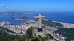
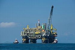
The Southeast is divided into four key states, each contributing uniquely to the region's identity. São Paulo is the industrial heart, Rio de Janeiro is a global tourism and energy hub, Minas Gerais is renowned for mining and dairy, and Espírito Santo is vital for logistics and food production.
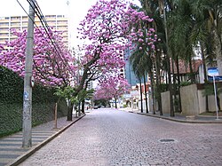
Demographically, the region is highly diverse. According to 2022 IBGE data, the ethnic composition consists of 55.0% White, 38.7% Mixed, 5.6% Black, 0.7% Asian, and 0.1% Indigenous populations.
Major Urban Centers
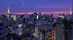
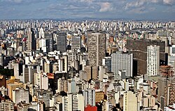
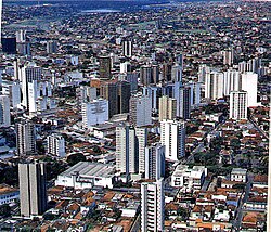
The region hosts some of the largest cities in the Southern Hemisphere. São Paulo leads with over 11 million residents, followed by Rio de Janeiro and Belo Horizonte. These cities serve as the primary nodes for education, healthcare, and commerce.
Economic Pillars
Agriculture and Livestock
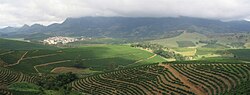
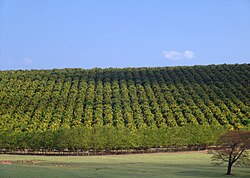
The Southeast is a global leader in several agricultural sectors. It produces 85% of Brazil's coffee and oranges, and 65% of its sugarcane. Brazil is the world's largest producer of these three crops, with the Southeast driving the majority of the output.
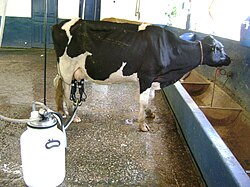
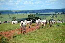
In livestock, the region is a powerhouse for poultry and eggs. São Paulo alone is the largest national producer of chicken eggs. In the dairy sector, Minas Gerais is the leading state, contributing significantly to the region's 34.2% share of national milk production.
Mining and Mineral Wealth
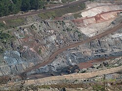
Minas Gerais is the epicenter of Brazilian mining. It is the country's largest producer of iron, gold, zinc, and niobium. The state is also world-famous for its gemstones, particularly Imperial Topaz, which is found exclusively in Ouro Preto, and high-value aquamarines.

Industrial Diversification
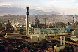
The industrial landscape of the Southeast is vast and varied:
- Automotive: The Greater ABC Region in São Paulo is the largest automobile center in Brazil, hosting giants like Volkswagen, GM, and Fiat.
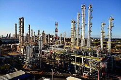
- Chemicals and Pharma: São Paulo is the primary hub for the chemical industry and the pharmaceutical market, with the state accounting for 76.8% of national drug sales.
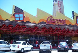
- Food and Beverage: The region is home to major brands like Garoto (Espírito Santo) and various food giants in São Paulo and Minas Gerais.
- Footwear: Specialized clusters exist in Franca (men's shoes), Jaú (women's shoes), and Birigui (children's shoes).


Infrastructure and Education
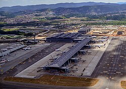
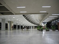
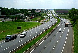
The region boasts the most advanced infrastructure in Brazil. This includes the São Paulo-Guarulhos International Airport (GRU) and Rio de Janeiro's Galeão Airport, the latter being a primary gateway for foreign tourists with the longest runway in Brazil (4,240 meters).
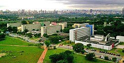
Educationally, the Southeast is the academic center of the country, hosting prestigious institutions such as the University of São Paulo (USP), the Federal University of Rio de Janeiro (UFRJ), and the Federal University of Minas Gerais (UFMG).
Cultural and Architectural Landmarks
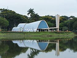
Beyond industry, the region is a cultural beacon. Belo Horizonte's Pampulha Church stands as a symbol of Brazilian Modern Architecture, reflecting the region's commitment to art and design.
Regional Summary Table
| Metric | Value / Detail |
|---|---|
| States | Espírito Santo, Minas Gerais, Rio de Janeiro, São Paulo |
| Total Area | 924,511.3 km² |
| Population | 89,012,240 |
| GDP | R$ 4.713 trillion |
| Literacy Rate | 96.7% |
| Main Crops | Coffee, Sugarcane, Orange |
Frequently Asked Questions
Which state is the largest producer of milk in the Southeast?
Minas Gerais is the main milk-producing state in Brazil, responsible for 26.6% of national production.
What are the primary industrial hubs in São Paulo?
The Greater ABC Region is the largest automobile center, while the Metropolitan Region of São Paulo and Campinas are the primary hubs for the textile and chemical industries.
Why is Minas Gerais significant for the global gemstone market?
Minas Gerais produces some of the world's most valuable aquamarines and is the only place where the highly valued Imperial Topaz is found (specifically in Ouro Preto).
How does the Southeast region rank in terms of population?
The Southeast region ranks 1st in Brazil for both total population and population density.
Which airport is the main gateway for international tourists in Rio de Janeiro?
Galeão International Airport is the main gateway, handling nearly 40% of foreign tourists visiting Brazil.