Mato Grosso: Brazil's Agricultural Powerhouse and Natural Wonder
Located in the heart of Brazil's Central-West region, Mato Grosso (literally meaning "Thick Bush") is a land of immense scale and biological diversity. As the third largest state by area, it serves as a critical pillar of the Brazilian economy, blending vast industrial agricultural landscapes with some of the most pristine ecosystems on Earth.
The state is a mosaic of diverse environments, bordering six other Brazilian states—Rondônia, Amazonas, Pará, Tocantins, Goiás, and Mato Grosso do Sul. Its sheer size is comparable to neighboring nations, covering roughly 82.2% of the landmass of Bolivia.
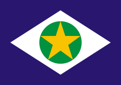
Key Facts
- Capital: Cuiabá, the state's financial and administrative center.
- Area: 903,357 km², ranking 3rd largest in Brazil.
- Economy: A global leader in soy, maize, and cotton production.
- Nature: Home to the Pantanal, one of the world's largest wetland ecosystems.
- Population: Approximately 3.89 million people (2025 estimate).
- HDI: 0.812, categorized as very high.
Geography and Natural Ecosystems
Mato Grosso is defined by its extraordinary biodiversity. Most notable is the Pantanal, a massive wetland and prairie ecosystem. The Paraguay basin within the Pantanal is a sanctuary for approximately 230 species of fish, making it a premier destination for scientific research and sport fishing. This region shares ecological similarities with the Florida Everglades, though it is significantly larger in scale.
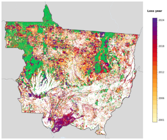
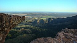
Beyond the wetlands, the state features dramatic landscapes such as the Chapada dos Guimarães, known for its sandstone formations and the Aroe Jari cavern, the largest of its kind in Brazil.
History and Demographics
The region has been inhabited for centuries by indigenous peoples, including the Bororo Indians. Throughout the 19th century, the area saw significant conflict between settlers, prospectors, and indigenous groups. A notable geopolitical shift occurred in 1903 via the Treaty of Petrópolis, where Brazil ceded the southwestern portion of the state to Bolivia in exchange for the territory of Acre.
In 1977, the state underwent a major administrative change when it was split in two, leading to the creation of the neighboring state of Mato Grosso do Sul.
Demographically, the state is characterized by a high proportion of caboclos (people of mixed European and Indigenous ancestry). According to census data, the population is predominantly Pardo (56%), followed by White (32.3%), Black (9.86%), Indigenous (1.55%), and Asian (0.3%) ethnicities.
Economic Engine of Brazil
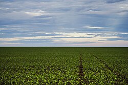
Mato Grosso is a global titan in agribusiness. Agriculture is the primary driver of the state's GDP (40.8%), followed closely by the service sector (40.2%). The state is the national leader in the production of soy, maize, and cotton, with cotton production alone accounting for roughly 65% of Brazil's total harvest.
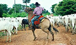
The livestock industry is equally dominant. In 2009, the state boasted the largest cattle herd in Brazil, totaling 30 million head, representing nearly 14% of national production. Additionally, the state is a significant producer of pork and sugarcane.
Mining also contributes to the economy, particularly in the city of Juína. Mato Grosso is the second-largest national producer of diamonds and also extracts gold, tin, sapphire, and jasper.
Industrial Breakdown
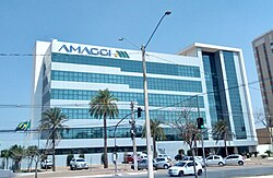
The industrial sector represents 19% of the GDP, with the majority of activity concentrated in five key areas: construction, food processing, public utilities (electricity and water), beverages, and oil/biofuels.
Infrastructure and Urban Centers
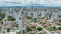
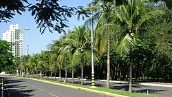
Cuiabá serves as the capital and largest city, acting as the hub for education and finance. The city hosts major institutions like the Federal University of Mato Grosso (UFMT). Other significant urban centers include Várzea Grande and Rondonópolis.
Transportation is critical for exporting the state's massive agricultural yields. The road network includes major federal highways such as the BR-163 and BR-364. For air travel, the Marechal Rondon International Airport in Várzea Grande handles over half a million passengers annually.
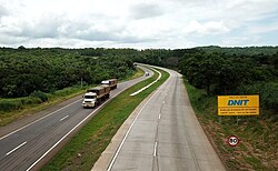
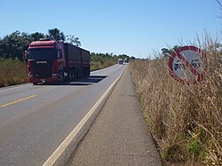
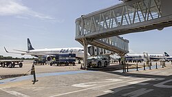
Rail transport is managed by the Northern Brazil Railway, which connects the state to São Paulo and various seaports via freight trains running as far inland as Rondonópolis.
Tourism and Recreation
Mato Grosso offers diverse attractions for nature lovers and adventurers:
- North Pantanal: Accessible via the Transpantaneira Highway, a 149 km dirt road with 126 wooden bridges, ideal for spotting alligators, capybaras, and exotic birds.
- Lagoa Azul State Park: Located in Nobres, this park features a stunning limestone cave with a deep blue pool formed by the Saloba River.
- Águas Quentes State Park: The state's first protected area, famous for its therapeutic thermal waters.
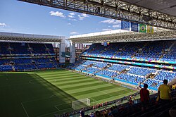
In the realm of sports, the state gained international visibility when Cuiabá hosted matches for the 2014 FIFA World Cup at the Arena Pantanal.
| Category | Detail |
|---|---|
| Total Area | 903,357 km² |
| Population (2025) | 3,893,659 |
| GDP (Total) | R$ 233.390 billion |
| Main Exports | Soybeans, Wood, Meats, Cotton |
| Highest Elevation | 902 m |
| Time Zone | UTC-4 |
Frequently Asked Questions
What is the primary economic activity in Mato Grosso?
Agriculture is the largest component of the state's GDP, with Mato Grosso leading Brazil in the production of soy, maize, and cotton, as well as maintaining the country's largest cattle herd.
What is the Pantanal?
The Pantanal is one of the world's largest wetland and prairie ecosystems, known for its immense biodiversity, including over 230 species of fish and a wide array of wild animals like jaguars and capybaras.
How was Mato Grosso divided in 1977?
In 1977, the state was split into two halves, resulting in the creation of the new state of Mato Grosso do Sul from the southern portion of the original territory.
Which city is the capital of Mato Grosso?
Cuiabá is the capital and largest city, serving as the state's financial center and a major educational hub.
What are the most important minerals produced in the state?
Mato Grosso is a significant producer of gold and tin, and it ranks as the second-largest national producer of diamonds, primarily centered around the city of Juína.