Mississippi River–Gulf Outlet Canal: History, Impact, and Closure
The Mississippi River–Gulf Outlet Canal (commonly known as the MR-GO or MRGO) was a 76-mile (122 km) shipping channel designed to streamline maritime access between the Gulf of Mexico and the inner harbor of New Orleans. Constructed by the United States Army Corps of Engineers under congressional direction in the mid-20th century, the canal aimed to provide a shorter route to the Industrial Canal via the Intracoastal Waterway.
While intended as an economic catalyst, the MRGO became a focal point of environmental concern and engineering scrutiny. It is most remembered for its role during Hurricane Katrina in 2005, where it acted as a conduit for storm surges, leading to catastrophic flooding and the eventual permanent closure of the waterway.
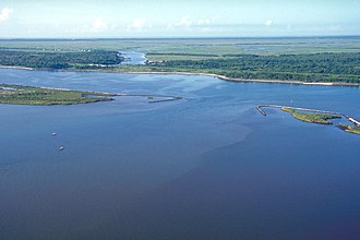
Key Facts
- Length: 76 miles (122 km).
- Purpose: To provide a shorter route for deep-draft vessels from the Gulf of Mexico to New Orleans.
- Completion: Construction was finished in 1968.
- Environmental Impact: Caused significant saltwater intrusion and wetland erosion.
- Katrina Role: Amplified storm surges, contributing to levee and floodwall failures.
- Current Status: Closed to maritime shipping since April 22, 2009.
The Origins and Construction of the MRGO
The concept for the MRGO emerged in the early 20th century as the Port of New Orleans sought to remain competitive. The winding nature of the Mississippi River made navigation slow for oceangoing vessels, a disadvantage compared to the Houston Ship Channel, which opened in 1914. New Orleans first attempted to address this in 1923 with the Industrial Canal, linking the river to Lake Pontchartrain.
By the 1940s, two competing plans emerged: the "Alexander Seaway" (proposed by the Dock Board of New Orleans) and the "Arrow to the Americas" (proposed by Jefferson Parish). As ship sizes grew, existing locks became obsolete. To accommodate deep-draft vessels, Congress authorized the MRGO through the Rivers and Harbors Act of 1956.
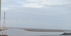
Operational Failures and Economic Decline
Following the canal's completion in 1968, the Port of New Orleans launched "Centroport U.S.A.," an ambitious plan to move most wharf activities to the inner harbor. However, the project lacked sufficient funding and was abandoned by the mid-1980s, leaving only the France Road Container Terminal and Jourdan Road Wharf as completed elements.
As the port refocused on the Mississippi River, traffic on the MRGO dwindled. By 2005, an average of less than one oceangoing vessel used the channel per day, yet it cost approximately $13 million annually to maintain. Critics, including the Competitive Enterprise Institute, argued that the canal provided negligible economic benefit while costing nearly $1 billion to construct and maintain.
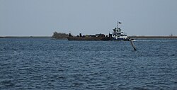
The "Hurricane Highway": Role in the Katrina Disaster
The MRGO is widely criticized for its role in the devastation caused by Hurricane Katrina. Experts, including Hassan Mashriqui of Louisiana State University, had warned that the canal was a "Trojan Horse" that could amplify storm surges by 20 to 40 percent.
Post-storm analysis and computer modeling revealed that the MRGO intensified the initial surge by 20 percent and increased the water's velocity from 3 feet per second to 8 feet per second in the funnel-shaped area where the MRGO and Gulf Intracoastal Waterway converge. This effect contributed to the scouring that undermined levees and floodwalls, leading to breaches in approximately 20 locations. This flooded much of New Orleans East and St. Bernard Parish.
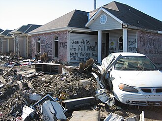
Closure and Environmental Restoration
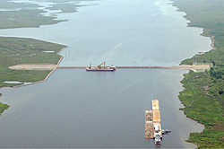
In the wake of the disaster, the U.S. Army Corps of Engineers announced the closure of the MRGO. On April 22, 2009, maritime traffic was officially barred. A permanent closure structure—an earthen dam—was completed in July 2009 at Bayou La Loutre to help restore the natural ridge and protect the surrounding marshes.
The Corps also proposed the MRGO Ecosystem Restoration Plan, a $2.9 billion initiative to revitalize damaged wetlands, including the creation of thousands of acres of brackish and fresh marshes and cypress swamps. However, this plan was never implemented due to funding disputes between the federal government and the State of Louisiana.
The Surge Barrier
To prevent future disasters, a massive 1.8-mile surge barrier was constructed near New Orleans, completed in 2011. Costing over $1 billion, this barrier is the largest of its kind in the U.S. and is designed to protect against surges up to 28 feet high. It effectively closes the narrow end of the "funnel" to prevent storm surges from entering the Industrial Canal and Intracoastal Waterway, while utilizing gates at Bayou Bienvenue and the Intracoastal Waterway for small commercial traffic during normal weather.
| Feature | Details |
|---|---|
| Total Length | 76 miles (122 km) |
| Original Width | 650 feet (200 m) |
| Width by 2005 | Up to 3,000 feet in some areas |
| Closure Date | April 22, 2009 |
| Surge Barrier Height Capacity | Up to 28 feet |
| Annual Maintenance Cost (2005) | Approximately $13 million |
Frequently Asked Questions
Why was the MRGO built?
It was constructed to provide a shorter, more direct route for deep-draft oceangoing vessels to reach the inner harbor of New Orleans, reducing the time spent navigating the twists of the Mississippi River.
How did the MRGO contribute to the flooding during Hurricane Katrina?
The canal acted as a funnel, amplifying the storm surge's height and velocity. This increased pressure and scouring undermined the levees and floodwalls, leading to multiple breaches.
Is the MRGO still used for shipping?
No. The channel was closed to all maritime shipping on April 22, 2009, and a permanent closure structure was built at Bayou La Loutre.
What happened to the Ecosystem Restoration Plan?
The $2.9 billion plan to restore marshes and swamps was never implemented because the U.S. Army Corps of Engineers and the State of Louisiana could not agree on how to share the costs.
What is the purpose of the 2011 surge barrier?
The barrier prevents storm surges from penetrating the inner harbor of the Industrial Canal and Intracoastal Waterway, protecting the region from surges up to 28 feet high.