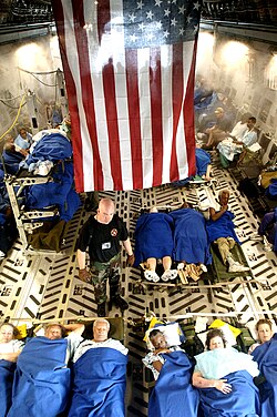
Hurricane KatrinaNew Orleans floodinglevee failuresSuperdome evacuationstorm surge

Hurricane Katrina: The Devastation and Aftermath in New Orleans

Hurricane Katrina: The Devastation and Aftermath in New Orleans On August 29, 2005, New Orleans faced one of the most catastrophic events in its history when Hurricane Katrina made landfa...

Hurricane Katrina: The Devastation and Aftermath in New Orleans

On August 29, 2005, New Orleans faced one of the most catastrophic events in its history when Hurricane Katrina made landfall. A Category 3 major hurricane at the time of impact, the storm brought sustained winds of 125 mph and a lowest pressure of 920 mbar. While the wind caused significant damage, the true disaster unfolded as the city's flood protection systems failed, leading to widespread inundation and a humanitarian crisis.

The geography of New Orleans, much of which sits below sea level, made it uniquely vulnerable. Before the storm, forecasts predicted that the hurricane's eye would pass through the city, pushing massive volumes of water from Lake Pontchartrain against the city's levees. Experts anticipated a storm surge of 14–18 feet, with additional waves reaching 7 feet above that surge.
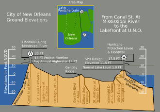
Vertical cross-section of New Orleans, showing maximum levee height of 23 feet (7 m) at the Mississippi River on the left and 17.5 feet (5 m) at Lake Pontchartrain on the right

Key Facts

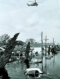
Flooding in the Lower Ninth Ward of New Orleans after Hurricane Betsy in 1965
  • Landfall Date: August 29, 2005
  • Storm Intensity: Category 3 major hurricane with 125 mph winds
  • Human Toll: 986 fatalities and 639 people missing
  • Financial Impact: Approximately $70 billion in damages (2005 USD)
  • Primary Cause of Flooding: Multiple levee and floodwall breaches

The Failure of the Levee System
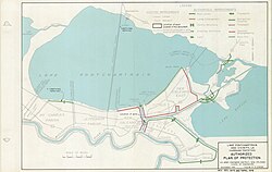
Authorized Plan of Protection for Lake Pontchartrain and Vicinity, Louisiana, November 1965. Map by U.S. Army Engineer District, New Orleans Corps of Engineers. Revised Dec 1970 and April 1978.

The most critical failure during Hurricane Katrina was the collapse of the levee system—the embankments designed to prevent flooding from adjacent bodies of water. Breaches occurred at several key locations, including the 17th Street Canal and the London Avenue Canal. These failures allowed water to pour into residential neighborhoods, turning streets into rivers and trapping thousands of residents.
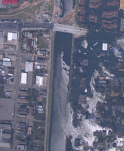
Breach in 17th Street Canal levee on August 31, showing the inundated Lakeview neighborhood on the right and the largely dry Metairie side on the left (NOAA)

The flooding was not uniform; some areas remained relatively dry while others were completely submerged. The Lower Ninth Ward and the Lakeview neighborhood were among the hardest hit, with homes destroyed by the force of the rushing water and piles of sand left behind by the breaches.
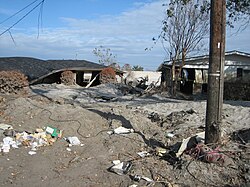
Severely damaged homes in piles of sand near the upper London Avenue Canal breach

The scale of the failure was immense, affecting the Central Business District and extending into surrounding areas like Metairie. Even major infrastructure, such as the I-10/I-610 interchange, was swallowed by the floodwaters.
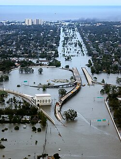
Flooded I-10/I-610 interchange and surrounding area of northwest New Orleans and Metairie, Louisiana

Humanitarian Crisis and Evacuation

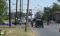
Checkpoint in the Ninth Ward at the Industrial Canal in October 2005. Residents were allowed in to examine and salvage from their property during daylight.

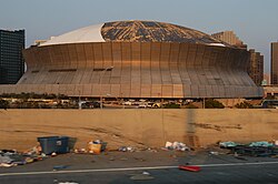
As the city flooded, thousands of people who were unable to evacuate early sought refuge in the Louisiana Superdome. The facility became a makeshift shelter for roughly 25,000 people. Conditions inside the dome deteriorated rapidly as floodwaters rose and resources dwindled.
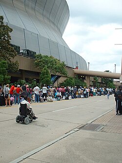
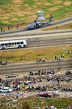
Displaced people bringing their belongings and lining up to get into the Superdome

By August 31, Governor Blanco ordered the complete evacuation of the Superdome. A massive logistical operation involving FEMA, the National Guard, Greyhound, and Houston Metro was launched. Approximately 475 buses were used to transport evacuees across state lines to the Houston Astrodome, a process that took between two and three days to complete.
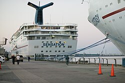
Carnival Cruise Ships Ecstasy and Sensation docked at the Port of New Orleans while used as housing for victims

Rescue Operations

Rescue efforts were carried out by the U.S. Coast Guard, the National Guard, and the U.S. Army. Aircrews searched for survivors on rooftops, and boats were used to navigate the flooded streets to evacuate residents from their homes. Some of the most critical rescues involved pregnant women and the sick, who were eventually transported via C-17 Globemaster III aircraft.
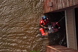
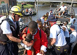
Successful rescue of a pregnant woman

Aftermath and Civil Unrest

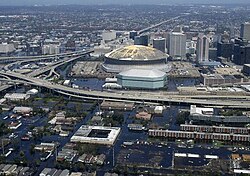
An aerial view of the flooding in part of the Central Business District. The Superdome is at the center where many people stayed through the course of Katrina.

The period following the storm was marked by chaos and civil disturbances. Communication failures hindered the coordination of relief efforts, and the city experienced outbreaks of looting and violence. These events were exacerbated by a "zero tolerance" policy toward looters announced by President George W. Bush.
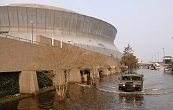
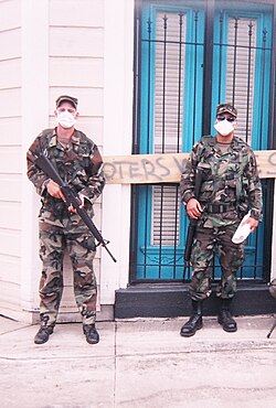
A United States National Guard humvee patrols Poydras Street outside of the Superdome.

The aftermath also revealed deep racial and economic disparities. Many of the city's Black residents, particularly the middle class, were disproportionately affected by the displacement and faced greater hurdles in returning to and rebuilding their homes.

Summary of Storm Impact

Hurricane Katrina Impact Summary (New Orleans)
Metric Detail
Wind Speed 125 mph (205 km/h)
Lowest Pressure 920 mbar
Fatalities 986
Missing Persons 639
Economic Loss $70 Billion (2005 USD)

Frequently Asked Questions

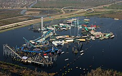
Six Flags New Orleans still flooded 2 weeks after the levee failures
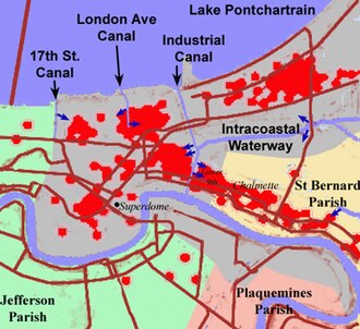
Sketch of New Orleans (shaded gray), indicating the locations of the principal breaches in the levees/floodwalls (dark blue arrows). Red dots show locations of deaths.
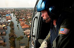
A U.S. Coast Guard aircrew searches for survivors in New Orleans during the aftermath of Hurricane Katrina.
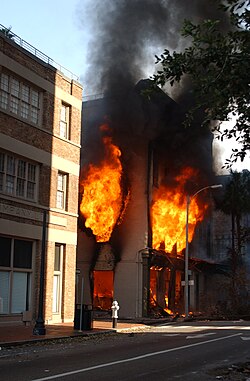
A fire raging in a downtown business at 329 Tchoupitoulas Street on the morning of September 2
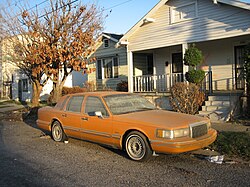
A Lincoln Town Car disabled by the flooding from Katrina
U.S. Army Infantry on patrol in New Orleans in an area previously underwater, September 2005
Damage to the Superdome as a result of Katrina
Hurricane evacuees in Metairie, Louisiana, being helped by the US Air National Guard on September 3
Rescue teams evacuating residents from flooded areas on August 30
Sick and injured people being evacuated aboard a C-17 Globemaster III

Why did New Orleans flood so severely?

The flooding was primarily caused by the failure of the levee and floodwall systems. These structures were unable to withstand the storm surge from Lake Pontchartrain and the pressure of the floodwaters, leading to multiple breaches that inundated the city.

What happened to the people at the Superdome?

Approximately 25,000 people used the Superdome as a shelter. Due to rising waters and poor conditions, they were eventually evacuated via hundreds of buses to the Houston Astrodome between August 31 and September 4, 2005.

How many people died as a result of the storm?

There were 986 recorded fatalities, and another 639 people were reported missing in the wake of the disaster.

What was the financial cost of the damage?

The total damage caused by Hurricane Katrina in the affected areas was estimated at $70 billion in 2005 USD.

Who was involved in the rescue efforts?

Rescue operations were a joint effort involving the U.S. Coast Guard, the U.S. Army, the National Guard, and various state and federal agencies including FEMA.

References

  1. Mittal, Anu (September 28, 2005). "Testimony Before the Subcommittee on Energy and Water Development, Committee on Appropriations, House of Representatives: Lake Pontchartrain and Vicinity Hurricane Protection Project" (PDF). Government Accountability Office. Archived from the original (PDF) on May 23, 2011. Retrieved October 31, 2015.
  2. McQuaid, John (September 2, 2005). "Levees' Weakness Well-Known Before Breaches" (PDF). The Times-Picayune. Archived (PDF) from the original on February 14, 2016. Retrieved February 12, 2016.
  3. Seed, Raymond (October 30, 2007). "New Orleans, Hurricane Katrina, and the Soul of the Profession" (PDF). Correspondence. Archived (PDF) from the original on November 21, 2015. Retrieved February 12, 2016.
  4. Christine A. Anderson; et al. (June 1, 2007). "The New Orleans Hurricane Protection System: What Went Wrong and Why" (PDF). American Society of Civil Engineers. Archived from the original (PDF) on November 26, 2007. Retrieved February 12, 2016.
  5. Wolshon, Brian (2006). "Evacuation Planning and Engineering for Hurricane Katrina". The Bridge. 36 (1). Archived from the original on November 14, 2011. Retrieved May 18, 2012.