Hurricane KatrinaCategory 5 hurricaneNew Orleans floodingGulf Coast disasterSaffir-Simpson scale

Hurricane Katrina: The Devastation and Aftermath of a Category 5 Storm

Hurricane Katrina: The Devastation and Aftermath of a Category 5 Storm Hurricane Katrina remains one of the most catastrophic natural disasters in United States history. A powerhouse of t...

Hurricane Katrina: The Devastation and Aftermath of a Category 5 Storm

Hurricane Katrina remains one of the most catastrophic natural disasters in United States history. A powerhouse of the 2005 Atlantic hurricane season, this storm evolved from a tropical system into a Category 5 major hurricane, bringing unprecedented destruction to the Gulf Coast. Beyond the wind and rain, the event became a symbol of systemic failure and human resilience, forever altering the landscape of the southeastern United States.

The storm's scale was immense, making it one of the largest-diameter hurricanes to ever strike the US Gulf Coast. While diameter does not always equate to strength—which is measured by sustained wind speeds—a larger storm increases the number of people exposed to its hazards.

Hurricane Katrina was one of the largest-diameter US Gulf Coast hurricanes.[48] Though large size does not imply strength—which is based on sustained wind measurements—it can mean that more people are exposed to its hazards.[48]

Key Facts

Flooding in Venice, Louisiana
  • Peak Intensity: Category 5 with maximum sustained winds of 175 mph (280 km/h).
  • Lowest Pressure: 902 mbar (hPa).
  • Human Toll: Between 1,245 and 1,836 fatalities, with 652 people reported missing.
  • Economic Impact: $125 billion (2005 USD), making it the costliest tropical cyclone on record when adjusted for inflation.
  • Primary Areas Affected: Louisiana, Mississippi, Florida, the Bahamas, Cuba, and Eastern Canada.

Meteorological History
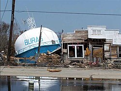
A fallen water tower in Buras-Triumph, Louisiana, where Katrina made landfall

Hurricane Katrina formed on August 23, 2005. It rapidly intensified as it moved through the Gulf of Mexico, reaching its peak intensity on August 28. The storm's power was characterized by extreme wind speeds and a dangerously low central pressure of 902 mbar.
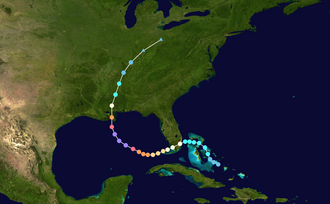
Map plotting the storm's track and intensity, according to the Saffir–Simpson scale

After making landfall at the Louisiana-Mississippi border, the storm began to weaken. It became extratropical on August 30 and finally dissipated on August 31, 2005.
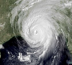
Hurricane Katrina making landfall at the Louisiana-Mississippi border

Regional Impact and Destruction

New Orleans
New Orleans

Louisiana and New Orleans

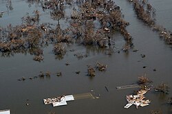
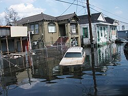
Louisiana bore the brunt of the disaster, recording between 986 and 1,577 deaths. The city of New Orleans suffered a catastrophic failure of its levee system—the embankments designed to prevent flooding from the lake and river. These breaches left vast portions of the city underwater, turning streets into canals.
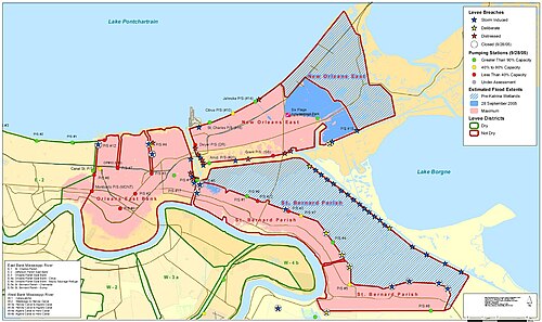
A map of levee breaches in New Orleans

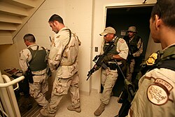
The resulting flooding was so severe that the U.S. Army and Border Patrol had to conduct room-by-room searches of hotels and neighborhoods to find survivors.
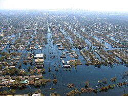
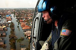
View of flooded New Orleans in the aftermath of Hurricane Katrina

A U.S. coast guardsman searches for survivors in New Orleans in the Katrina aftermath.

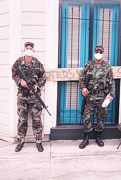
U.S. Army Infantry on patrol in New Orleans in an area previously underwater, September 2005

A Border Patrol Special Response Team searches a hotel room-by-room in New Orleans in response to Hurricane Katrina.

Mississippi and Alabama

Mississippi experienced devastating storm surges that wiped out coastal areas. In Pass Christian, the Bay St. Louis Bridge on U.S. Route 90 was completely destroyed, and cities like Long Beach and Pascagoula saw massive structural damage.
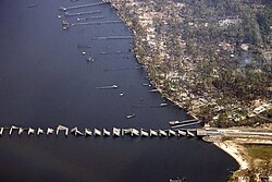
U.S. Route 90's Bay St. Louis Bridge on Pass Christian was destroyed as a result of Katrina.

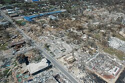
Damage to Long Beach, Mississippi following Hurricane Katrina

Surge damage in Pascagoula, Mississippi

Alabama also felt the storm's power, with floodwaters reaching the steps of the federal courthouse in Mobile and grounding cargo ships in Bayou La Batre.
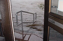
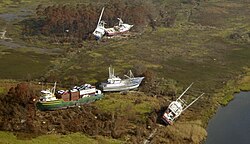
Flood waters come up the steps of Mobile's federal courthouse.

Bayou La Batre: cargo ship and fishing boats were grounded

Florida and Other Regions

Before hitting the Gulf Coast, Katrina drenched Florida, causing significant damage to mobile homes in areas like Davie. The storm's reach extended as far as the Bahamas, Cuba, and Eastern Canada, where heavy rains washed out roads in Quebec.
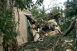
Damage to a mobile home in Davie, Florida following Hurricane Katrina

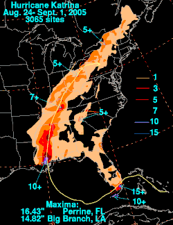
Total rainfall from Katrina in the United States. Data for the New Orleans area is not available.

Environmental and Economic Consequences
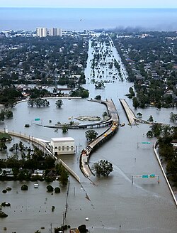
Flooded I-10/I-610/West End Blvd interchange and surrounding area of northwest New Orleans and Metairie, Louisiana

The environmental toll was severe, highlighted by massive oil spills. The most significant leak occurred at Bass Enterprises in Cox Bay, releasing approximately 3.78 million gallons of oil into the environment.

Major Oil Spills Caused by Hurricane Katrina
Spill Location Quantity (US Gallons) Quantity (Liters)
Bass Enterprises (Cox Bay) 3,780,000 14,300,000
Shell (Pilot Town) 1,050,000 4,000,000
Chevron (Empire) 991,000 3,750,000
Murphy Oil (Meraux and Chalmette) 819,000 3,100,000
Bass Enterprises (Pointe à la Hache) 461,000 1,750,000

Coastal geography was also permanently altered. The Chandeleur Islands, for example, showed visible erosion and land loss following the storm's passage.
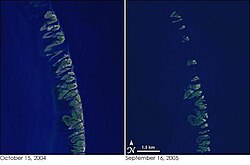
The Chandeleur Islands, before Katrina (left) and after (right), showing the impact of the storm along coastal areas

The Aftermath and Response

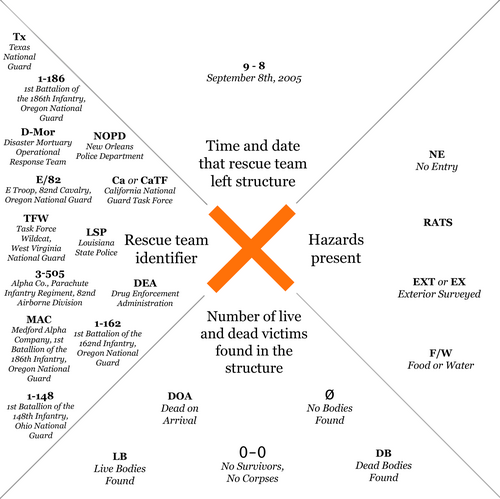
Chart showing some common uses of the FEMA marking system in New Orleans after Hurricane Katrina

The government response was heavily criticized, particularly the coordination between the Federal Emergency Management Agency (FEMA) and local authorities. Thousands of displaced residents sought refuge in the Houston Astrodome, supported by the Red Cross and other agencies.
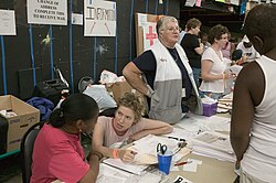
Residents of Louisiana, who had to flee their homes because of Hurricane Katrina, are inside the Houston Astrodome and being helped by the Red Cross and other agencies and associations.

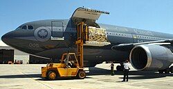
International aid poured in from countries including Canada, Israel, and New Zealand. The U.S. Navy deployed the USNS Comfort to provide medical supplies and relief to the devastated coast.
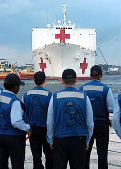
USNS Comfort takes on supplies at Mayport, Florida, en route to the Gulf Coast.

United States Navy personnel unload Canadian relief supplies from a Royal Canadian Air Force transport aircraft in Pensacola, Florida.

In the years following the disaster, the U.S. Army Corps of Engineers focused on reconstruction and the modification of levees to prevent a repeat of the 2005 failures. The name "Katrina" was subsequently retired from the list of Atlantic hurricane names due to the storm's infamy.

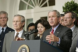
Flanked by Michael Chertoff, Secretary of Homeland Security, left, and Secretary of Defense Donald Rumsfeld, President Bush meets with members of the Task Force on Hurricane Katrina Recovery on August 31, 2005.

President Bush stands with Donald Rumsfeld, Elaine Chao, and Mike Leavitt during a press conference from the Rose Garden, regarding the devastation along the Gulf Coast caused by Katrina.

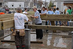
Volunteers from AmeriCorps in New Orleans, January 2006

Frequently Asked Questions

What was the maximum wind speed of Hurricane Katrina?

At its peak intensity, Hurricane Katrina had maximum sustained winds of 175 mph (280 km/h), classifying it as a Category 5 hurricane on the Saffir-Simpson scale.

Why did New Orleans suffer such extreme flooding?

While the storm brought heavy rain, the primary cause of the catastrophic flooding in New Orleans was the failure of the city's levee system, which allowed storm surges to breach the city's defenses.

How many people died as a result of the storm?

The total death toll is estimated between 1,245 and 1,836 people, with the vast majority of fatalities occurring in Louisiana.

What was the total economic cost of the disaster?

Hurricane Katrina caused approximately $125 billion in damages (2005 USD), making it the costliest tropical cyclone on record when adjusted for inflation.

Which company was responsible for the largest oil spill during the storm?

Bass Enterprises (Cox Bay) was responsible for the largest spill, releasing approximately 3.78 million US gallons of oil.

References

  1. On January 4, 2023, the NHC updated the Katrina fatality data on the basis of a 2014 report, which reduced the total number from an estimated 1,833 to 1,392.
  2. Almost exactly 20 years later, the Mardi Gras Service would restore service served by the Sunset Limited between New Orleans and Mobile.
  3. The storm category color indicates the intensity of the hurricane when landfalling in the U.S.
  4. Costliest U.S. tropical cyclones tables update (PDF) (Report). United States National Hurricane Center. January 12, 2018. Archived (PDF) from the original on January 27, 2018. Retrieved January 12, 2018.
  5. Knabb, Richard D; Rhome, Jamie R; Brown, Daniel P; National Hurricane Center (December 20, 2005). Hurricane Katrina: August 23–30, 2005 (PDF) (Tropical Cyclone Report). United States National Oceanic and Atmospheric Administration's National Weather Service. Archived (PDF) from the original on October 2, 2015. Retrieved January 8, 2016.