Mariana Islands: Geography, History, and Culture of a Pacific Archipelago
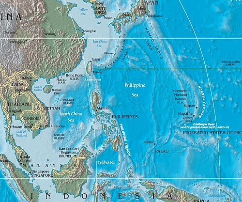
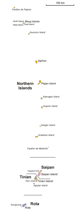
The Mariana Islands are a stunning, crescent-shaped archipelago located in the north-western Pacific Ocean. Comprising the summits of fifteen mostly dormant volcanic mountains, these islands stretch between the 12th and 21st parallels north. Positioned east of the Philippines and west of the Mariana Trench, they serve as the eastern limit of the Philippine Sea.
Politically, the archipelago is divided into two United States jurisdictions: the territory of Guam at the southern end and the Commonwealth of the Northern Mariana Islands (CNMI) to the north. Named after Queen Mariana of Austria during the 17th-century Spanish colonization, the islands are a vital part of the Micronesia sub-region.
Key Facts
- Total Land Area: Approximately 1,008 km² (389 sq mi).
- Political Status: Divided into Guam (U.S. territory) and the CNMI (U.S. commonwealth).
- Indigenous People: The Chamorro (Taotao Tano), known for their distinct civilization and latte stone architecture.
- Geological Origin: Volcanic mountains forming part of a submerged range extending 1,565 miles toward Japan.
- Biodiversity: Home to 59 bird species and 2 mammal species, though 76.8% of habitat has been lost.
Geography and Geology
The Marianas are situated in the western Oceanic sub-region of Micronesia. The islands are the visible peaks of a massive submerged mountain range that extends from Guam northward toward Japan. This volcanic chain is characterized by its longitudinal orientation and its proximity to some of the deepest points in the world's oceans.
Ecologically, the region is defined by tropical and subtropical dry broadleaf forests. However, these ecosystems are currently in a critical or endangered state, with only 1.11% of the habitat remaining under protection.
History of the Mariana Islands
Early Settlement and the Chamorro Civilization
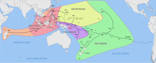
Archaeological evidence suggests human activity in the islands as early as 1500 to 1400 BC. Pottery found in the region features red-slipped and stamped designs similar to Nagsabaran pottery from the Cagayan Valley in the Philippines, suggesting an ancient migration across the ocean.
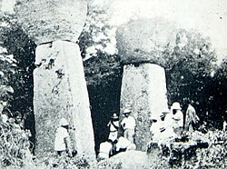
The indigenous Chamorro people, who called themselves Taotao Tano (people of the land), developed a sophisticated civilization. A hallmark of their architecture is the latte stone—massive square stone columns topped with round capitals used to support elevated buildings.
Spanish Colonization and the Manila Galleons
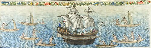
Spain formally claimed the islands in 1667, naming them Las Marianas in 1668. During this era, Guam became a critical stopover for the Manila Galleons, the trade convoys traveling between Acapulco, Mexico, and Manila, Philippines.
The arrival of Europeans brought devastating diseases that decimated the native population. While the Chamorro population was estimated at 50,000 in 1668, only 1,800 natives remained a century later, with the majority of the population becoming mestizo (mixed Spanish-Chamorro blood).
Transition of Power: Germany and the United States
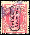
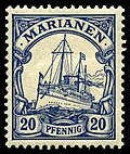
Following the Spanish-American War, a weakened Spain sold the Northern Marianas to Germany in 1899 for 837,500 gold marks. These islands were then incorporated into the German Protectorate of New Guinea, while Guam remained under U.S. control.
World War II and Strategic Importance
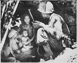
The islands became a fierce battleground during World War II. Japan captured Guam in December 1941. In 1944, the United States launched a campaign to recapture the chain, seizing Saipan, Tinian, and Guam. These islands were strategically vital as bombing bases; the B-29 bombers that dropped atomic bombs on Hiroshima and Nagasaki flew their missions from Tinian's North Field.
Post-War Administration
After the war, the Northern Mariana Islands became part of the U.S.-administered Trust Territory of the Pacific Islands (TTPI) before eventually becoming a U.S. commonwealth. Despite both being under U.S. jurisdiction, Guam and the CNMI remain separate due to their differing wartime experiences and historical trajectories.
Modern Economy and Tourism
Tourism is a primary economic driver for the islands, particularly in Guam. Visitors primarily arrive from East Asia, including Japan, Korea, China, and Taiwan. However, the industry has faced significant challenges recently.
Between 2019 and 2024, visitor numbers dropped by 55.6% in Guam and 53% in the CNMI, largely due to the COVID-19 pandemic and delays in electronic travel authorizations for Chinese tourists. To combat this, Guam has implemented a $60 million tourist recovery plan.
Regional Overview
| Jurisdiction | Key Islands | Approx. Population (2020) | Status |
|---|---|---|---|
| Guam | Guam | 153,836 | U.S. Territory |
| CNMI | Saipan, Tinian, Rota | 47,329 | U.S. Commonwealth |
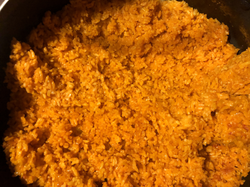
Cultural heritage continues to thrive through traditional cuisine, such as Chamorro red rice, which remains a staple of the local identity.
Frequently Asked Questions
What are latte stones?
Latte stones are prehistoric architectural elements consisting of a square stone pillar and a round capital. They were used by the ancient Chamorro people to support elevated wooden structures.
Why are the islands divided into two different U.S. jurisdictions?
The division is due to their different histories: Guam was a U.S. possession since 1898 and was occupied by Japan for 31 months during WWII, while the Northern Marianas were under German and then Japanese rule for decades before becoming a U.S. trust territory.
Who are the Chamorro people?
The Chamorro are the indigenous people of the Mariana Islands. They established a distinct civilization with unique pottery and architecture long before European contact.
What was the role of the Manila Galleons?
The Manila Galleons were Spanish trading ships that traveled between Mexico and the Philippines. Guam served as a vital stopover and supply point for these convoys.
How did the islands contribute to the end of World War II?
The capture of Saipan and Tinian provided the U.S. military with bases within round-trip range of mainland Japan, enabling the strategic bombing campaign and the atomic missions from Tinian's North Field.