Caroline Islands: Geography, History, and Culture of a Pacific Archipelago
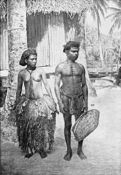
The Caroline Islands are a vast and scattered archipelago in the Western Pacific Ocean, stretching approximately 3,540 kilometers (2,200 miles) from Tobi in Palau to Kosrae in the Federated States of Micronesia (FSM). Comprising about 963 islands—including roughly 500 small coral islands—this region is a vital part of Micronesia, blending diverse ethnic influences from Micronesian, Filipino, and Japanese heritage.
From the towering peaks of Pohnpei to the unique cultural traditions of Yap, the Carolines represent a intersection of ancient maritime skill and a complex colonial history involving Spain, Germany, Japan, and the United States.
Key Facts
- Total Islands: Approximately 963, including about 500 coral islands.
- Major Islands: Yap, Chuuk, Pohnpei, Kosrae, and Palau.
- Highest Point: Dolohmwar on Pohnpei, reaching 791 meters (2,595 feet).
- Current Administration: Divided between the Federated States of Micronesia and Palau.
- Population: Estimated at 125,000 as of 2024.
- Languages: English and various Micronesian languages.
Geography and Administration
The archipelago is characterized by its immense length and varied terrain. While many of the islands are low-lying coral formations, others feature significant elevation. The region is currently administered by two sovereign entities: the Federated States of Micronesia and Palau.
| Feature | Detail |
|---|---|
| Location | Western Pacific Ocean |
| Total Length | 3,540 km (2,200 mi) |
| Major Landmasses | Yap, Chuuk, Pohnpei, Kosrae, Palau |
| Highest Elevation | 791 m (Dolohmwar, Pohnpei) |
| Time Zones | UTC+9, UTC+10, UTC+11 |
People and Cultural Heritage
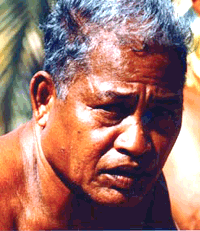
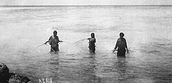
The Carolines are renowned for their traditional maritime expertise. One of the most significant figures in this legacy was Mau Piailug (1932–2010) from Satawal. Mau was a master of the Weriyeng school of navigation, a system of traditional wayfinding that survived in the remoteness of the Carolines while other techniques faded.
In the 1970s, Mau shared these ancestral secrets with the Polynesian Voyaging Society, sparking a global revival of traditional Polynesian navigation and providing anthropologists with critical insights into the migration and history of Pacific peoples.
Indigenous History and Legends
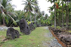
Local histories vary by island. On Pohnpei, oral tradition divides pre-colonial history into three distinct eras:
- Mwehin Kawa (or Mwehin Aramas): The era of building and peopling (before 1100).
- Mwehin Sau Deleur: The reign of the Saudeleur (1100 to approximately 1628).
- Mwehin Nahnmwarki: The era of tribal chiefs (1628 to 1885).
Colonial History
The Spanish Era
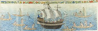
European contact began in 1525 with Portuguese navigators Diogo da Rocha and Gomes de Sequeira. By 1528, Spanish explorer Álvaro de Saavedra Cerón claimed the Ulithi Islands for Spain. The archipelago was later named Las Carolinas in honor of King Charles II of Spain by Francisco de Lezcano in 1686.
Spanish control was inconsistent for centuries. After a period of ceased relations following the death of missionary Juan Antonio Cantova in 1731, Spain resumed trade-focused relations in 1787. By 1885, Spain established formal sovereignty through agreements with tribal chiefs in Koror and Artingal.
German and Japanese Rule
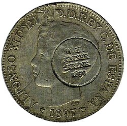
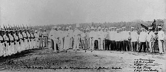
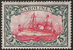
Following the Spanish-American War, Spain sold the Carolines and Northern Marianas to the German Empire in 1899 for 25 million pesetas. Germany administered the region as the Karolinen, associating it with German New Guinea.
During World War I in 1914, Japan invaded and occupied the islands to seize German colonial possessions. In 1920, the League of Nations granted Japan a mandate to control the Caroline and Marshall Islands. Japan utilized Truk Lagoon as a major military base during World War II until it was neutralized by Allied forces during Operation Hailstone.
Path to Independence
After World War II, the islands became trust territories of the United States. This period of administration eventually led to sovereignty, with the Federated States of Micronesia gaining independence in 1986, followed by Palau in 1994.
Ecclesiastical and Natural History
Religious missions in the islands were primarily led by Jesuits and later Spanish Capuchins. The Spanish Capuchins developed a catechism and prayer book in the Pohnpeian language and a grammar and dictionary of the Yap language by 1890. However, the transition to German rule in 1899 saw a decline in church attendance as the German administration did not mandate schooling as the Spanish had.
In terms of biodiversity, the region hosts unique species, such as Crinum bakeri, a plant endemic to the Caroline and Marshall Islands first described in 1887.
Frequently Asked Questions
Which countries currently administer the Caroline Islands?
The islands are divided between the Federated States of Micronesia (FSM) and the Republic of Palau.
Who was Mau Piailug?
Mau Piailug was a master navigator from Satawal who preserved traditional Micronesian navigation techniques and shared them with the Polynesian Voyaging Society in the 1970s.
How did the islands get the name "Carolines"?
They were named Las Carolinas by Francisco de Lezcano in 1686 to honor King Charles II of Spain.
What was the significance of Truk Lagoon during World War II?
Truk Lagoon served as a major Japanese military base for expansion into the southeastern Pacific until it was neutralized by the Allies in Operation Hailstone.
What is the highest point in the Caroline Islands?
The highest point is Dolohmwar, located on the island of Pohnpei, with an elevation of 791 meters (2,595 feet).