Interstate 90 in Washington: The American Veterans Memorial Highway
Spanning the width of the state, Interstate 90 (I-90) serves as a critical artery for transportation, commerce, and travel in Washington. Known as the American Veterans Memorial Highway, this massive engineering feat connects the bustling coastal hub of Seattle with the inland city of Spokane, traversing some of the most diverse landscapes in the Pacific Northwest.
From the floating bridges of Lake Washington to the rugged peaks of the Cascade Mountains and the sweeping vistas of the Columbia Plateau, I-90 is more than just a road; it is a lifeline that integrates the state's economy and geography.
Key Facts
- Total Length: 297.51 miles (478.80 km).
- Official Name: American Veterans Memorial Highway.
- Maintenance: Managed by the Washington State Department of Transportation (WSDOT).
- Completion Date: The route was fully completed in 1993.
- Major Cities Served: Seattle, Bellevue, Ellensburg, and Spokane.
- Counties Traversed: King, Kittitas, Grant, Adams, Lincoln, and Spokane.
Route Overview and Geography
Seattle, Mercer Island, and Bellevue
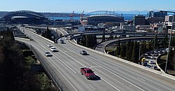
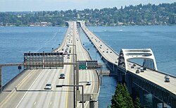
The western terminus of I-90 begins in Seattle at SR 519 and connects with I-5. One of the most distinctive features of this segment is the twin floating bridge across Lake Washington, which utilizes floating bridge technology—a method where the roadway is supported by buoyant pontoons rather than traditional piers. This section also includes specialized express lanes in the center to manage heavy commuter traffic between Seattle and Bellevue.
East King, Snoqualmie Pass, and Kittitas
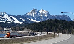
As the highway moves east, it ascends into the Cascade Range. The most challenging segment is Snoqualmie Pass, a high-altitude crossing that requires rigorous maintenance to manage snow and avalanches. In recent years, WSDOT has implemented wildlife crossings to allow animals to safely traverse the corridor without entering traffic.
Columbia Plateau and Spokane Area
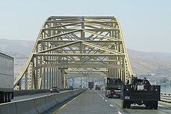
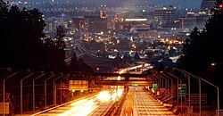
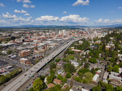
Beyond the mountains, I-90 enters the Columbia Plateau, characterized by wide-open spaces and agricultural land. The route crosses the Columbia River via the Vantage Bridge before continuing east through Ritzville. Upon reaching Spokane, the highway descends Sunset Hill and utilizes a complex viaduct system in the downtown area, which was constructed in stages between 1965 and 1971.
Highway Summary Table
| Feature | Details |
|---|---|
| Length | 297.51 miles |
| West End | SR 519 / I-5 (Seattle) |
| East End | Idaho State Line (near Liberty Lake) |
| Major Junctions | I-5, I-405, I-82, US 395, US 2, US 195 |
| Designation | National Highway System (NHS) |
Historical Development
Early Roads and the Sunset Highway
Before the Interstate era, the route followed the path of early state roads and the Sunset Highway. These early paths were often rough and difficult to navigate, with the Snoqualmie Pass wagon road being a primary early link established in the late 19th century.
The Interstate Era and Modernization
The transition to the Interstate Highway System began in 1957. Construction progressed in segments, with the Spokane freeway planning facing several legal and routing disputes in the late 1950s and early 1960s before the downtown viaduct was finally completed. The final gaps in the Washington section of I-90 were closed by 1993.
Recent Upgrades
Modern improvements have focused on capacity and safety. This includes the expansion of Snoqualmie Pass to reduce avalanche-related closures and the implementation of reversible car-pool (HOV) lanes in the Seattle-Bellevue corridor to optimize traffic flow during peak hours.
Frequently Asked Questions
What is the American Veterans Memorial Highway?
It is the official honorary name given to the section of Interstate 90 that runs through the state of Washington.
How does the I-90 floating bridge work?
Unlike traditional bridges with underwater supports, the Lake Washington bridges are supported by massive concrete pontoons that float on the water, allowing the road to span the lake's depth.
What are the express lanes on I-90?
The express lanes are reversible lanes located in the center of the highway between Seattle and Bellevue, designed to move high volumes of traffic in the direction of peak demand.
Why are wildlife crossings important at Snoqualmie Pass?
Wildlife crossings are specialized bridges or underpasses that allow animals to cross the highway safely, reducing vehicle-animal collisions and preserving local migration patterns.
When was the Washington section of I-90 fully completed?
While construction began in 1957, the entire route across Washington was not fully completed until 1993.