Hurricane Betsy: The Devastating Category 4 Storm of 1965
Hurricane Betsy remains one of the most significant and destructive tropical cyclones in United States history. Striking in September 1965, this Category 4 major hurricane left a trail of destruction across the Caribbean and the American Gulf Coast, fundamentally altering how the nation viewed hurricane preparedness and disaster response.
The storm was characterized by its immense power, with sustained winds reaching 140 mph and a minimum central pressure of 942 mbar. From its formation in late August to its eventual dissipation in mid-September, Betsy impacted multiple countries and several U.S. states, resulting in significant loss of life and economic ruin.
Key Facts
- Highest Sustained Winds: 140 mph (220 km/h)
- Lowest Pressure: 942 mbar (hPa)
- Total Fatalities: 81
- Estimated Damage: $1.43 billion (1965 USD)
- Peak Intensity: Category 4 on the Saffir-Simpson scale
- Duration: August 27 to September 13, 1965
Meteorological History

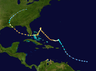
Hurricane Betsy first formed on August 27, 1965. In its early stages, it developed as a tropical system that gradually gained strength as it moved through the Atlantic. By August 29, the system was upgraded to hurricane intensity.
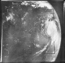
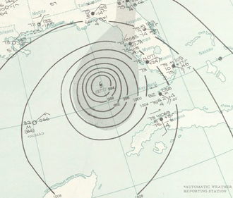
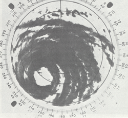
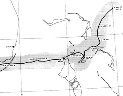
As the storm progressed, it underwent periods of intensification and fluctuation. It passed through the Bahamas and brushed the coast of Florida before entering the Gulf of Mexico, where it reached its peak intensity as a major hurricane. The storm's eye was documented by Hurricane Hunter aircraft, providing critical data on the storm's structure.

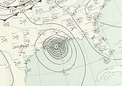
Betsy eventually made landfall in Southeast Louisiana on September 10. After moving inland, it transitioned into an extratropical cyclone on September 12 and finally dissipated on September 13, 1965.
Regional Impacts and Destruction
The Bahamas and Florida
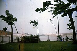
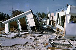
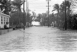
The Bahamas bore the initial brunt of the storm's power, with high winds and heavy rainfall causing widespread damage. As Betsy moved toward Florida, it brought severe weather to the east coast and the Florida Keys. In Key West, the storm surge caused significant flooding, battering canals and destroying homes.
The Gulf Coast and Louisiana
The most catastrophic impact occurred when Betsy struck the United States Gulf Coast. Louisiana, particularly New Orleans, suffered immense damage. The storm caused severe flooding in the Lower 9th Ward, with water inundating residential areas and infrastructure.
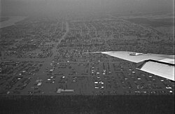
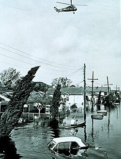
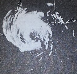
The storm's influence extended beyond Louisiana, affecting Mississippi and Alabama. Radar imagery from the time captured the storm's final approach and landfall, documenting the scale of the system as it moved across the coast.
Inland Effects
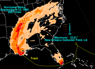
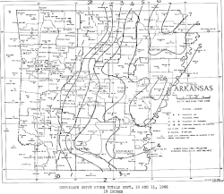
Even after losing its tropical characteristics, the remnants of Betsy continued to bring heavy rainfall and flooding to the interior United States. States including Arkansas, Tennessee, and Missouri experienced significant precipitation, leading to inland flooding events.
Storm Summary Table
| Metric | Detail |
|---|---|
| Formation Date | August 27, 1965 |
| Dissipation Date | September 13, 1965 |
| Max Sustained Winds | 140 mph |
| Minimum Pressure | 942 mbar |
| Total Deaths | 81 |
| Financial Loss | $1.43 Billion (1965 USD) |
| Primary Areas Affected | Bahamas, Florida, Louisiana, Mississippi |
Frequently Asked Questions
What was the peak intensity of Hurricane Betsy?
Hurricane Betsy reached Category 4 status on the Saffir-Simpson scale, with maximum sustained winds of 140 mph (220 km/h) and a minimum central pressure of 942 mbar.
Which U.S. city suffered the most damage from the storm?
New Orleans, Louisiana, experienced the most severe impact, particularly in the Lower 9th Ward, where storm surge and heavy rains caused catastrophic flooding.
How many people died as a result of Hurricane Betsy?
The storm resulted in a total of 81 fatalities across the various regions it affected.
Did Hurricane Betsy affect states other than the Gulf Coast?
Yes, the remnants of the storm brought significant rainfall and flooding to inland states, including Arkansas, Tennessee, and Missouri.
What was the total economic cost of the hurricane?
The estimated damage caused by Hurricane Betsy was $1.43 billion in 1965 USD.