Geomatics: The Science of Earth Mapping and Spatial Analysis
Geomatics is a comprehensive umbrella term encompassing the tools and techniques used to analyze the Earth's surface. This multidisciplinary field integrates various methods of earth mapping, including land surveying, remote sensing, nautical charts, cartography, and geographic information systems (GIS). While some researchers prefer the terms geoinformatics or geographic information science to avoid ambiguity, the use of these terms often varies by country.
The rapid expansion of geomatics since the 1990s has been driven by significant leaps in computer hardware, software engineering, and computer science, alongside the development of space-borne and airborne remote-sensing technologies.
Key Facts
- Geomatics integrates surveying, GIS, and remote sensing to analyze the Earth's surface.
- Land surveying provides the foundational data for legal property boundaries and civil engineering.
- Hydrogeomatics (or hydrography) focuses on mapping water bodies and seabed topography.
- GNSS consists of six global constellations providing worldwide navigation and communication.
- Geovisualization transforms raw spatial data into interactive 3D models and animations.
Core Disciplines of Geomatics
Land Surveying
Land surveying is the measurement and analysis of specific points on the ground to determine angles, distances, and heights. Often described as both an art and a science, it is the primary method used to establish the legal property boundaries that define land ownership today. This discipline is essential for construction, civil engineering, and subdivision planning and design.
Geovisualization
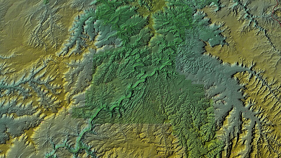
Geovisualization merges computer science with cartography to bring spatial data to life. Unlike traditional static maps, geovisualization emphasizes the construction of knowledge through interactive tools, such as 3D models, manipulated images, and time-lapse animations. By allowing users to filter data layers and change visual parameters, it provides a level of clarity and exploration that paper maps cannot match. In a professional workflow, a geomatics engineer gathers the raw data, and geovisualization makes that data understandable.
Hydrogeomatics
Also known as hydrography—a term coined in the mid-16th century—hydrogeomatics involves surveying work conducted on, above, or below the surface of the sea and other water bodies. The field has deep roots in military history; Alexander Dalrymple, appointed by the British navy in 1795, was a pioneer who prepared charts for naval and merchant shipping.
The establishment of the UK Hydrographic Office (UKHO) in 1795 and the U.S. Naval Observatory and Hydrographic Office (USNO) in 1854 laid the groundwork for global shipping and defense. Today, agencies like the National Oceanic and Atmospheric Administration (NOAA) apply these techniques to study bathymetry (underwater topography) using technologies such as multibeam sonars for seabed mapping. The scope of the field now ranges from military surveillance to the conservation of oceanic habitats.
Specialized Applications of Geomatics
Health Geomatics
Health geomatics examines the critical relationship between location and health. By analyzing spatial data, professionals can improve public health tasks such as disease prevention and the planning of healthcare services. A key area of current research involves utilizing open data to plan lifesaving activities.
Mining Geomatics
Mining geomatics is a specialized branch dedicated to the acquisition, processing, and analysis of spatial data within mining environments. This data supports critical operations, including monitoring, prediction, modeling, and decision-making. As the industry evolves, university programs formerly known as "topographic science" or "survey engineering" have increasingly transitioned to titles like "geomatics engineering" or "spatial information technology" to reflect these modern professional competencies.
Global Navigation Satellite Systems (GNSS)
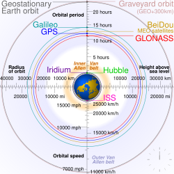
GNSS refers to a collection of geospatial systems that provide global coverage for purposes ranging from mobile navigation to communications. There are currently six operational GNSS constellations:
- GPS (United States)
- GLONASS (Russia)
- Galileo (Europe)
- BeiDou/Compass (China)
- QZSS (Japan)
- IRNSS (India)
Geomatics Summary Table
| Branch | Primary Focus | Key Tools/Technologies |
|---|---|---|
| Land Surveying | Ground points, boundaries, and heights | Measurement and analysis tools |
| Geovisualization | Interactive spatial data communication | 3D models, data layer filters |
| Hydrogeomatics | Water bodies and seabed mapping | Multibeam sonars, nautical charts |
| Health Geomatics | Location-based health analysis | Open data, spatial health mapping |
| Mining Geomatics | Mining environment spatial data | Monitoring and prediction models |
Frequently Asked Questions
What is the difference between geomatics and geovisualization?
Geomatics is the broad field of gathering and analyzing Earth data, while geovisualization is the specific process of using computer science and cartography to present that data in interactive, easy-to-understand formats like 3D models.
What is bathymetry in the context of hydrogeomatics?
Bathymetry is the study and mapping of underwater topography, essentially the "land surveying" of the ocean floor, often achieved using multibeam sonars.
Which countries operate GNSS constellations?
The United States (GPS), Russia (GLONASS), the European Union (Galileo), China (BeiDou/Compass), Japan (QZSS), and India (IRNSS) all operate GNSS constellations.
How is geomatics used in public health?
Health geomatics analyzes the relationship between location and health to assist in disease prevention, healthcare service planning, and the use of open data for lifesaving activities.
Why have many surveying degrees changed their names to geomatics?
The shift reflects the rapid progress in computer science, software engineering, and remote-sensing technologies since the 1990s, moving the field beyond traditional surveying into a broader spatial information science.