Topography: The Science of Mapping Earth's Surface Features
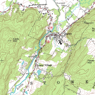
Topography is the detailed study of the forms and features of land surfaces. While it is often associated with the physical landforms themselves, it also encompasses the descriptions and depictions of these features on maps. As a critical branch of geoscience and planetary science, topography focuses on local details, including relief (the difference in elevation between the highest and lowest points) as well as both natural and artificial features such as buildings, roads, and land boundaries.
In a strict scientific sense, topography involves geomorphometry—the recording of terrain and the identification of specific landforms. In the modern era, this is primarily achieved through the generation of digital elevation data, which allows scientists and engineers to visualize the three-dimensional quality of a surface with extreme precision.
Key Facts
- Definition: The study of the shapes and features of land surfaces, including both natural relief and man-made structures.
- Core Objective: To determine the exact position of features using horizontal coordinates (latitude and longitude) and altitude.
- Modern Standard: The use of Digital Elevation Models (DEMs) to represent terrain in a raster-based digital format.
- Primary Tools: Includes field surveying (theodolites), remote sensing (lidar, radar), and photogrammetry.
- Applications: Essential for military planning, geological exploration, and civil engineering projects.
The Evolution of Topographic Study
The term originates from the Greek words topos ("place") and graphia ("writing"). In ancient Greece and Rome, topography referred to the detailed description of a place, a practice that evolved into what is now known as local history. In Europe, this original meaning is still occasionally used.
The transition to scientific mapping began with detailed surveys. In Britain, these were known as Ordnance Surveys starting in the late 18th century. France saw the development of the Cassini maps, produced by the Cassini family over four generations. In the United States, the practice was formalized by the Topographical Bureau of the Army during the War of 1812, eventually leading to the establishment of the United States Geological Survey (USGS) in 1878.
Modern Techniques for Data Collection
Depending on the scale and accessibility of the area, topographers use several distinct methodologies to gather data.
Field Surveying
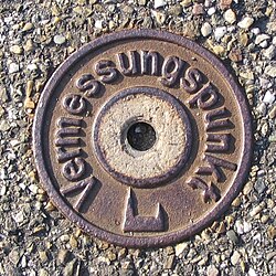
Direct surveying remains the foundation for all topographic work. Using instruments such as theodolites, dumpy levels, and clinometers, surveyors determine the precise three-dimensional position of points. Today, this is supplemented by Global Navigation Satellite Systems (GNSS) and GPS to provide absolute control points for larger datasets.
Remote Sensing
Remote sensing involves collecting geodata from a distance. This is achieved through several high-tech methods:
- Lidar (Light Detection and Ranging): A laser scanner emits millions of pulses per second to create a high-resolution "point cloud." This can achieve vertical accuracy within 10 centimeters and is used to create DEMs of the bare earth by filtering out vegetation and buildings.
- Photogrammetry: This technique determines 3D coordinates by analyzing two or more overlapping photographs taken from different positions (usually via aircraft). Through triangulation, the intersection of lines of sight determines the position of a point.
- Active Sensors: Satellite RADAR is used for large-scale elevation models, while sonar is used for bathymetric surveys to map the ocean floor.
Passive Sensor Methodologies
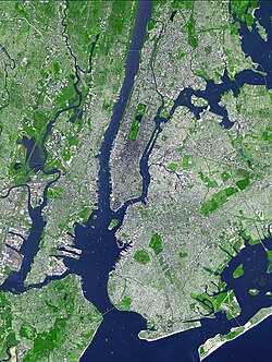
Aerial and satellite imagery are used to delineate terrain and land-cover features. False-color imaging and non-visible spectra are particularly useful for distinguishing vegetation and land-use patterns that might be invisible to the naked eye.
Topographic Data and Modeling
Once data is collected, it is modeled mathematically to be useful for analysis. There are two primary types of models:
- Vector Models (TIN): Triangulated Irregular Networks are commonly used in civil engineering and entertainment industries.
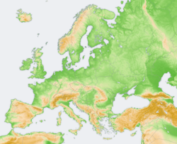
- Gridded Models (Raster): These are the standard for environmental sciences, where the surface is divided into a grid of pixels.
A Digital Land Surface Model (DLSM) provides continuous elevation data for every location in a study area. This differs from a Digital Surface Model, which might include the tops of tree canopies or buildings. By comparing a surface model with a bare-earth DEM, researchers can calculate volumetric measures, such as the height of a forest canopy.
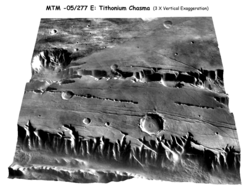
Topographic Mapping vs. Other Disciplines
While often confused, topographic mapping is distinct from geological mapping. Topography focuses on the identifiable surface features and relief, whereas geological mapping examines the underlying structures and processes beneath the surface.
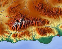
In the United States, the USGS produces topographic maps using contour lines to show elevation. Maps that show features like roads and buildings but lack these elevation contours are referred to as planimetric maps.
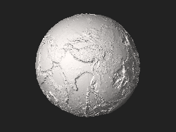
Topography in Other Scientific Fields
The concept of mapping surface features has extended beyond geography into various specialized sciences:
- Neuroscience: EEG topography is used for brain mapping.
- Ophthalmology: Corneal topography maps the curvature of the cornea.
- Tissue Engineering: Atomic force microscopy maps nanotopography.
- Anatomy: Topography refers to superficial human anatomy.
- Mathematics: It describes the organization of features on a map or the distribution of variables in a space.
| Model Type | Technical Name | Primary Use Case | Data Structure |
|---|---|---|---|
| Vector | TIN (Triangulated Irregular Network) | Civil Engineering, Entertainment | Triangles/Vertices |
| Gridded | Raster / DEM | Environmental Sciences | Pixels with elevation values |
| Topological | GIS Analysis | Spatial Relationship Modeling | Adjacency and Proximity |
Frequently Asked Questions
What is the difference between a DEM and a DSM?
A Digital Elevation Model (DEM) represents the bare earth surface, excluding objects like buildings and trees. A Digital Surface Model (DSM) includes these surface objects, capturing the top of the canopy or architectural structures.
How does Lidar differ from traditional surveying?
Traditional surveying involves measuring specific points on the ground using instruments like theodolites. Lidar is a remote sensing technique that uses millions of laser pulses to create a dense point cloud of the entire landscape from a distance.
What are contour lines on a topographic map?
Contour lines are lines that connect points of equal elevation. They allow a two-dimensional map to represent the three-dimensional relief of the terrain.
Is topography the same as geomorphology?
While related, they differ in focus. Topography is primarily concerned with the description and mapping of surface features, whereas geomorphology focuses on the processes that shape those landforms over time.
What is photogrammetry?
Photogrammetry is the science of making measurements from photographs. By taking images of the same object from different angles, researchers can use triangulation to determine the 3D coordinates of points on the surface.