Dinaric Alps: The Rugged Karst Backbone of the Balkans
The Dinaric Alps, also known as the Dinarides, form a massive mountain system in Southern and South-Central Europe. Acting as a natural barrier, they separate the continental Balkan Peninsula from the Adriatic Sea. This extensive range stretches from Italy in the northwest, traversing Slovenia, Croatia, Bosnia and Herzegovina, Serbia, Montenegro, Kosovo, and North Macedonia, before ending in Albania to the southeast.
Spanning approximately 645 kilometers (401 mi) in length, the Dinarides are among Europe's most rugged landscapes. The range is characterized by its dramatic relief, ranging from the coastal harbors of Croatia to the towering peaks of the Accursed Mountains. The highest point of the entire system is Maja Jezercë in Albania, which reaches an elevation of 2,694 meters (8,839 ft).
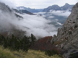
Key Facts
- Highest Peak: Maja Jezercë (2,694 m) in Albania.
- Total Length: Approximately 645 km (401 mi) running NW-SE.
- Primary Rock Type: Sedimentary (limestone and dolomite).
- Defining Feature: Extensive karst topography (landscapes shaped by water dissolving soluble rocks).
- Countries Involved: Albania, Bosnia and Herzegovina, Croatia, Italy, Montenegro, Kosovo, Serbia, and Slovenia.
Geology and the Formation of Karst
The Dinaric Alps are primarily composed of Mesozoic and Cenozoic sedimentary rocks, including limestone, dolomite, sandstone, and conglomerates. These materials were originally deposited by ancient seas and lakes. Between 50 and 100 million years ago, during the Alpine earth movements, immense lateral pressures folded and overthrust these rocks into a great arc.
The most significant tectonic phase occurred during the Paleogene period of the Cenozoic Era, caused by the collision of the Adriatic Microplate (Adria) with Europe. This process remains active today. This geological history created the world-renowned Dinaric Karst, a region where groundwater chemically dissolves limestone to create unique landforms.
![Geomorphological subdivisions of Dinaric Alps Legend: A1: The area of the North Adriatic – the territory of Istria and the Kras area A2: Northern Adriatic – North Adriatic islands A3: Mountains of Dalmatia – Central mountain range A4: Dalmatian Mountains – Coastal Mountain Range A5: The mountains of southern Dalmatia and Mediterranean Herzegovina A6: The islands of Central and South Adriatic and Peljesac A7: Primorje Mountains of Montenegro A8: Coastal and Central Montenegro Mountains – Garač and Katun plateau A9: Mountains of the Montenegrin Rudina A10/11: Mountains of Low Herzegovina B1: Group of Trnovski gozd B2: Snežnik and Risnjak plateaus B3: Plateaus of Inner Carniola and Lower Carniola B4: Velika Kapela B5: Massive Velebit B6: Mala Kapela and central Lika B7: Massif Lička Plješivica B8: Massif Dinara B9: Šator B10: Cincar B11: Klekovača (S) and Grmeč (N) B12: Raduša B13: Čvrsnica B14: Massif Prenj B15: High mountains of Herzegovina – Velež and Herzegovinian Rudine B16: Mountains of High Herzegovina – Mountain range of Crvanj-Lebršnik B17: Zelengora Group B18: Bioč-Maglic-Volujak Group B19: Vranica Group B20: Bjelašnica (Southern Sarajevo Mountains) B21: Mountain range Golija-Vojnik B22: Prekornica [sr] B23: Durmitor area B24: Sinjajevina B25: The Morača Mountains and Maganik B26: Ljubišnja B27: Massif Bjelasica B28: Komovi B29: Visitor B30: Kučke planine (Žijovo [sr]) B31: Albanian Alps C1: Group of Kočevski Rog C2: Žumberak / Gorjanci Group C3: Central and Eastern Bosnia Mountains – Vlašić Group C4: Central Bosnia Mountains C5: Eastern Bosnia Mountains C6: Central and Eastern Bosnia Mountains – Jahorina Group C7: Mountains of Stari Vlah and Raška (Sandžak) – Kovač-Podrinje Group C8: Mountains of Stari Vlah and Raška (Sandžak) – Zlatar-Pešter Group C9: Mountains of the Stari Vlah – the central group C10: Mountains of Serbia – Podrinje-Valjevo mountains C11: Pre-Dinaric Mountains: Kozara (NW) och Majevica (SE).](/images/ec/1d/ec1d1e7c3670e48a5fe6224a83e58e80e1be214d9ec58a3aba7683b21bc1167c.webp)
Distinctive Karst Landforms
Because limestone is porous yet resistant to surface erosion, water percolates through cracks, creating vast underground networks. This results in several signature features:
- Caverns and Sinkholes: Enormous waterless caves and grottoes formed by deep underground drainage.
- Poljes: Large, flat-floored depressions in karst limestone. These can be "open" (drained by surface water) or "closed" (drained by ponors, or swallow holes), often becoming seasonal lakes during floods.
- Gorges and Canyons: Steep-sided valleys carved by rivers cutting through hard limestone escarpments.
While most of the range saw little glaciation during the Quaternary ice ages, the Accursed Mountains and the summits of Durmitor, Orjen, and Prenj show clear evidence of glacial valleys and moraines.
Hydrology and River Systems
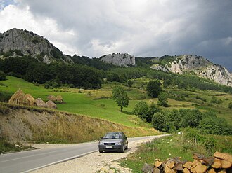
Water in the Dinarides is characterized by extreme purity due to the nature of the limestone. However, because the rock is so porous, many rivers disappear underground only to resurface elsewhere. Major rivers that have carved the characteristic canyons of the region include the Neretva, Drina, Tara, Piva, and the Drin.
One notable example is the Jadro Spring, which historically provided water for Diocletian's Palace in Split. Due to the lack of soil-making residue, these rivers are often crystal clear with very low pollutant levels.
Human History and Activity
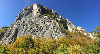
The rugged terrain of the Dinaric Alps has historically served as a natural fortress. During the Roman period, the Illyrians used these mountains to resist conquest until 14 AD. Later, the mountains of Montenegro provided a refuge that the Ottoman Empire could not fully subjugate. In the 20th century, the terrain was ideal for guerrilla warfare, supporting the Yugoslav Partisans during World War II.
Today, the region remains sparsely populated. The primary economic drivers are mining and forestry. Interestingly, the inhabitants of this region are noted for their stature; people from the Dinaric Alps are recorded as some of the tallest in the world, with particularly high averages found in Bosnia and Herzegovina.
Regional Summary Table
| Feature | Details |
|---|---|
| Total Area | 200,000 km² |
| Highest Peak | Maja Jezercë (Albania) - 2,694 m |
| Eponymous Peak | Mount Dinara (Croatia/Bosnia and Herzegovina) - 1,831 m |
| Major Passes | Postojna Gate, Vratnik, Kupres Gate, Čakor |
| Key Rail Lines | Zagreb–Split, Sarajevo–Ploče, Belgrade–Bar |
Frequently Asked Questions
What is the Dinaric Karst?
The Dinaric Karst is a geological region characterized by soluble limestone rocks that have been eroded by groundwater. This process creates unique features like sinkholes, underground caves, and poljes, and it has given its name to similar terrains worldwide.
Which is the highest mountain in the Dinaric Alps?
The highest peak is Maja Jezercë, located in Albania, with an elevation of 2,694 meters (8,839 ft).
How were the Dinaric Alps formed?
They were formed primarily during the Alpine orogenesis, specifically through the collision of the Adriatic Microplate with the European plate during the Cenozoic Era (Paleogene), which folded sedimentary rocks into a great arc.
What is a polje in the context of these mountains?
A polje is a large, flat-floored depression found in karst limestone. They often run parallel to structural trends and can drain via surface water or swallow holes (ponors), sometimes turning into lakes during the wet season.
Why is the region historically significant for warfare?
The steep cliffs, deep canyons, and rugged terrain provided excellent shelter and defensive positions for resistance forces, including the Illyrians against Rome, Montenegrins against the Ottomans, and Yugoslav Partisans in WWII.