Cold Fronts: Mechanics, Weather Patterns, and Atmospheric Impact
A cold front is the leading edge of a cooler air mass at ground level that displaces a warmer air mass. This boundary typically exists within a pronounced surface trough of low pressure and often forms behind an extratropical cyclone—a low-pressure system that brings diverse weather patterns. In the Northern Hemisphere, these systems generally move from west to east, while in the Southern Hemisphere, they move from east to west.
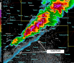
The interaction between these two contrasting air masses can be dramatic. Temperature differences across a cold front boundary can exceed 30 °C (54 °F). Depending on the available moisture and atmospheric instability, a cold front can trigger anything from a broad shield of light rain to a violent line of thunderstorms.

Key Facts
- Definition: The boundary where a cold, dense air mass replaces a warmer air mass.
- Temperature Shift: Can cause sudden drops of up to 30 °C (54 °F).
- Movement: Cold fronts generally move faster than warm fronts.
- Seasonality: Most intense during spring and fall; weakest during summer.
- Visual Marker: Represented on weather maps by a blue line with triangles pointing in the direction of travel.
How Cold Fronts Develop
Cold fronts occur when a mass of colder, drier air pushes into a region occupied by warmer, moister air. Because cold air is denser, it does not mix easily with the warm air; instead, it acts like a wedge, sliding under the warmer air and forcing it upward. This rapid lifting of moist air often leads to strong vertical cloud development.
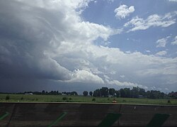
This process is driven by frontogenesis, the mechanism that creates or steepens the temperature gradient of a front. During frontogenesis, the atmosphere attempts to restore balance through a circular motion: air is lifted up along the cold front and drops downward behind the frontal boundary. This upward motion is the primary force responsible for the clouds and precipitation associated with the front.
Wind and Pressure Changes
The passage of a cold front is marked by distinct shifts in atmospheric pressure and wind direction. As a front approaches, barometric pressure steadily decreases. Once the front passes, the pressure rises sharply and then stabilizes.
Wind shifts also occur based on the hemisphere:
- Northern Hemisphere: Winds typically shift from southwest to northwest (a clockwise shift known as veering).
- Southern Hemisphere: Winds typically shift from northwest to southwest (a counterclockwise shift known as backing).
Weather Phenomena and Cloud Formations
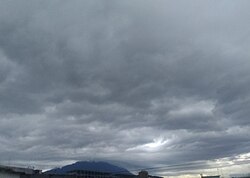
The type of weather produced by a cold front depends heavily on the stability of the air mass. If the atmosphere is highly unstable, cumulonimbus clouds (towering thunderstorm clouds) form, often producing severe thunderstorms, hailstorms, or tornadoes. If the air is more stable, the front may produce a broad shield of nimbostratus clouds and steady rain.
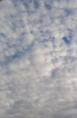
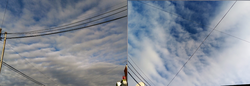
As the front approaches, observers may see cirrus, cirrostratus, and altostratus clouds. After the front passes, the sky usually clears as high pressure builds. However, if the air remains humid, cloud streets—long bands of cumulus or stratocumulus clouds—may persist.
Precipitation Patterns
Precipitation typically occurs in a narrow band along the leading edge of the front. In spring, these bands can be particularly violent. In winter, cold fronts may bring snow squalls or cold spells, though some pass with little to no precipitation if moisture is insufficient (for example, if the air has passed over a mountain barrier).
Summary of Frontal Passage Characteristics
| Phenomenon | Prior to Passage | During Passage | After Passage |
|---|---|---|---|
| Temperature | Warm | Cooling suddenly | Steadily cooling |
| Pressure | Decreasing steadily | Lowest, then sudden increase | Increasing steadily |
| Winds (NH) | Southwest to Southeast | Gusty; shifting | North to West (usually NW) |
| Clouds | Cirrus $\rightarrow$ Altostratus | Cumulonimbus / Cumulus congestus | Stratocumulus / Scattered cumulus |
| Visibility | Fair to poor (haze) | Poor, but improving | Good (except in showers) |
Advanced Frontal Interactions
Cold fronts do not always act in isolation. They often follow a warm front. When a fast-moving cold front catches up to a slower warm front, an occluded front is created, lifting the warm air entirely off the ground. In some cases, this creates a trowal (Trough Of Warm Air ALoft), a feature where warm air is trapped aloft poleward of the cyclone.
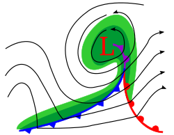
If a cold front stalls and stops moving, it is reclassified as a stationary front. Conversely, if it begins to retreat, it may be re-designated as a warm front.
Frequently Asked Questions
What is the difference between a cold front and a cold wave?
A cold front is the specific boundary between two air masses that triggers weather changes, whereas a cold wave refers to a prolonged period of intensely cold and dry weather.
Why do cold fronts cause thunderstorms?
Because cold air is denser than warm air, it forces the warm, moist air to rise rapidly. This vertical lift creates instability, leading to the formation of cumulonimbus clouds and thunderstorms.
How can I tell a cold front is passing based on the wind?
In the Northern Hemisphere, you will typically notice a shift from southwesterly winds to northwesterly winds, often accompanied by a strong, sudden gust of wind.
Do cold fronts always bring rain?
No. If there is insufficient moisture—such as when an air mass has moved across a mountain barrier—a cold front can pass without producing any clouds or precipitation.
What is a "trowal"?
A trowal, short for "Trough Of Warm Air ALoft," occurs during the formation of an occluded front when a mass of warm air is lifted completely off the surface.