Chilean Antarctic Territory
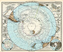
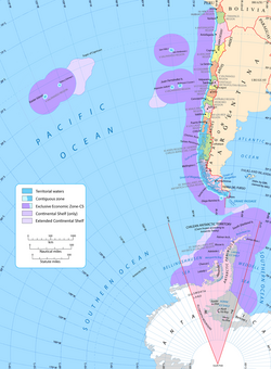
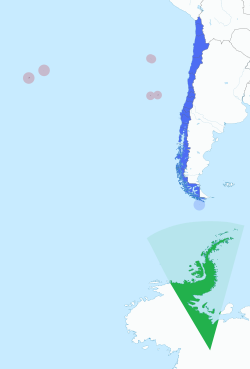
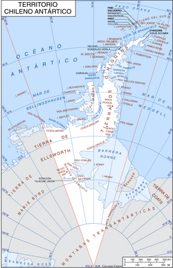
The Chilean Antarctic Territory (Territorio Chileno Antártico) represents a significant portion of Chile's national identity and territorial ambition. Spanning the frozen landscapes of the far south, this region encompasses the South Shetland Islands, the Antarctic Peninsula—known in Chile as O'Higgins Land (Tierra de O'Higgins)—and several adjacent islands and lands, including Alexander Island, Charcot Island, and Ellsworth Land.
Administratively, the territory is organized as the commune of Antártica, which is part of the Antártica Chilena Province within the Magallanes y la Antártica Chilena Region. Interestingly, while it is a distinct commune, it is managed by the municipality of Cabo de Hornos, based in Puerto Williams.
Key Facts
- Claim Date: Formalized on November 6, 1940.
- Total Area: 1,250,257.6 km², accounting for approximately 62.28% of Chile's total national territory.
- Capital: Puerto Covadonga.
- Largest Settlement: Villa Las Estrellas, the only civil settlement in the region.
- Highest Point: Vinson Massif at 4,897 meters.
- Governance: Managed under the Magallanes region with oversight from the Chilean Antarctic Institute (INACH).
Historical Foundations of the Claim
Colonial Roots and Terra Australis
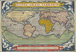
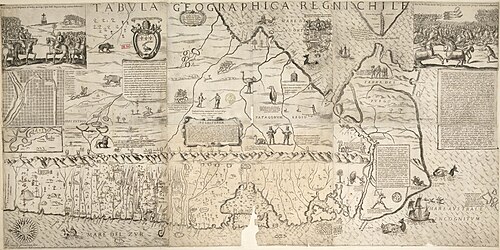
Chile's claim is rooted in the legal principle of uti possidetis juris, which suggests that newly independent states inherit the administrative boundaries of their colonial predecessors. Chile asserts that it inherited rights to Terra Australis (the unknown southern land) from the Spanish Empire. Historical records indicate that in 1539, Emperor Charles V granted rights to these lands to Pedro Sancho de Hoz, and by 1555, these claims were incorporated into the Governorate of Chile.
![Map of the Spanish Governorate of Terra Australis (1539–1555),[12] the first territorial claim over the lands near the South Pole; later it was incorporated into the Governorate of Chile.[13][9][10]](/images/90/f5/90f5547744bae7a14c34658020f3adfad04c4b0ee387b913aa3818ed05cf5645.webp)
Early 20th Century Activity
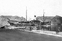
The early 1900s saw a surge in economic activity, primarily through whaling. In 1906, the Whaling Society of Magallanes established operations in Whalers Bay on Deception Island using the factory ship Gobernador Bories. This period marked a transition from theoretical claims to physical presence, as Chilean flags were hoisted and coaling stations were established to support maritime navigation.
Formalization and the 20th Century
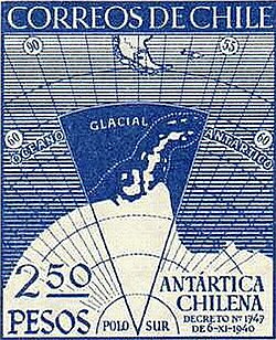
The boundaries of the territory were officially formalized via Decree 1747 on November 6, 1940. This date is now celebrated annually as Chilean Antarctic Day. Throughout the mid-20th century, Chile expanded its presence by establishing permanent research bases and settlements to reinforce its sovereignty.
Sovereignty and the Antarctic Treaty
The geopolitical landscape of Antarctica is complex. In 1942, Argentina declared its own Antarctic rights, leading to overlapping claims between the two nations. To manage these tensions and prioritize science over politics, the Antarctic Treaty was established. This international agreement freezes all territorial claims, prohibiting new claims or the enlargement of existing ones, while ensuring the continent is used exclusively for peaceful purposes and scientific research.
Geography, Climate, and Human Presence
Physical Landscape
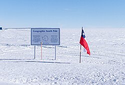
The territory is characterized by extreme terrain and ice. To the southwest of the Antarctic Peninsula lie some of the continent's highest peaks within the Sentinel Range, including the Vinson Massif (4,897 m), Mount Tyree (4,852 m), and Mount Shinn (4,800 m).
Settlements and Research Bases
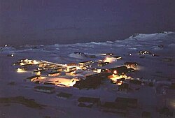
Human presence in the Chilean Antarctic Territory is centered around scientific research and strategic settlements. Villa Las Estrellas, inaugurated in 1984 on King George Island, serves as the primary civilian settlement, allowing families to reside in the region.
Summary of Chilean Antarctic Bases
| Base Name | Location | Type |
|---|---|---|
| Presidente Eduardo Frei Montalva | King George Island | Permanent |
| General Bernardo O'Higgins Riquelme | Antarctic Peninsula | Permanent |
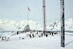
| Capitán Arturo Prat | Greenwich Island | Permanent |
| Professor Julio Escudero | King George Island | Permanent |
| Glaciar Unión | Union Glacier | Seasonal |
| Presidente Gabriel González Videla | Paradise Bay | Seasonal |
Frequently Asked Questions
What is the legal basis for Chile's claim to Antarctica?
Chile bases its claim on the principle of uti possidetis juris, inheriting rights from the Spanish Empire's claims to Terra Australis, which were transferred to the Governorate of Chile in 1555.
How does the Antarctic Treaty affect Chile's sovereignty?
The treaty does not eliminate Chile's claim but "freezes" it. It prevents the expansion of the claim and prohibits military activity, ensuring the region remains a zone of peace and scientific cooperation.
What is Villa Las Estrellas?
Villa Las Estrellas is the only civilian settlement in the Chilean Antarctic Territory, located on King George Island. It was inaugurated in 1984 to establish a permanent human presence.
Which is the oldest Chilean base in Antarctica?
The Capitán Arturo Prat Base, opened on February 6, 1947, on Greenwich Island, is the oldest Chilean Antarctic base.
How large is the Chilean Antarctic Territory compared to the rest of Chile?
The territory covers 1,250,257.6 km², which represents approximately 62.28% of Chile's total national area if reckoned as national territory.