Antarctic Peninsula: The Gateway to the Frozen Continent
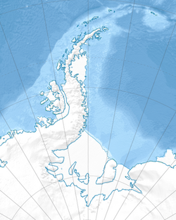
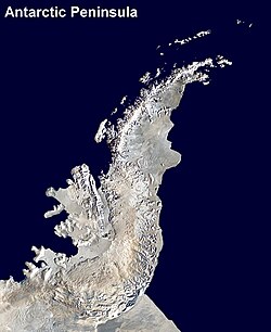
The Antarctic Peninsula is the northernmost extension of mainland Antarctica, stretching 1,300 km (810 miles) toward South America. Known by various names depending on the region—including O'Higgins Land in Chile and Tierra de San Martin in Argentina—this rugged region serves as a critical link between the deep south and the rest of the world. Separated from the southernmost tip of South America, Tierra del Fuego, by the turbulent waters of the Drake Passage, the peninsula is a land of dramatic contrasts, where towering mountains meet vast ice sheets.
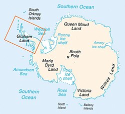
Covering an area of 522,000 square kilometres (202,000 sq mi), approximately 80% of the peninsula is covered in ice. Beneath this frozen exterior lies a complex system of bedrock islands separated by deep channels, all bound together by a grounded ice sheet.

Key Facts
- Total Area: 522,000 square kilometres.
- Ice Coverage: 80% of the landmass.
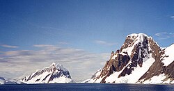
- Highest Point: Mount Hope, reaching 3,239 m (10,627 ft).
- Climate Type: Classified as tundra rather than an ice cap.
- Distance to South America: Approximately 1,000 km (620 miles).
- Key Geographic Divisions: Graham Land (north of 69° S) and Palmer Land (south of 69° S).
Discovery and Naming History
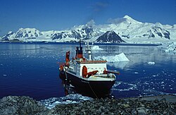
The exploration of the peninsula began in earnest in 1820, when Edward Bransfield and William Smith charted the Trinity Peninsula, the region's extreme northeast portion. In 1832, British explorer John Biscoe named the northern section Graham Land. Early 20th-century exploration continued with the Swedish Antarctic Expedition (1901–1904) led by Otto Nordenskjöld, though their ship, the Antarctic, sank during the mission.
For decades, there was a dispute over whether the region was an archipelago or a peninsula. This was resolved between 1934 and 1937 by the British Graham Land expedition, which used aerial surveys via a de Havilland Fox Moth aircraft to confirm it was a continuous peninsula. In 1964, an international agreement standardized the name "Antarctic Peninsula," while designating the area north of the line between Cape Jeremy and Cape Agassiz as Graham Land and the area south as Palmer Land, named after American seal hunter Nathaniel Palmer.
Geography and Geology
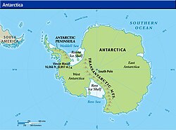
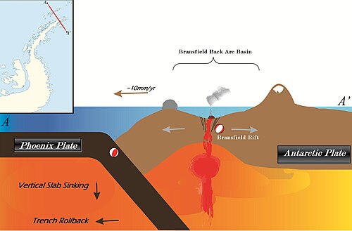
The peninsula is characterized by a mountainous spine that is considered a geological continuation of the South American Andes. This connection is maintained via a submarine ridge and the Scotia Arc, an island arc system linking the peninsula to Tierra del Fuego.
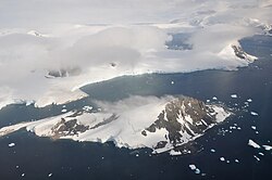
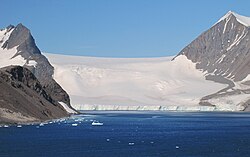
The terrain is dominated by high peaks, including Deschanel, Castro, and Mount Hope. Along the west coast, the Forster Ice Piedmont is formed by the Airy, Seller, Fleming, and Prospect Glaciers. The region also features unique geological formations such as Brown Bluff, a rare tuya (a flat-topped volcano formed when lava erupts through a thick glacier), and the Sheppard Nunatak.
Recent scientific discoveries have expanded our understanding of the region's biodiversity. In March 2025, researchers identified a thriving marine ecosystem 4,250 feet (1,300 m) below the seafloor in an area previously covered by a 500-foot-thick iceberg that broke off from the George VI Ice Shelf around 2020. This ecosystem includes several previously unknown species.
Climate and Environmental Change
Due to its northern position, the Antarctic Peninsula experiences the mildest climate on the continent, categorized as a tundra. The west coast is the mildest region, with temperatures exceeding 0°C (32°F) for three to four months during the summer. In contrast, the east coast, facing the Weddell Sea, is significantly colder, which explains the persistence of large ice shelves in that area.
| Region | Summer Avg Temp | Winter Avg Temp | Annual Precipitation |
|---|---|---|---|
| West Coast (North to 68° S) | 1 to 2 °C | Above −10 °C | 35–50 cm |
| West/Northeast Coast (68° S to 63° S) | Above 0 °C (1-2 mo) | ~ −15 °C | ≤ 35 cm |
| East Coast (South of 63° S) | Above 0 °C (max 1 mo) | −5 to −25 °C | 10–15 cm |
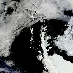
Current data indicates dramatic climate shifts. In 2024, temperatures as high as 10°C were recorded, deviating significantly from historical patterns. Northwesterly winds have contributed to increased snow sublimation and melting, particularly affecting the Larsen B and C ice shelves. NASA research confirms that the ice sheet is currently melting without interruption.
Geological Evolution and Paleontology
The peninsula has undergone a profound transformation over the last 37 million years. During the Eocene, the region supported diverse angiosperm-dominated vegetation. As atmospheric CO2 concentrations dropped and the climate cooled, these woodlands were replaced by southern beech (Nothofagus) and conifer forests during the Oligocene (34–23 Ma). By the middle Miocene (16–11.6 Ma), all woodlands were extirpated and replaced by tundra.
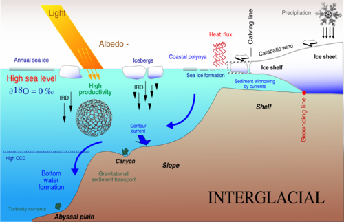
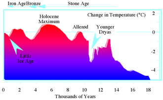
The transition to a dynamic ice sheet occurred approximately 12.8 million years ago, with the bedrock islands being fully overridden by ice in the early Pliocene (5.3–3.6 Ma). During the Last Glacial Maximum (20,000 to 18,000 years ago), the ice sheet was significantly thicker, burying almost the entire peninsula and extending into the Weddell Sea. Deglaciation occurred between 18,000 and 6,000 years ago, with a climatic optimum occurring between 3,000 and 5,000 years ago before a final cooling period leading into historic times.
Frequently Asked Questions
What is the difference between Graham Land and Palmer Land?
Graham Land refers to the northern part of the Antarctic Peninsula, while Palmer Land refers to the southern part. The two are divided by a line running between Cape Jeremy and Cape Agassiz, roughly at 69° S.
Is the Antarctic Peninsula part of the Andes?
Geologically, the mountains of the peninsula are considered a continuation of the South American Andes, connected by a submarine ridge and the Scotia Arc island system.
How has the vegetation changed over millions of years?
The region evolved from diverse angiosperm forests in the Eocene to southern beech and conifer woodlands in the Oligocene, then to tundra in the Miocene, before being completely covered by an ice sheet in the Pliocene.
What is the current state of the ice on the peninsula?
The ice is melting non-stop according to NASA data. Recent events in 2024, including record temperatures of 10°C and strong northwesterly winds, have accelerated melting in areas like the Larsen B and C ice shelves.
What was the "Hope Bay incident" or oil spill?
In 1989, the Argentine ship ARA Bahía Paraíso ran aground near the peninsula, resulting in an oil spill of approximately 170,000 US gallons (640,000 L).