Ucayali River: The Mighty Headstream of the Amazon
The Ucayali River serves as the primary headstream of the Amazon River, carving a vital path through the heart of Peru. Rising approximately 110 km (68 mi) north of Lake Titicaca in the Arequipa region, this massive waterway flows northeast until it meets the Marañón River near the city of Nauta, where the two combine to officially form the Amazon River.
The river is central to the geography and economy of the region, with the city of Pucallpa situated along its banks. Its complex network of tributaries and vast basin make it one of the most significant hydrological features in South America.
Key Facts
- Primary Role: Main headstream of the Amazon River.
- Total Length: Approximately 2,238 km (1,391 mi), though combined headwater systems reach 2,669.9 km.
- Source: The confluence of the Tambo and Urubamba Rivers.
- Mouth: Confluence with the Marañón River in Loreto, Peru.
- Wildlife: Home to the Amazon river dolphin, giant otter, and Amazonian manatee.
Hydrology and Physical Characteristics
The Ucayali is characterized by its dynamic nature and varying width, which ranges from 400 to 1,200 meters (1,300–3,900 ft) due to the presence of numerous islands. The river maintains a steady current of 5–6 kilometers per hour (3.1–3.7 mph).
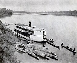
Navigation on the Ucayali can be challenging. While a channel with a minimum depth of 1.5 m (4.9 ft) is generally available, sailors must contend with five difficult passes caused by timber rafts and fallen trees. Additionally, large rocks from the mountains can create dangerous whirlpools in the riverbed.
Basin and Discharge
The river's basin is immense, covering 351,549 square kilometers. Discharge rates vary significantly by location and season. At Requena, the average discharge is approximately 13,385 m³/s, with maximums reaching 28,000 m³/s. Further downstream at Pucallpa, the average discharge is recorded at 8,931.2 m³/s.
| Feature | Detail |
|---|---|
| Length | 2,238 km (1,391 mi) |
| Basin Size | 351,549 km² (135,734 sq mi) |
| Left Tributaries | Tambo, Pachitea, Aguaytia, Pacaya, Pisqui, Cushabatay |
| Right Tributaries | Urubamba, Tamaya, Tapiche |
| Average Discharge (Requena) | 13,385 m³/s |
Exploration and Early History
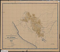
Throughout history, the river has been known by many names, including San Miguel, Ucayare, Poro, Apu-Poro, Cocama, and Rio de Cuzco. Peru conducted several expensive expeditions to map the region. In 1867, one expedition claimed to have reached within 380 km (240 mi) of Lima.
The steamer Napo demonstrated the river's navigability by ascending 1,240 km from the Amazon confluence to the Tambo River, and further ascending the Urubamba River to a point 320 km north of Cuzco.
The Rubber Boom and Social Conflict
During the first Amazon rubber boom, the Ucayali basin became a site of intense economic exploitation. Carlos Fitzcarrald emerged as the wealthiest rubber entrepreneur on the river by 1888, basing his operations near Atalaya. This era was marked by correrías—violent slave raids targeting indigenous groups such as the Asháninka, Amahuaca, Piro (Yine), Shipibo, and Conibo.
Other prominent rubber barons included Luis Felipe Morey, Julio Cesar Arana, and the Rodriguez brothers. The period was defined by extreme human exploitation, where indigenous people were treated as commodities to fuel the rubber trade.
In 1893, Fitzcarrald established the Isthmus of Fitzcarrald, a critical portage route connecting the Urubamba River to the Manu tributary of the Madre de Dios River. This opened the Madre de Dios basin to Peruvian rubber activity. Fitzcarrald's reign ended in 1897 when he and partner Antonio Vaca Díez drowned after their steamship sank on the Urubamba.
Indigenous Resistance
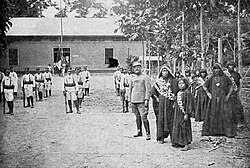
Between 1910 and 1915, the Upper Ucayali saw a series of indigenous uprisings against slave traders. In September 1910, Baldomero Rodríguez and eleven employees were killed. In January 1914, Asháninka warriors attacked Puerto Yessup, killing fifteen non-indigenous people, including César Lúrquin, a former police commissioner accused of trafficking children.
The resistance culminated on September 3, 1915, when an alliance of Asháninka, Conibo, Piro, and Yine peoples launched coordinated attacks on several rubber estates, including Cumaría, Casa Fitzcarrald, Sepa, and Chicosta.
Environmental Significance
Today, the river is a cornerstone of Peruvian biodiversity. The lower Ucayali forms the southeastern border of the Pacaya-Samiria National Reserve. This protected area is a sanctuary for rare aquatic species, including the Amazonian manatee, the giant otter, and the Amazon river dolphin.
Frequently Asked Questions
Where does the Ucayali River begin?
The Ucayali River begins at the confluence of the Tambo and Urubamba Rivers in Peru.
How does the Ucayali contribute to the Amazon River?
The Ucayali is the main headstream of the Amazon. It flows northeast and joins the Marañón River near Nauta, Peru, at which point the combined flow becomes the Amazon River.
Who was Carlos Fitzcarrald?
Carlos Fitzcarrald was a prominent Peruvian rubber baron during the first rubber boom who dominated the Atalaya region and established a key portage route known as the Isthmus of Fitzcarrald.
What wildlife can be found in the Ucayali basin?
The basin, particularly within the Pacaya-Samiria National Reserve, is home to the giant otter, the Amazon river dolphin, and the Amazonian manatee.
What were the 'correrías' during the rubber boom?
Correrías were slave raids conducted by rubber barons to forcibly capture indigenous people, such as the Asháninka and Shipibo, to work as forced labor in the rubber extraction industry.