Tujunga Wash: History, Geography, and Flood Management
Tujunga Wash is a critical hydrological system in Los Angeles, serving as a primary drainage route for the San Gabriel Mountains. From its deep roots in Indigenous history to its modern role in urban flood prevention, the wash represents a complex intersection of natural geography and human engineering.
The Origins and Meaning of Tujunga
The name Tujunga (or Tuxunga) translates to "old woman's place" in both the Fernandeño and Tongva languages, with Tuxu meaning "old woman." This name is linked to the Khra'wiyawi, an ethnohistoric narrative collected in 1916 by Carobeth Laird. According to the story, the wife of the regional chief, Khra'wiyawi, retreated to the mountains in grief over the loss of her daughter and eventually turned to stone. This legend is physically mirrored in Little Tujunga Canyon, where a large rock resembles a sitting woman.
Interestingly, another Fernandeño village near Big Tujunga Canyon was called Muxúnga. In the Fernandeño dialect of the Tongva language, this means "place of shooting," derived from the verb muxú, meaning "shoot him."
Geography and Water Flow
Tujunga Wash is formed by two primary forks originating in the San Gabriel Mountains. The system begins as Tujunga Creek (or Big Tujunga Creek), which flows generally from east to west. As it moves, it collects several tributaries before reaching the Big Tujunga Reservoir.
Below the Big Tujunga Dam, the waterway is known as Big Tujunga Wash. It continues westward into the San Fernando Valley, where it merges with Little Tujunga Wash—a northern drainage from the San Gabriel Mountains—approximately one mile before reaching the Hansen Reservoir. After passing through the Hansen Dam, the wash flows south and is joined by the Pacoima Wash. The journey concludes when the Tujunga Wash meets the Los Angeles River in the Studio City neighborhood of Los Angeles.
Infrastructure and Flood Control
To manage the volatile water flows from the mountains, two major dams were constructed. The Big Tujunga Dam, completed by Los Angeles County in 1931, created a reservoir with a capacity of 5,960 acre-feet. While it was tested during the massive Los Angeles Flood of 1938, it later required a seismic retrofit to meet modern safety standards. This project, completed in July 2011, involved doubling the thickness of the gravity arch dam.
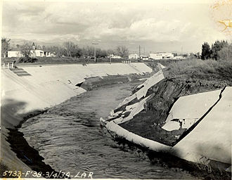
Further downstream, the United States Army Corps of Engineers completed the Hansen Dam in 1940. This facility is significantly larger, with a reservoir capacity of 74,100 acre-feet.
Groundwater Recharge and Urban Challenges
While these dams are primarily designed for flood control (the management of water to prevent overflowing), they also assist in groundwater recharge, the process where water moves downward from surface water to groundwater. However, this natural process is hindered by two main factors:
- High Flow Velocities: In the upper reaches of the watershed, water moves too quickly for significant soil absorption.
- Urbanization: In the lower watershed, concrete-lined channels have replaced bare ground, preventing percolation and forcing most runoff to discharge directly into the ocean.
Historical Flood Events
Despite these engineering efforts, the region has faced severe incidents. In 1969, a flood occurred when water diverted into a formerly inactive channel, flowing into a gravel pit between 15 and 23 meters (49 to 75 feet) deep. This caused the channel bed to degrade by approximately 4 meters (13 feet), resulting in the destruction of seven homes and the failure of three highway bridges.
Key Facts
- Etymology: Tujunga means "old woman's place" in Tongva and Fernandeño.
- Major Dams: Big Tujunga Dam (1931) and Hansen Dam (1940).
- Big Tujunga Reservoir Capacity: 5,960 acre-feet.
- Hansen Reservoir Capacity: 74,100 acre-feet.
- Final Destination: The Los Angeles River in Studio City.
- Seismic Upgrade: The Big Tujunga Dam's thickness was doubled in 2011.
| Facility | Completion Year | Capacity (Acre-Feet) | Primary Purpose |
|---|---|---|---|
| Big Tujunga Dam | 1931 | 5,960 | Flood Control & Recharge |
| Hansen Dam | 1940 | 74,100 | Flood Control & Recharge |
Frequently Asked Questions
What does the name Tujunga mean?
Tujunga means "old woman's place" in the Tongva and Fernandeño languages, likely referring to a legend about a grieving mother who turned to stone in the mountains.
Where does the Tujunga Wash eventually empty?
The Tujunga Wash flows through the San Fernando Valley and eventually meets the Los Angeles River in the Studio City neighborhood.
Why is groundwater recharge limited in the lower watershed?
Extensive urbanization has replaced natural soil with concrete-lined channels, which prevents water from percolating into the ground and instead directs it toward the ocean.
What happened to the Big Tujunga Dam in 2011?
The dam underwent a seismic retrofit to meet modern safety standards, which included doubling the thickness of the gravity arch dam.
What caused the bridge failures during the 1969 flood?
Water flowed into a deep gravel pit via an inactive channel, causing the channel bed to degrade by about 4 meters, which undermined and failed three highway bridges.