Tigris River: The Lifeline of Ancient Mesopotamia
The Tigris is one of the two great rivers that define the historical region of Mesopotamia, alongside the Euphrates. Flowing from the rugged mountains of the Armenian Highlands through the Syrian and Arabian Deserts, the Tigris has served as a vital artery for civilization for millennia. From nurturing the Assyrian Empire to supporting the modern capitals of the region, this river remains a central pillar of geography, culture, and spirituality in the Middle East.
Historically, the Tigris was known for its swift current, a characteristic that distinguished it from the slower-moving Euphrates. This speed influenced how ancient peoples settled and farmed along its banks, creating a dynamic environment that fostered some of the world's first urban societies.
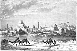
Key Facts
- Total Length: Approximately 1,900 km (1,200 mi).
- Source: Lake Hazar in the Taurus Mountains, Turkey.
- Mouth: Merges with the Euphrates at Al-Qurnah to form the Shatt al-Arab.
- Countries Spanned: Turkey, Syria, and Iraq.
- Major Cities: Elazığ, Diyarbakır, Mosul, and Baghdad.
- Basin Size: 375,000 square kilometers.
Geography and Course
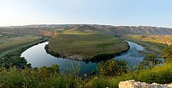
The Tigris rises in the Taurus Mountains of eastern Turkey, specifically at Lake Hazar, at an elevation of 1,150 meters. It flows for 400 km through southeastern Turkey before reaching the Syria-Turkey border. Interestingly, only a small stretch of 44 km is located within Syria.
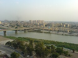
As the river moves south into Iraq, it passes through several major urban centers and archaeological sites. Near its end, the river becomes complex, splitting into various channels. The artificial Shatt al-Hayy joins the Euphrates, while other branches like the Shatt al-Muminah and Majar al-Kabir feed the Central Marshes. Finally, the main channel converges with the Euphrates near Al-Qurnah to form the Shatt al-Arab, which eventually empties into the Persian Gulf.
Major Tributaries
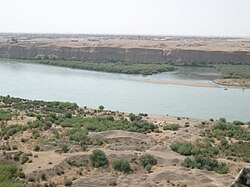
The river is fed by several significant tributaries that increase its volume and discharge. The left-bank tributaries include the Greater Zab, Lesser Zab, Khabur, Botan, and Diyala. On the right bank, the Wadi Tharthar serves as a notable feature of the basin.
Historical and Cultural Significance
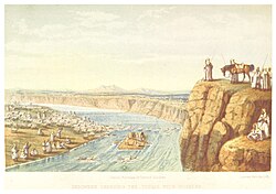
The Tigris is inextricably linked to the Cradle of Civilization. It provided the necessary irrigation for the Sumerians and supported the rise of the Assyrian Empire. Ancient cities such as Nineveh, Ctesiphon, and Seleucia flourished on its banks. Even as early as 2900 B.C., complex canal systems were dug to divert the river's waters to cities like Lagash.
Beyond politics and trade, the river holds deep religious meaning. In Sumerian mythology, the god Enki is credited with creating the river. In the Old Testament, the Tigris is mentioned as one of the four rivers branching from the Garden of Eden and appears in the visions of the prophet Daniel. For the Mandaeans, the river is essential for the rite of baptism.
Etymology and Naming
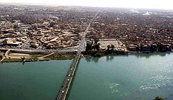
The name "Tigris" has evolved through many languages. It likely derives from the Sumerian Idigna, meaning "the swift river." This name transitioned into Akkadian as Idiglat and later into Arabic as Dijlah. In Kurdish, the river is known as Ava Mezin, which translates to "the Great Water."
Modern Management and Environmental Challenges
Today, the Tigris is a heavily managed waterway. Turkey and Iraq have constructed numerous dams to provide irrigation for arid regions and to prevent the devastating floods that historically occurred during the April snowmelts in the Turkish mountains. The Mosul Dam stands as the largest dam in Iraq.
However, these interventions have led to geopolitical tension. Downstream nations have expressed concern over reduced water flow due to upstream damming. Furthermore, the river faces threats from climate change and poor water management. In 2016, international warnings were issued regarding the potential collapse of the Mosul Dam, which could have put up to 1.5 million people at risk in cities like Tikrit, Samarra, and Baghdad.
Despite these challenges, diplomatic efforts like the "Geneva Consensus on Tigris River" (2014) have attempted to create a framework for data exchange and sustainable water standards between Iraq and Turkey.
Tigris River Summary Table
| Feature | Detail |
|---|---|
| Source | Lake Hazar, Turkey (1,150 m) |
| Mouth | Shatt al-Arab, Iraq (1 m) |
| Length | 1,900 km (1,200 mi) |
| Average Discharge | 1,014 m³/s (at Baghdad) |
| Basin Area | 375,000 km² |
| Primary Countries | Turkey, Syria, Iraq |
Frequently Asked Questions
Where does the Tigris River begin and end?
The Tigris begins at Lake Hazar in the Taurus Mountains of Turkey and ends where it merges with the Euphrates River at Al-Qurnah in Iraq to form the Shatt al-Arab, which then flows into the Persian Gulf.
Why was the Tigris called "the swift river"?
The Sumerian name Idigna translates to "the swift river," referring to its faster current compared to the Euphrates. This speed meant the Tigris deposited less silt than its neighbor, resulting in a lower riverbed.
What is the significance of the Mosul Dam?
The Mosul Dam is the largest dam in Iraq, used for irrigation and flood control. However, it has been a point of concern due to structural stability warnings that could potentially threaten downstream cities if it were to collapse.
Which ancient civilizations relied on the Tigris?
The Tigris was fundamental to the Sumerians and the Assyrian Empire, providing the water necessary for agriculture and urban development in the region known as Mesopotamia.
How does the Tigris figure into religious texts?
The river is mentioned in the Book of Genesis as one of the rivers of Eden and in the Book of Daniel. It is also referenced in Islamic texts (Sunan Abi Daud) and is used by the Mandaean community for baptism.