Thurso: The Most Northerly Town on the British Mainland
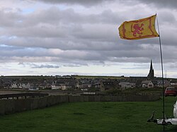
Perched on the rugged northern coastline of Scotland, Thurso serves as a gateway to the far north. Overlooking the Orkney Islands and situated at the northern terminus of the A9 road, this town blends a rich Norse heritage with modern industrial significance. From its role as a historic trading port to its current status as a hub for education and energy, Thurso remains a vital center for the Caithness area.
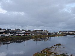
The town is defined by its geography, sitting at the junction of the A9 and A836 roads. The 34-mile (55 km) River Thurso winds through the town before emptying into Thurso Bay and the Pentland Firth, providing a small harbor that has supported the community for centuries.
Key Facts
- Location: The most northerly town on the British mainland.
- Population: 7,426 (2022 Census).
- Transport: Home to the most northerly railway station on Britain's rail network.
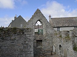
- Heritage: Features Old St Peter's Kirk, one of Scotland's oldest churches (dating to at least 1125).
- Economy: Significant employment provided by the Dounreay Nuclear Research Establishment and a lithium-ion battery plant.
History and Heritage
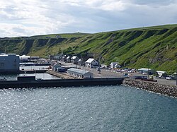
Thurso's roots are deeply entwined with Norse Orcadian rule, which lasted in Caithness until 1266. Long before the town's establishment, the area was inhabited by Neolithic peoples; horned cairns used for rituals and burials on nearby Shebster Hill date back approximately 5,000 years.
By the medieval period, Thurso had become an essential Norse port. Its economic influence was so significant that in 1330, King David II of Scotland decreed that the national standard unit of weight be aligned with that of Thurso. The town continued to trade extensively with northern European ports until the 19th century, while also building a reputation for tanning and linen-cloth production.
Architectural Landmarks
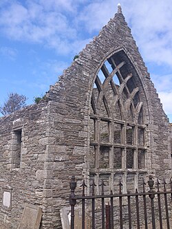
The town's spiritual history is anchored by Old St Peter's Kirk (St. Peter's Church), a Category-A listed ruin dating back to at least 1125. In 1832, the current St Andrew's and St Peter's church was constructed by architect William Burn in the Gothic style, featuring a square tower and buttressed walls.
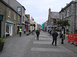
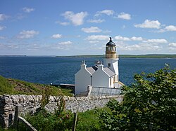
Other notable sites include the ruins of Thurso Castle (built in 1872) and the Holburn Head Lighthouse, completed in 1862 by David and Thomas Stevenson. In the heart of town, Sir John's Square features an ornamental garden and a statue of Sir John Sinclair, a pioneer of agricultural reform in Caithness.
Geography and Climate
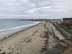
Thurso occupies a unique position on the map, sitting slightly further north than Juneau, Alaska, but slightly south of Stockholm, Sweden. It is located 19.5 miles (31.4 km) west of John o' Groats and 20.4 miles (32.8 km) northwest of Wick.
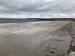
The town experiences a cool oceanic climate (Köppen Cfb). While temperatures are mild enough to support tree growth, the landscape is dominated by windswept grasslands similar to those found in Orkney and Shetland. The surrounding sea remains chilly year-round, with minimal temperature fluctuation.
Climate Summary
| Metric | Winter (Jan/Dec) | Summer (Jul/Aug) | Annual Total/Record |
|---|---|---|---|
| Mean Max Temp | 6.2°C / 11.1°C | 16.6°C / 14.6°C | Record High: 25°C |
| Mean Min Temp | 0.8°C / 4.9°C | 10.2°C / 8.2°C | Record Low: -11°C |
| Precipitation | 100.4mm / 110.4mm | 70.5mm / 76.3mm | 1,002.4mm |
| Sunshine Hours | 36.6h / 28.7h | 140.9h / 135.2h | 1,240.5h |
Economy and Infrastructure
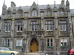
Modern Thurso is supported by a mix of industrial, educational, and service sectors. The Dounreay Nuclear Research Establishment, though largely decommissioned, remains a major employer. Additionally, a plant producing lithium-ion batteries for the Ministry of Defence (MoD) and a large British Telecom call centre contribute significantly to the local economy.
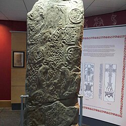
The town is also investing in renewable energy, with the Baillie wind farm approved in 2010 to supply 52.5 MW of power, enough for approximately 25,000 homes. For visitors, the North Coast Visitor Centre provides a museum experience, including control room panels from the Dounreay Materials Testing Reactor, Scotland's first operational nuclear reactor (1958).
Education and Culture
Thurso is a regional center for learning. The main campus of North Highland College (part of the University of the Highlands & Islands) offers diverse courses ranging from Golf Management to Nuclear Decommissioning. Thurso High School, established in 1958, holds the distinction of being the northernmost secondary school on the British mainland.
There is also a strong effort to revive the Scottish Gaelic language. Mount Pleasant Primary School includes a Gaelic medium unit, and the Cròileagan Inbhir Theòrsa Gaelic nursery school was established in 1996.
Sport and Leisure
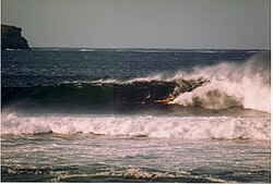
The community is active in various sports. Thurso FC, known as "the Vikings," competes in the North Caledonian League. Rugby is also prominent, with the Caithness Crushers (Rugby League) and Caithness RFC (Rugby Union). The town boasts the largest swimming club in the Highland area, the Thurso Amateur Swimming Club (TASC), with over 250 members.
Transport
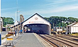
Thurso is well-connected by road and rail. The Thurso railway station, which opened in 1874, is the most northerly point of the British rail network. It currently operates as part of the Far North Line, linking the town to Wick and Inverness.
Frequently Asked Questions
What is the significance of Thurso's location?
Thurso is the most northerly town on the British mainland and serves as the northern terminus of the A9 road. It also hosts the most northerly railway station in the UK.
What are the main employers in Thurso?
The primary employers include the Dounreay Nuclear Research Establishment, a lithium-ion battery plant for the MoD, and a sizeable British Telecom call centre.
How old is the oldest church in Thurso?
The ruined Old St Peter's Kirk is one of the oldest churches in Scotland, with origins dating back to at least 1125.
What educational institutions are located in the town?
Thurso is home to the main campus of North Highland College (UHI) and Thurso High School, the northernmost secondary school on the British mainland.
What is the climate like in Thurso?
Thurso has a cool oceanic climate characterized by mild temperatures that allow tree growth, though the landscape is largely windswept grassland. Average annual precipitation is approximately 1,002.4 mm.