Sunken Meadow State Park: A History of Growth and Infrastructure
Sunken Meadow State Park stands as a cornerstone of Long Island's recreational landscape. What began as a collection of town-owned parcels in Smithtown has evolved into a massive coastal destination, shaped by mid-century urban planning and a strategic effort to provide the northern shore of Long Island with accessible beach facilities.
The Early Years and Expansion
The park officially opened in 1928, initially spanning 400 acres (160 ha). The transition of this land to state ownership was decided by a public vote, which passed with 493 votes in favor and 436 against. This transfer came with the promise of expanded facilities and the construction of a dedicated parkway to improve access.
By 1949, the park had grown significantly to 925 acres (374 ha), boasting 10,000 feet (3,000 m) of beach. During this era, Robert Moses and the Long Island State Park Commission (LISPC) identified Sunken Meadow as the primary solution for providing beach access on the northern shore, particularly as restrictive land usage in Nassau County limited other options. Despite this strategic importance, funding for the promised parkway remained elusive for several years.
The Development of the Sunken Meadow State Parkway
The Sunken Meadow State Parkway was conceived as one of three spurs of the Sagtikos State Parkway, designed to bridge the eastern gap in the Long Island parkway system. Originally known as the Sunken Meadow Spur, the route was intended to link the Northern State and Sagtikos parkways directly to the park. Before the parkway existed, visitors had to use a remote entrance on NY 25A in Fort Salonga.
The Sagtikos State Parkway opened on September 29, 1952, setting the stage for the spur's construction. The first two miles (3.2 km), stretching from the Northern State to NY 25 (Jericho Turnpike), opened on November 29, 1954, although landscaping near NY 25 was not yet finished.
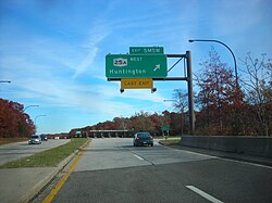
The full 7-mile (11 km) alignment of the Sunken Meadow State Parkway finally opened to traffic on April 1, 1957. This project cost $11 million (1957 USD). The LISPC anticipated that this improved access would make Sunken Meadow the second-most visited park on Long Island, trailing only Jones Beach State Park.
Modernizing Facilities for Increased Traffic
To accommodate the surge of visitors brought by the new parkway, the Long Island Parks Commission invested $1 million (1957 USD) in facility upgrades. These improvements included a new cafeteria and the extension of the existing 2,000-foot (610 m) boardwalk by an additional 1,700 feet (520 m).
Parking capacity saw a dramatic increase, rising from 3,000 vehicles to 7,500 vehicles through the addition of four new lots. Furthermore, a new overlook was built to accommodate another 1,250 vehicles. These expansions brought the total size of the park to 1,020 acres (410 ha) with 11,700 feet (3,600 m) of beachfront.
Future Planning and Transportation Studies
Between 1997 and 2001, a $6.5 million (2001 USD) study was conducted to plan the expansion of Long Island's transportation system through 2020. This plan proposed 130 miles (210 km) of road widening. A key component of this proposal was the widening of the Sunken Meadow State Parkway from the Northern State to NY 454 to include restricted-access lanes for buses and carpooling drivers, as part of a broader 60-mile (97 km) system across Long Island.
Key Facts
- Opening Year: 1928
- Initial Size: 400 acres (160 ha)
- Final Expanded Size: 1,020 acres (410 ha)
- Total Beachfront: 11,700 feet (3,600 m)
- Parkway Cost: $11 million (1957 USD)
- Peak Parking Capacity: 8,750 vehicles (including overlook)
| Period/Date | Land Area | Beach Length | Key Milestone |
|---|---|---|---|
| 1928 | 400 acres | Not specified | Park opens via public vote |
| 1949 | 925 acres | 10,000 feet | Significant land expansion |
| 1957 | 1,020 acres | 11,700 feet | Parkway completion and facility upgrades |
Frequently Asked Questions
How did Sunken Meadow State Park begin?
The park was formed from several parcels of land owned by the town of Smithtown, which were transferred to the state following a public vote of 493 to 436.
Who was responsible for the park's strategic development?
Robert Moses and the Long Island State Park Commission (LISPC) managed the development, specifically designating the park as the primary beach destination for Long Island's northern shore.
When was the Sunken Meadow State Parkway completed?
The full 7-mile alignment of the parkway opened to traffic on April 1, 1957, following an $11 million construction project.
How did the parkway affect the park's capacity?
The parkway's opening led to a massive expansion of parking, increasing capacity from 3,000 to 7,500 vehicles in new lots, plus an additional 1,250 spaces at a new overlook.
What were the proposed transportation changes in the 1997-2001 study?
The study proposed widening the parkway from the Northern State to NY 454 to include restricted-access lanes for carpooling and buses.