Sahul: The Geological and Cultural History of the Australia-New Guinea Continent
While often viewed as separate entities today, mainland Australia, New Guinea, and Tasmania were once part of a single, massive prehistoric landmass. Known scientifically as Sahul, this continent represents a unique geological and biological chapter in Earth's history, bridging the gap between the arid plains of the south and the tropical highlands of the north.
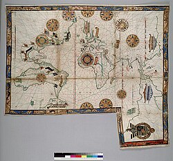
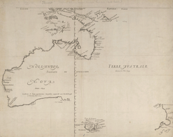
The terminology used to describe this region has evolved over decades. Prior to the 1970s, the term Australasia was commonly used, though it often vaguely included New Zealand—a landmass not actually part of the same continental shelf. In the early 1970s, researchers introduced the term Greater Australia, before finally settling on Sahul in 1975 to specifically describe the Pleistocene continent and its associated shelf.
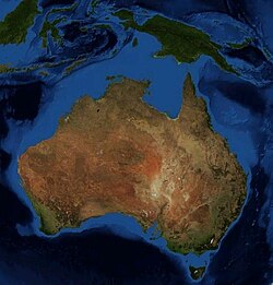
Key Facts
- Total Area: Approximately 8,600,000 square kilometers.
- Current Population: Roughly 39.3 million people.
- Primary Countries: Australia and Papua New Guinea.
- Geological Feature: The Sahul Shelf connects the mainland to New Guinea and Tasmania.
- Human Arrival: Archaeological evidence suggests humans arrived at least 50,000 years ago, with some research indicating up to 65,000 years ago.
Geological Evolution and Geography
The current geography of the region is the result of dramatic sea-level fluctuations over the last 18,000 to 10,000 years. During the Pleistocene epoch, lower sea levels exposed the Sahul Shelf, a vast continental shelf covering some 2.5 million square kilometers, much of which is now less than 50 meters deep.
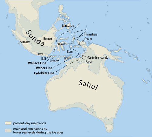
The separation of the continent occurred in stages as the last glacial period ended around 10,000 BC. First, rising waters created the Bass Strait, isolating Tasmania from the mainland. Subsequently, between 8,000 and 6,500 BC, the northern lowlands were flooded, finally separating mainland Australia from New Guinea and the Aru Islands.

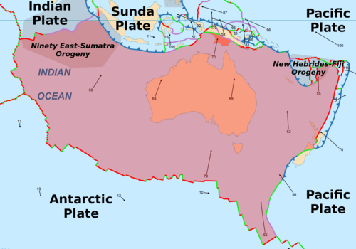
Tectonic Context
The entire region sits upon the Australian Plate, which has influenced the diverse topography of the area, from the low-lying arid regions of the mainland to the rugged, mountainous terrain of the New Guinea Highlands.
Indigenous Peoples and Early History
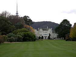
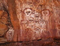
The original inhabitants of the continent are the Indigenous Australians, comprising Aboriginal Australians and Torres Strait Islanders. These populations migrated from Africa to Asia approximately 70,000 years ago, eventually reaching the shores of Sahul. Their deep connection to the land is preserved through ancient traditions and art, such as the Wandjina pictographs found in Western Australia.
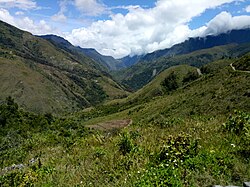
The cultural landscape of the region remains diverse, particularly in Papua New Guinea, where the Baliem Valley serves as a testament to the enduring traditions of the highland peoples.
Biodiversity and Ecology
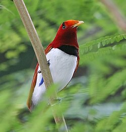
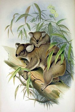
The isolation of Sahul led to the evolution of highly specialized flora and fauna. From the iconic koalas and eucalyptus forests of the mainland to the vibrant birds-of-paradise in West Papua, the region is a sanctuary of unique biological diversity.
![Fauna of Australia. Illustration from Yuzhakov's [ru] Great Encyclopedia [ru]](/images/fd/b0/fdb0b744d656ef7c88f046c0ff9126c21c406ff2ae242f6bd1e65e3de32908e3.jpg)
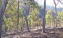
The environmental variety is stark: the region encompasses everything from the ice caps of Puncak Jaya in Papua to the tropical rainforests of New Guinea and the regenerating eucalyptus forests of Australia.
Modern Regional Overview
Today, the region is defined by two sovereign nations: Australia and Papua New Guinea, along with various dependencies and Indonesian territories like Western New Guinea. The area is characterized by a mix of global metropolitan hubs and remote wilderness.
Cities like Sydney and Melbourne are recognized globally for their quality of life, architecture, and street art, while Port Moresby and Jayapura serve as critical urban centers in the north.
![The Sydney Opera House is an iconic image of Sydney, and the continent itself.[111][112] Ranking highly in quality of life measurements, Sydney is consistently selected as one of the world's most liveable cities.](/images/74/2f/742f4c776d6aad16e7e6a073ea00a3e673bcc7bd7538121ed5db103a9768705d.jpg)
![Melbourne has been placed alongside New York City and Berlin as one of the world's great street art spots, ranked the world's most liveable city for several years running and designated a "City of Literature" by UNESCO in its Creative Cities Network.[113]](/images/e3/f6/e3f6665d43b77464faaefbbcc34e63d239a6123acc0baa483e3cc680baa5c3d4.jpg)
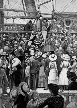
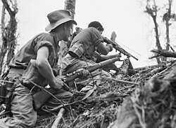
The region's modern history is marked by significant migration and international cooperation, as well as shared military history, such as the campaigns in Papua New Guinea during World War II.
Regional Summary Table
| Attribute | Details |
|---|---|
| Total Area | 8,600,000 km² |
| Population | 39,357,469 |
| GDP (PPP) | 1.5 Trillion |
| Major Countries | Australia, Papua New Guinea |
| Key Geological Feature | Sahul Shelf |
| Population Density | 4.2/km² |
Frequently Asked Questions
What is Sahul?
Sahul is the scientific name for the prehistoric Pleistocene landmass that connected mainland Australia, New Guinea, and Tasmania before rising sea levels separated them.
When did humans first arrive in Sahul?
Archaeological evidence indicates that Indigenous peoples arrived at least 50,000 years ago, though some recent research suggests they may have arrived as early as 65,000 years ago.
How did Australia, New Guinea, and Tasmania become separate?
As the last glacial period ended around 10,000 BC, rising sea levels flooded the low-lying Sahul Shelf. The Bass Strait formed first, separating Tasmania, followed by the flooding of northern lowlands which isolated New Guinea.
What is the difference between Australasia and Sahul?
Australasia is a broader geographical term that often includes New Zealand. Sahul refers specifically to the landmasses that sit on the same continental shelf (Australia, New Guinea, and Tasmania).
Which countries are currently part of the Sahul region?
The primary sovereign nations are Australia and Papua New Guinea, though the region also includes Indonesian territories such as Western New Guinea and the Aru Islands.