S13 Highway: A Scenic Route Across the Javakheti Plateau
The S13 highway is one of the shortest S-routes in Georgia, serving as a vital link through the high-altitude landscapes of the south. Traversing the rugged beauty of the Javakheti Plateau, this route connects the historic town of Akhalkalaki with the Turkish border, offering travelers a glimpse into Georgia's unique geography and military history.
Route Overview and Starting Point
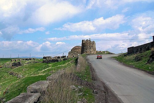
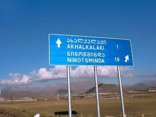
The journey begins at the north terminus near the historic Akhalkalaki Castle, where the S13 diverges from the S11 highway. From this starting point, the road leads directly to the ruins of the castle perched on a cliff before making a sharp left turn. The route then skirts the western side of Akhalkalaki, following the path of the Kirkhbulaki River.
As the highway exits the town, it passes a former Soviet/Russian military base. Since 2020, this facility has been repurposed as a training center for the Georgian armed forces. Shortly after, the S13 intersects with the Akhalkalaki Bypass, a critical shortcut for international traffic traveling between Turkey and Armenia.
Geography of the Javakheti Plateau
Akhalkalaki is situated at the northern edge of the Javakheti Plateau, sitting at an altitude of 1,700 meters (5,600 ft) above sea level. The S13 traverses a characteristic flat plateau landscape, featuring a gentle incline as it moves toward Turkey, with moderately high mountains framing the horizon.
The region is defined by its alpine environment, characterized by numerous small lakes and wetlands. One such wetland area is located in the village of Vachiani, which the highway passes through on its way west.
High-Altitude Landmarks
As the road approaches Sulda village, it ascends a step in the highland plateau to reach 1,900 meters (6,200 ft). Here, the route enters the Sulda Managed Reserve, a protected wetland area. After another ascent, the S13 reaches its peak elevation of 1,970 meters (6,460 ft) at the point where it comes closest to the Baku–Tbilisi–Kars railway.
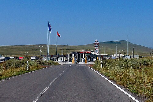
From its highest point, the highway gradually descends toward Kartsakhi village. Along this stretch, the road passes Kartsakhi Lake—Georgia's second-largest lake and a key feature of the Javakheti National Park—before terminating at the Turkish border at an altitude of 1,820 meters (5,970 ft).
Key Facts
- Highest Point: 1,970 meters (6,460 ft) near the Baku–Tbilisi–Kars railway.
- Key Destinations: Connects Akhalkalaki to the Turkish border at Kartsakhi.
- Natural Landmarks: Passes through the Sulda Managed Reserve and by Kartsakhi Lake.
- Strategic Infrastructure: Intersects with the Akhalkalaki Bypass for Turkey-Armenia transit.
- Military Significance: Passes a Georgian armed forces training center (formerly a Soviet/Russian base).
Route Summary Table
| Location/Feature | Altitude (m) | Altitude (ft) | Significance |
|---|---|---|---|
| Akhalkalaki | 1,700 | 5,600 | North Terminus |
| Sulda Village | 1,900 | 6,200 | Entry to Sulda Managed Reserve |
| Peak Elevation | 1,970 | 6,460 | Closest point to Baku–Tbilisi–Kars railway |
| Turkish Border | 1,820 | 5,970 | West Terminus (Kartsakhi) |
Frequently Asked Questions
Where does the S13 highway begin and end?
The S13 begins near Akhalkalaki Castle in the town of Akhalkalaki and ends at the Kartsakhi border checkpoint on the border with Turkey.
What is the highest point of the S13 route?
The highest point of the highway is 1,970 meters (6,460 ft) above sea level, located where the road meets the Baku–Tbilisi–Kars railway.
Which national parks or reserves does the S13 pass through?
The route passes through the Sulda Managed Reserve wetlands and runs by Kartsakhi Lake, which is part of the Javakheti National Park.
What is the significance of the Akhalkalaki Bypass?
The Akhalkalaki Bypass serves as a shortcut for international traffic traveling between Turkey and Armenia, intersecting with the S13 as it leaves the town of Akhalkalaki.
What military site is located along the S13?
The road passes a former Soviet/Russian military base that has been used as a training center for the Georgian armed forces since 2020.