S11 Highway: A Journey Through Georgia's Samtskhe-Javakheti Region
The S11 highway serves as a vital artery through the Samtskhe-Javakheti region, a territory geographically situated within the Armenian Highlands. This route is more than just a transport link; it is a scenic passage that climbs from the river valleys of southern Georgia to the highest border crossing in the country, passing through historic fortresses and high-altitude plateaus.
Key Facts
- Starting Point: Akhaltsikhe, at an elevation of 960 metres (3,150 ft).
- Highest Point: Georgia–Armenia border, reaching 2,150 metres (7,050 ft).
- Major Rivers: Follows the Kura and Paravani rivers.
- Key Landmarks: Khertvisi Fortress and the route to Vardzia cave monastery.
- International Connection: Connects Georgia to the Armenian M1 highway.
From Akhaltsikhe to the Kura River Gorge
The journey begins in the eastern edge of Akhaltsikhe, a town famous for the historic Rabati Castle. The S11 starts at a junction with the S8 highway on the left bank of the Potskhovi River. After crossing the river, the highway heads southeast, passing through the outskirts of town before joining the Kura river south of Chacharaki village.
At Minadze, the road shifts to the right bank of the Kura. For the next 39 kilometres (24 mi), the highway travels upstream toward Khertvisi. This segment is characterized by stunning river gorge scenery and a gradual increase in elevation, passing through several small settlements, including the town of Aspindza at the 30-kilometre mark, where the gorge narrows into a dramatic rocky landscape.
Historic Fortresses and High Plateaus
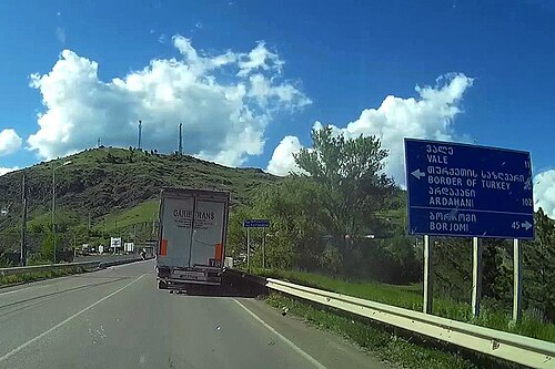
At the 44-kilometre mark, the S11 reaches a significant geographical and historical landmark: the confluence of the Kura and Paravani rivers. Perched on a rocky hill above this meeting point is the Khertvisi Fortress, dating back to the 10th-11th century and recognized as one of the oldest fortresses in Georgia.
This location also serves as a critical junction for travelers wishing to visit Vardzia. By taking the Sh58 road 16 kilometres (9.9 mi) upstream along the Kura, visitors can reach the Vardzia cave monastery, a premier tourist destination carved directly into the rocks.
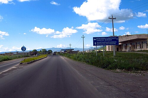
Continuing from Khertvisi, the S11 follows the Paravani river upstream toward Akhalkalaki. During this 23-kilometre (14 mi) stretch, the terrain becomes more rugged as the road climbs from 1,150 metres (3,770 ft) to 1,650 metres (5,410 ft). As the highway winds up onto the plateau where Akhalkalaki is situated, it meets the S13 highway, which provides the primary route to the Turkish border at Kartsakhi.
The Ascent to the Armenian Border
After passing through the main street of Akhalkalaki, the S11 continues south through the villages of Martuni and Khospio. A notable industrial landmark occurs halfway between Akhalkalaki and Ninotsminda, where the highway intersects with the Baku–Tbilisi–Kars railway line. This area features a large switchyard used for break of gauge bogie exchange—the process of changing the wheelsets of railway cars to accommodate different track widths between countries.
Upon reaching Ninotsminda, the highway and railway separate. In the town center, the S11 meets the Sh31 state route, which leads toward Tbilisi via Tsalka. The final leg of the journey heads southeast for 23 kilometres (14 mi) toward the border. The road climbs steadily to reach its peak elevation of 2,150 metres (7,050 ft) at the Georgia–Armenia border, marking the highest border crossing in Georgia and the highest point of the Armenian M1 highway.
Route Summary Table
| Location/Landmark | Distance/Elevation | Key Feature |
|---|---|---|
| Akhaltsikhe | 960 m (3,150 ft) | Route start; junction with S8 |
| Aspindza | 30 km from start | Narrow rocky gorge scenery |
| Khertvisi | 44 km from start | Khertvisi Fortress; junction to Vardzia (Sh58) |
| Akhalkalaki | 1,650 m (5,410 ft) | Plateau town; junction with S13 to Turkey |
| Ninotsminda | Variable | Junction with Sh31 to Tbilisi |
| Georgia–Armenia Border | 2,150 m (7,050 ft) | Highest border crossing in Georgia |
Frequently Asked Questions
What is the highest point of the S11 highway?
The highest point is the Georgia–Armenia border crossing, which reaches an elevation of 2,150 metres (7,050 ft).
How can I get to the Vardzia cave monastery from the S11?
You can reach Vardzia by taking the Sh58 road at the junction near Khertvisi, traveling 16 kilometres (9.9 mi) upstream along the Kura river.
Which international borders are accessible via junctions on the S11?
The S11 leads directly to the Armenian border and provides access to the Turkish border via the S13 highway junction at Akhalkalaki.
What is the significance of the railway site between Akhalkalaki and Ninotsminda?
The site is part of the Baku–Tbilisi–Kars railway and features a large switchyard used for break of gauge bogie exchange to handle different railway track widths.
Which rivers does the S11 highway follow?
The highway initially follows the Kura river upstream and later follows the Paravani river toward Akhalkalaki.