Rocky Mountains: A Comprehensive Overview of North America's Iconic Range
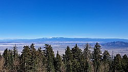
The Rocky Mountains, often referred to as the Rockies, represent the easternmost portion of the vast North American Cordillera. Stretching from the Liard River in British Columbia, Canada, south to the headwaters of the Pecos River in New Mexico, this massive mountain system is a complex network of distinct subranges, high basins, and rolling tablelands. Spanning a straight-line distance of approximately 3,000 miles (4,800 km), the range covers an area of roughly 300,000 square miles.
Key Facts
- Highest Peak: Mount Elbert, Colorado (14,440 ft / 4,400 m)
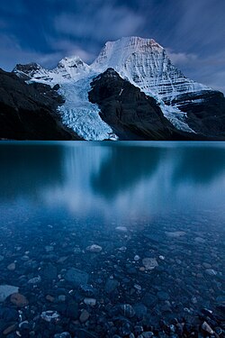
- Highest Canadian Peak: Mount Robson, British Columbia (12,972 ft / 3,954 m)
- Total Length: Approximately 3,000 miles (4,800 km)
- Primary Countries: Canada and the United States
- Geological Composition: Igneous, sedimentary, and metamorphic rocks
Geography and Scale
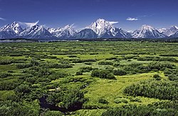
The Rockies are not a single, uniform line of peaks but a collective network of dozens of subranges. Their width varies significantly, ranging from 70 to 300 miles (110 to 480 km). The range contains the highest peaks in central North America, providing a dramatic skyline that defines much of the western continent.
Human settlement in the Rockies is relatively sparse, with an average density of only four people per square kilometer. While few cities in the region exceed 50,000 residents, the area has seen significant growth. Between 1950 and 1990, population increases in Rocky Mountain states ranged from 35% in Montana to as high as 150% in Utah and Colorado. Some mountain communities have seen even more explosive growth; for instance, Jackson, Wyoming, saw its population increase by 260% between 1972 and 2012.
Geology and Landscape Formation
The formation of the American Rockies is attributed to an unusual subduction process. The Farallon Plate dove beneath the North American Plate at a very shallow angle. This low-angle subduction moved the area of melting and mountain building much further inland than usual, increasing friction with the thick continental mass. This process resulted in tremendous thrusts that piled sheets of crust on top of one another, creating the broad, high range seen today.
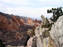
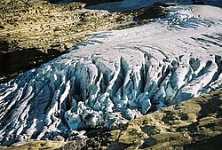
Glaciation has played a critical role in sculpting the landscape. During the Pleistocene and Holocene epochs, massive ice sheets carved out iconic features such as U-shaped valleys and cirques (bowl-shaped depressions). Notable recent glacial episodes include the Bull Lake Glaciation and the Pinedale Glaciation, the latter of which may have persisted until as recently as 15,000 to 20,000 years ago.
Ecology and Diverse Climates
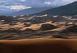
Because the Rockies span a vast latitudinal range—from 59° N in British Columbia to 35° N in New Mexico—there is no single monolithic ecosystem. Instead, the range is divided into several biotic zones based on their ability to support tree growth and the presence of indicator species.
Major Ecological Zones
- The Plains: Located to the east of the mountains, characterized by prairie grasses at elevations below 1,800 meters (550 ft).
- Alpine Tundra: High-altitude regions located above the tree-line. The tree-line varies significantly, from 760 meters (2,500 ft) in the north to 3,700 meters (12,000 ft) in New Mexico.
Climate conditions also vary wildly. Annual precipitation can range from 250 mm (10 in) in southern valleys to 1,500 mm (60 in) at northern peaks. Similarly, average January temperatures can fluctuate from -7°C (20°F) in British Columbia to 6°C (43°F) in Colorado.
Historical Exploration and Settlement
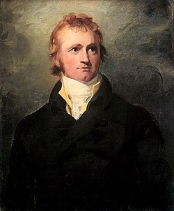
The history of the Rockies is marked by both indigenous presence and waves of European exploration. Sir Alexander Mackenzie was the first European recorded to cross the mountains in 1793, completing a transcontinental crossing of North America north of Mexico.
Later, the Lewis and Clark Expedition (1804–1806) provided the first scientific reconnaissance of the range, collecting biological and geological specimens. Before widespread settlement, "mountain men" of French, Spanish, and British origin roamed the region between 1720 and 1800, primarily hunting for furs and searching for minerals.
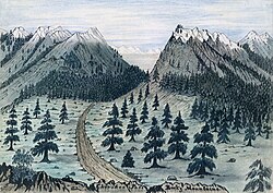
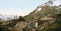
As the 19th century progressed, the region saw increased activity from fur traders and settlers. The Oregon Treaty of 1846 eventually settled boundary disputes between Britain and the United States, ceding lands south of the 49th parallel to the U.S. The era of mining also left a significant mark, particularly in areas like Aspen, Colorado.
Modern Economy and Tourism
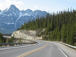
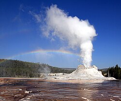
Today, the Rockies are a major hub for tourism and resource extraction. The region is home to numerous world-class national parks, including Yellowstone, Glacier, and Banff. These protected areas allow visitors to experience the rugged beauty of the mountains safely.
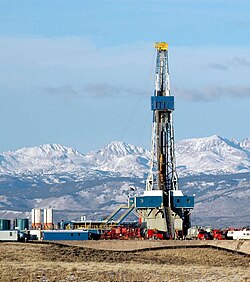
Beyond tourism, industries such as natural gas drilling continue to operate within the range's foothills and surrounding areas.
Frequently Asked Questions
What is the highest point in the Rocky Mountains?
The highest peak in the entire Rocky Mountain range is Mount Elbert, located in Colorado, with an elevation of 14,440 feet (4,400 meters).
How were the Rocky Mountains formed?
The mountains were formed through a process of subduction where the Farallon Plate moved beneath the North American Plate at a shallow angle, causing intense friction and crustal thickening.
What are the different ecosystems in the Rockies?
The Rockies consist of various biotic zones, including the Great Plains (prairie grasses), forested areas, and the Alpine tundra, which exists above the tree-line.
Are there safety hazards when visiting the Rockies?
Yes. The terrain can be dangerous, with risks including falls from steep cliffs and falling rocks. Visitors should be aware of the rugged nature of the landscape.
Which national parks are located in the Rockies?
In the United States, notable parks include Yellowstone, Glacier, Grand Teton, and Rocky Mountain National Parks. In Canada, the range includes Banff, Jasper, Kootenay, Waterton Lakes, and Yoho National Parks.