Oyster Bay – Rye Bridge: The History of Long Island's Proposed Sound Crossing
For decades, urban planners and policymakers have envisioned a direct link across the Long Island Sound to connect Nassau County with Westchester County. The most prominent of these visions was the Oyster Bay – Rye Bridge, a massive infrastructure project designed to alleviate the crushing congestion of New York City's arterial roads. While the bridge was never built, its history reflects the complex intersection of mid-century ambition, environmental law, and political volatility.
The 1957 Vision and Early Planning
The concept first emerged in 1957, proposed by Charles H. Sells, a former commissioner for the New York State Department of Public Works. Sells suggested two potential crossings: one between Oyster Bay and Rye, and another between Orient Point and Watch Hill, Rhode Island. At the time, Sells believed such projects were not immediately necessary, suggesting they be deferred until traffic and commuting patterns on Long Island increased.
By 1964, Sells' predictions had materialized. The Northern State Parkway and the Long Island Expressway were heavily congested, and the Throgs Neck and Bronx–Whitestone bridges were operating at their maximum designed capacities. In response, Robert Moses, chairman of the Triborough Bridge and Tunnel Authority, commissioned a $150,000 feasibility study by the firm Madigan-Hyland.
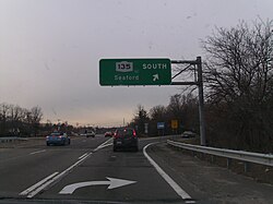
In February 1966, the results were presented to the Nassau and Suffolk Regional Planning Board. The proposed bridge—originally called the Bayville – Rye Bridge—was designed to complete the Interstate 287 beltway around the New York Metropolitan Area. The plan called for a 6.1-mile (9.8 km) cable-stayed suspension bridge connecting the Cross Westchester Expressway (I-287) in Rye to the Seaford – Oyster Bay Expressway (NY 135) in Nassau County, with an estimated cost of $150 million (1966 USD).
Political Setbacks and Delays
Despite support from Governor Nelson Rockefeller, the project faced a series of administrative and political hurdles. In 1968, the Triborough Bridge and Tunnel Authority merged with the Metropolitan Transportation Authority (MTA), and Robert Moses was removed as chairman, remaining only as a consultant. Throughout the late 1960s and early 1970s, the project was repeatedly delayed due to a "soft" bond market and the political risks associated with gubernatorial elections.
By 1970, new federal environmental laws required a comprehensive Environmental Impact Statement (EIS), which expanded the scope of the study to include the highway approaches. Despite these delays, Moses continued to push for construction, viewing the bridge as the essential final link for the region's transportation network.
Technical Specifications and Route Alternatives
The proposed project was a 16.5-mile (26.6 km) undertaking, measured from the I-287/I-95 interchange in Rye to the NY 135/NY 25 interchange in Syosset. The bridge itself would have featured four lanes, with a maximum clearance of 135 feet (41 m) and a minimum of 55 feet (17 m) above the sound. A 1,200-foot (370 m) center span between two towers would have been separated by a median divider and a girder box for smooth traffic flow.
Planners considered several approach routes to minimize property seizure and environmental impact:
- Westchester County: Four alternatives (W-1 through W-4) were proposed, ranging from low-viaduct structures near Playland Park to a route through Port Chester Harbor.
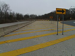
- Nassau County: Three alternatives (N-1 through N-3) were evaluated. N-1 and N-2 involved deep cuts and viaducts through Bayville and Mill Neck, while N-3 proposed a longer bridge touching down in Ferry Beach.
The total projected cost rose to $200 million for the bridge, with an additional $52–72 million for approaches and $25 million to complete the NY 135 segment between NY 25 and NY 106.
Projected Economic and Traffic Benefits
Proponents argued that the bridge would drastically reduce congestion on I-95 (the New England Thruway) and the Hutchinson River Parkway by diverting Long Island traffic away from New York City. The economic projections were ambitious, with an estimated 11.8 million users in the first year, growing to 23 million by the twentieth year.
| Metric | Detail/Value |
|---|---|
| Estimated Bridge Cost | $200 Million |
| Approach Costs | $52–72 Million |
| Year 1 Traffic Volume | 11.8 Million people |
| Year 20 Traffic Volume | 23 Million people |
| Passenger Car Toll | $1.75 |
| Construction Labor | ~2,100 average workers (3,000 peak) |
Beyond traffic, Robert Moses highlighted several regional advantages in the 1973 Economic Impact Statement, including the creation of a wider regional market for businesses, expanded employment opportunities for skilled workers, and the ability to move freight to Long Island without navigating New York City congestion.
Opposition and Cancellation
The project eventually collapsed under the weight of growing public opposition on both sides of the Sound. Furthermore, plans to designate the Oyster Bay area as a protected park and bird sanctuary created legal barriers to construction. On June 20, 1973, Governor Rockefeller officially canceled the project.
21st Century Revivals
The idea of a Sound crossing resurfaced in January 2008, when developer Vincent Polimeni proposed a privately financed tunnel. This proposal envisioned two three-lane tubes and one maintenance tube, stretching 16 to 18 miles (26 to 29 km)—which would have made it the longest highway tunnel in the world. The estimated cost was between $12 billion and $16 billion.
Later, during his second term, Governor Andrew Cuomo also proposed a similar tunnel connecting NY 135 to Rye. However, following a polarizing public debate, the New York State Department of Transportation (NYSDOT) announced that the tunnel project would not move forward.
Key Facts
- Original Proposal: First suggested in 1957 by Charles H. Sells.
- Primary Goal: To complete the I-287 beltway and reduce NYC traffic.
- Bridge Design: A 6.1-mile cable-stayed suspension bridge.
- Cancellation Date: June 20, 1973, by Governor Nelson Rockefeller.
- Modern Alternative: A proposed $12–$16 billion tunnel by Vincent Polimeni in 2008.
Frequently Asked Questions
Why was the Oyster Bay – Rye Bridge never built?
The project was canceled due to strong community opposition on both shores of the Long Island Sound and legal restrictions regarding the creation of a bird sanctuary and protected park in the Oyster Bay area.
Who was the primary driver behind the bridge's planning?
Robert Moses, the influential chairman of the Triborough Bridge and Tunnel Authority, was the primary force behind the feasibility studies and the detailed planning of the bridge and its approaches.
How would the bridge have affected traffic in New York?
It was intended to divert traffic from Long Island bound for New England or upstate New York away from the East River bridges and I-95, thereby reducing congestion in New York City.
What was the most recent attempt to connect Oyster Bay and Rye?
In 2008, developer Vincent Polimeni proposed a privately funded tunnel that would have been the longest highway tunnel in the world. Governor Andrew Cuomo also later proposed a tunnel, but neither project proceeded.
What was the projected cost of the original 1960s bridge?
The bridge itself was estimated to cost $200 million, with additional costs ranging from $52 million to $72 million for the approach highways.