Outer Hebrides: A Journey Through Scotland's Western Isles
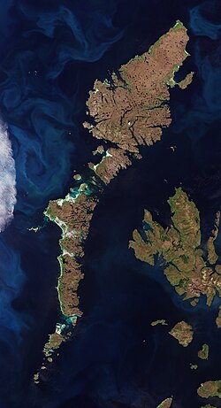
The Outer Hebrides, also known as the Western Isles, form a breathtaking archipelago off the west coast of Scotland. Stretching roughly 210 kilometres (130 mi) from the Butt of Lewis in the north to Barra Head in the south, these islands are a sanctuary of rugged beauty, ancient history, and a living linguistic heritage. With a mild oceanic climate and a landscape defined by ancient metamorphic bedrock, the region offers a unique glimpse into the natural and cultural heart of the United Kingdom.
Today, the islands are administered by the Comhairle nan Eilean Siar, serving a population that remains deeply connected to the land and sea.
Key Facts

- Total Area: 3,056 km² (1,180 sq mi).
- Population: 26,020 (as of 2024).
- Highest Point: Clisham, reaching 799 m (2,621 ft).
- Largest Town: Stornoway, located on the Isle of Lewis.
- Primary Language: English and Scottish Gaelic.
- Administrative Body: Comhairle nan Eilean Siar.
Geography and Natural Landscape
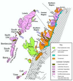
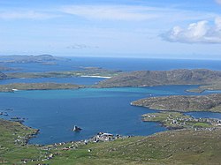
The archipelago consists of 19 inhabited islands and over 50 substantial uninhabited ones. The terrain is characterized by its geological antiquity, with much of the bedrock consisting of metamorphic rocks—rocks that have been transformed by intense heat and pressure over millions of years.
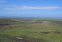
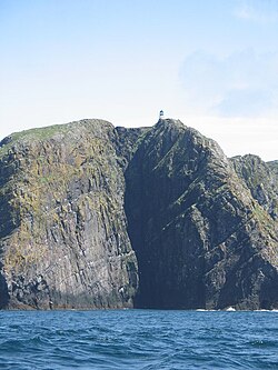
From the open, sweeping landscapes of Benbecula to the dramatic gneiss cliffs of Sloc na Bèiste at Barra Head, the geography is as diverse as it is striking. The islands are renowned for their "machair" (fertile low-lying grassy plains) and their stark, wind-swept coastlines.
Island Distribution and Population
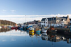
The population is concentrated primarily in the north, with Lewis and Harris hosting the vast majority of residents. Stornoway serves as the primary economic and transport hub for the region.
| Island | Population (2011) | Gaelic Speakers (%) |
|---|---|---|
| Lewis and Harris | 22,947 | 49% |
| North Uist | 1,254 | 61% |
| Benbecula | 1,303 | 60% (with S. Uist) |
| South Uist | 1,754 | 60% (with Benbecula) |
| Barra | 1,174 | 62% |
| Others | 1,168 | 13% |
Cultural Heritage and Language
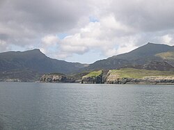
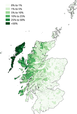
The Outer Hebrides are the most coherent Scottish Gaelic speaking area in Scotland. While the percentage of speakers has seen a decline—from over 50% on every island in 2001 to approximately 52% overall by 2011—the language remains a cornerstone of local identity. The Gaelic Language (Scotland) Act of 2005 was enacted to provide ongoing support for the preservation of this Celtic tongue.
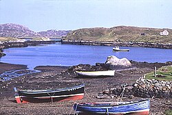
Spirituality also plays a significant role in island life. The region has the smallest percentage of non-religious residents in Scotland. While the Church of Scotland and Roman Catholicism are prominent, the Free Church of Scotland is well-known for its strict observance of the Sabbath.
History and Landmarks
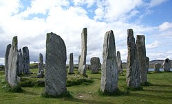
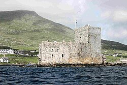
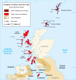
The islands' history is a tapestry of Norse control, Scottish rule, and clan rivalries. Ancient monuments like the Callanish Stones provide evidence of prehistoric settlement, while medieval structures like Kisimul Castle—the ancient seat of Clan MacNeil—stand as testaments to the power of the island lords.
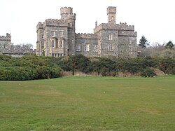
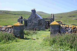
Other notable sites include Lews Castle in Stornoway and the remote, now-abandoned schoolhouse on Mingulay, which serves as a poignant reminder of the islands' shifting demographics over the last century.
Transport and Connectivity
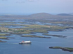
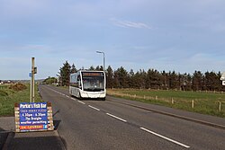
Connectivity is maintained through a network of ferries operated by Caledonian MacBrayne, linking the islands to mainland hubs such as Oban, Ullapool, and Mallaig. On the islands, Bus Na Comhairle provides essential local transit.
Frequently Asked Questions
What is the largest settlement in the Outer Hebrides?
Stornoway, located on the Isle of Lewis, is the largest settlement with a population of approximately 8,100 people.
Is Scottish Gaelic still spoken in the islands?
Yes, the Outer Hebrides are the strongest Gaelic-speaking region in Scotland, although the percentage of speakers has decreased over recent decades due to an increase in English-speaking residents.
What are the most famous historical sites in the region?
The most prominent sites include the prehistoric Callanish Stones, Kisimul Castle on Barra, and Lews Castle in Stornoway.
How do people travel to and between the islands?
The primary means of transport are ferries (notably Caledonian MacBrayne) connecting to the mainland and local bus services provided by Bus Na Comhairle.
What is the highest point in the Outer Hebrides?
The highest elevation is found at Clisham, which reaches a height of 799 metres (2,621 ft).