Oso Creek Watershed: Geography, Urban Impact, and Erosion Challenges
The Oso Creek watershed is a critical hydrological component of the larger San Juan Creek system, spanning 25 square miles (65 km²). Located in the west and northwest portions of the San Juan Creek watershed, it represents approximately 18% of the total 133-square-mile (340 km²) area. This region encompasses parts of three cities: Mission Viejo, Laguna Niguel, and San Juan Capistrano, with land use primarily divided between residential, commercial, and agricultural purposes.
Geographically, Oso Creek is bordered by several other waterways. It runs parallel to Trabuco Creek, with Salt Creek situated to the southwest, Sulphur Creek to the west, and Aliso Creek to the northwest. The landscape is defined by the southernmost portions of the San Joaquin Hills to the west and southwest, and the Santa Ana Mountains to the north and northeast. A pronounced drainage divide connects these two mountain ranges in a northeasterly direction, separating Oso Creek from the Aliso Creek watershed.
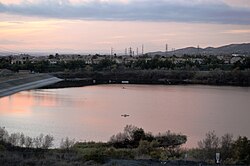
Key Facts
- Size: 25 square miles, comprising 18% of the San Juan Creek watershed.
- Location: Spans Mission Viejo, Laguna Niguel, and San Juan Capistrano.
- Boundaries: Bordered by the San Joaquin Hills and the Santa Ana Mountains.
- Flow Status: Transitioned from ephemeral (flowing only after rain) to perennial due to urban runoff.
- Infrastructure: Mostly channelized with a diversion structure leading to the Galivan Basin.
Urbanization and the "Nuisance Flow"
Historically, Oso Creek was an ephemeral stream, meaning it flowed only temporarily following precipitation. However, significant amounts of uncontrolled urban runoff have transformed it into a perennial stream. This constant dry-season flow is often referred to as a "nuisance flow," maintaining an average minimum of 1 cubic foot per second (0.03 m³/s).
Because much of the creek has been channelized—contained within artificial concrete structures—this constant flow has caused severe erosion in the remaining unlined reaches. To manage high inflow levels, a diversion structure directs water into the Galivan Basin. The volume of diverted water scales with the inflow: 350 cubic feet per second (10 m³/s) is diverted during a flow of 4,000 cubic feet per second (110 m³/s), while 4,800 cubic feet per second (140 m³/s) is diverted during a peak flow of 29,000 cubic feet per second (820 m³/s).
Erosion and Environmental Impact
Upstream development has led to significant geological instability. By 1991, continuous erosion had transformed a creek channel that was originally 6 feet deep and 6 feet wide into a canyon 50 feet (15 m) deep. This canyon begins less than one mile downstream of the Interstate 5 / California State Route 73 interchange, where the water exits the concrete channel onto bare ground, and extends to the confluence with Trabuco Creek. This erosion has historically threatened local citrus groves.
The instability of the watershed has also posed risks to local infrastructure. In early 1993, severe storm-driven erosion threatened a church and various sewer lines. Furthermore, the area has faced pollution incidents, such as on March 15, 2000, when a broken sewage pipeline in Mission Viejo released 21,000 U.S. gallons (80 m³) of waste into Oso Creek.
Watershed Summary
| Feature | Detail |
|---|---|
| Total Area | 25 square miles (65 km²) |
| Percentage of San Juan Creek Watershed | ~18% |
| Primary Land Uses | Residential, Commercial, Agricultural |
| Average Minimum Flow | 1 cubic foot per second (0.03 m³/s) |
| Maximum Diversion Capacity | 4,800 cubic feet per second (140 m³/s) |
Frequently Asked Questions
What is a "nuisance flow" in the context of Oso Creek?
A nuisance flow is the perennial flow of water during the dry season caused by uncontrolled urban runoff, whereas the creek was naturally ephemeral.
How has urbanization affected the physical structure of the creek?
Urbanization led to the channelization of most of the creek and caused severe erosion in unlined sections, creating a canyon 50 feet deep in some areas.
Where does the diverted water from Oso Creek go?
Depending on the inflow level, a portion of the flow is diverted into the Galivan Basin via a specialized diversion structure.
Which cities are located within the Oso Creek watershed?
The watershed includes parts of Mission Viejo, Laguna Niguel, and San Juan Capistrano.
What are the primary geographical boundaries of the watershed?
It is bordered by the San Joaquin Hills to the west and southwest, and the Santa Ana Mountains to the north and northeast.