Nur Mountains
The Nur Mountains (Turkish: Nur Dağları, meaning "Mountains of Holy Light") are a significant mountain range located in the Hatay Province of south-central Turkey. Known throughout history by various names—including the ancient Mount Amanus, the medieval Black Mountain, and the Arabic Jabal al-Lukkam—this range serves as a vital geographical and ecological bridge between different regions of Southwest Asia.
Stretching approximately 100 miles (200 kilometers) in length, the range begins south of the Ceyhan river and the Taurus Mountains. It runs roughly parallel to the Gulf of İskenderun, eventually meeting the Mediterranean coast between the gulf and the mouth of the Orontes (Asi) river.
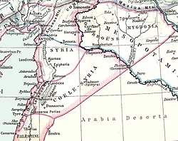
Key Facts
- Highest Peak: Bozdağ Dağı, reaching an elevation of 2,240 m (7,350 ft).
- Location: Hatay Province, Turkey.
- Ecological Status: Recognized as one of Turkey's nine environmental hotspots and a global biodiversity hotspot.
- Strategic Passes: The Belen Pass (Syrian Gates) and the Amanic Gates (Bahçe Pass).
- Historical Names: Amanus Mountains, Alma-Dağ, and the Black Mountain.
Geography and Topography
The Nur Mountains act as a natural border, dividing the coastal region of Cilicia from Antioch and inland Syria. This positioning makes the range a critical boundary between the southeast region of Asia Minor (Anatolia) and the rest of Southwest Asia.
The terrain is characterized by its ruggedness, with the highest point being Bozdağ Dağı. To facilitate travel across this barrier, two primary passes are utilized: the Belen Pass, located near the town of Belen, and the Amanic Gates (also known as the Bahçe Pass) situated further to the north.
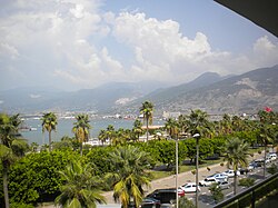
Biodiversity and Conservation
The region is celebrated for its pristine environment and typical Mediterranean flora. Because it hosts numerous endemic species—plants and animals found nowhere else on Earth—the Amanos Mountains are classified as one of the world's biodiversity hotspots. This rich ecosystem makes the range a priority for conservation efforts within Turkey.
The History of Monasticism on the Black Mountain
During the Middle Ages, the range was known as the Black Mountain in Latin, Syriac, Armenian, and Byzantine Greek. While solitary monks inhabited the peaks as early as the fourth century, the 10th and 11th centuries marked the area's peak as a center for Byzantine monasticism. Its influence in the Byzantine East was considered comparable to that of Mount Athos in the West.
The mountains hosted a diverse array of religious communities, including Georgian, Catholic, Jacobite, Melkite, and Armenian monasteries. Due to this high concentration of non-Muslim religious practitioners, the Turks later referred to the range as Gâvur Dağ (Mount of Infidels).
Conflict and Decline
The monastic communities often faced political and military turmoil:
- 1028: Emperor Romanos III attempted to draft Syriac and Armenian monks for a military campaign against Aleppo.
- 1050s: The physician Ibn Butlan noted the general health of the region's monasticism, specifically praising the monastery of St Simeon the Younger.
- 1066: The Seljuk Turkish general Afshin Bey devastated the monasteries, resulting in the deaths of many monks.
- 1098: Monks provided essential provisions to the Crusader army during the siege of Antioch.
- 1119: Following the Battle of Ager Sanguinis, the Artuqids of Aleppo plundered the monasteries and slew many of the remaining monks.
Summary of the Nur Mountains
| Feature | Details |
|---|---|
| Maximum Elevation | 2,240 m (7,350 ft) |
| Highest Peak | Bozdağ Dağı |
| Total Length | ~200 km (100 miles) |
| Province | Hatay, Turkey |
| Key Passes | Belen Pass, Amanic Gates |
Frequently Asked Questions
What are the different names for the Nur Mountains?
The range has been known as the Nur Mountains (Turkish), the Amanus Mountains (Ancient Greek), the Black Mountain (Medieval Byzantine/Latin), Alma-Dağ, and Jabal al-Lukkam (Arabic).
Why is the Nur Mountains range ecologically important?
It is recognized as one of Turkey's nine environmental hotspots and a global biodiversity hotspot due to its Mediterranean flora and numerous endemic species.
What is the significance of the Belen Pass?
The Belen Pass, also known as the Syrian Gates, is a major geographical pass that allows travel through the mountain range near the town of Belen.
Who lived in the mountains during the Middle Ages?
The mountains were a major hub for monasticism, housing Armenian, Melkite, Jacobite, Georgian, and Catholic monks and hermits.
What happened to the monasteries in 1066?
In 1066, the monasteries were devastated by the Seljuk Turkish general Afshin Bey, who killed many of the monks residing there.