New Orleans Regional Transit Authority
The New Orleans Regional Transit Authority (RTA or NORTA) is the primary public transportation agency serving the City of New Orleans and Orleans Parish, Louisiana. Established by the Louisiana State Legislature in 1979, the agency took full control of the city's mass transit system in 1983, ending nearly sixty years of management by New Orleans Public Service, Inc. Today, it stands as the largest public transit agency in the state of Louisiana.
With a diverse fleet utilizing diesel for buses and ferries and electricity for its iconic streetcars, the RTA provides a vital link for residents and tourists alike. As of 2025, the system recorded an annual ridership of 13,501,100, averaging approximately 42,400 passengers per weekday in early 2026.
Key Facts
- Founded: 1979 (Operations began in 1983).
- Annual Ridership: 13,501,100 (2025).
- Network: 28 bus routes, 5 streetcar lines, and 2 ferry routes.
- Leadership: Led by Chief Executive Lona Edwards Hankins.
- Primary Hub: Headquarters located on Canal Street.
History and Resilience
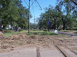
The RTA's history is marked by significant challenges and recovery, most notably following Hurricane Katrina. During the storm's onset, NORTA buses were utilized to transport citizens to the Superdome. However, the subsequent flooding devastated the agency's infrastructure. The administration building on Plaza Drive was submerged in approximately 10 feet (3.0 m) of water, and roughly 85% of the bus fleet was rendered inoperative.
The impact on the streetcar system was mixed. While the historic Perley Thomas-built streetcars of the St. Charles line remained undamaged, nearly all streetcars built in the 1990s and 2000s suffered severe flood damage. These newer cars were eventually repaired using components from the Brookville Equipment Co.
Post-Disaster Recovery
Service restoration occurred gradually as neighborhoods became habitable. The St. Charles streetcar line was the only route to maintain 24-hour service immediately following the disaster. By 2008, the St. Charles line resumed its full route, and by early 2009, the red Canal streetcars returned to service on the Canal and Riverfront Lines.
Recovery was a long-term process; by 2015, overall transit service was still at only 45% of pre-Katrina levels, with bus service specifically at 35%. Significant updates continued into 2016, including the extension of the Loyola/UPT streetcar line to Elysian Fields Avenue via Rampart Street.
Modern Services and Infrastructure
The RTA operates a multimodal system designed to connect the unique geography of New Orleans.
Bus Network and "New Links"
Buses are the backbone of the system, with 28 routes serving 11,250,100 riders in 2025. On September 25, 2022, the agency launched New Links, a comprehensive network redesign. This project was prompted by a survey of 3,000 people who found previous routes outdated. The redesign focused on reducing wait times, extending service hours, and improving access to landmarks and employment hubs.
Streetcar System
New Orleans is famous for its streetcars, which cover 15.9 miles (25.6 km) of track across five lines. In 2025, the streetcar system saw 3,136,500 riders.
| Line | Route Name | Terminals | Length | Notes |
|---|---|---|---|---|
| 12 | St. Charles | Carrolton Ave & S. Claiborne Ave to Canal St & Carondelet St | 6.6 mi | 24-hour service |
| 46 | Rampart/Loyola | Elysian Fields Ave to New Orleans Union Passenger Terminal | 2.2 mi | - |
| 47 | Canal/Cemeteries | Cemeteries Transit Terminal to Canal St. Ferry Terminal | 3.6 mi | 24-hour service |
| 48 | Canal/City Park | Museum of Art to Canal St. Ferry Terminal | 3.6 mi | 24-hour service |
| 49 | Riverfront | French Market to Julia Street | 1.3 mi | - |
Ferry Services
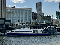
Two ferry routes cross the Mississippi River, providing essential transit between the east and west banks.
- Algiers Point Ferry: A pedestrian-only route connecting the Canal St. Ferry Terminal to the Algiers Ferry Terminal (0.43 mi).
- Chalmette Ferry: A route for both vehicles and pedestrians connecting Lower Algiers Ferry to Chalmette Ferry (0.45 mi).
Fares and Digital Integration
Standard boarding for buses and streetcars is $1.25, with discounted rates for seniors ($0.40), youth ($0.50), and disabled passengers. The Jazzy Pass offers 24-hour unlimited travel for $3 (with discounts for youth and seniors) and is valid across all modes, including ferries.
To modernize the rider experience, the RTA released Le Pass on July 18, 2022. This trip planner and ticketing app replaced the older GoMobile app and integrates tracking for both RTA and Jefferson Transit buses.
Governance and Operations
The RTA is governed by a Board of Commissioners appointed by the Mayor of New Orleans and the President of Jefferson Parish. The board is responsible for setting fares, approving budgets, and planning capital expansions.
While the agency previously used a private operator, Transdev, to manage day-to-day operations from 2008 to 2020, the RTA shifted back to in-house management on December 20, 2020. Now, all bus, streetcar, and paratransit operators are direct RTA employees, though ferry services continue to be operated by LabMar Ferry Services.
Frequently Asked Questions
Which streetcar lines offer 24-hour service?
The St. Charles (12), Canal/Cemeteries (47), and Canal/City Park (48) lines provide 24-hour service.
What is the Le Pass app?
Le Pass is a digital trip planner and ticketing application launched in July 2022 that allows users to buy tickets and track RTA and Jefferson Transit buses in real-time.
How did Hurricane Katrina affect the RTA fleet?
The storm was devastating, rendering approximately 85% of the bus fleet inoperative and severely damaging most streetcars built in the 1990s and 2000s, though the historic St. Charles streetcars remained undamaged.
What is the New Links project?
Launched in September 2022, New Links was a bus network redesign aimed at improving access to jobs and landmarks, reducing wait times, and speeding up transfers based on community feedback.
Who manages the daily operations of the RTA?
Since December 20, 2020, the RTA has managed its own operations in-house, employing its own operators and maintenance personnel, while LabMar Ferry Services continues to operate the ferries.