La Guajira: A Land of Desert, Culture, and Resilience
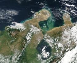
Located at the northernmost tip of Colombia, La Guajira is a department defined by its stark contrasts. From the arid expanses of its desert landscapes to the lush, isolated peaks of the Serranía de Macuira, this region is a crossroads of indigenous heritage, colonial history, and modern industry. Known as Mma'ipakat Wajiira in the Wayuu language, it serves as a vital cultural bridge between Colombia and Venezuela.
Key Facts
- Capital: Riohacha
- Established: July 1, 1965
- Primary Ethnic Group: Wayuu (indigenous)
- Key Industries: Coal mining, salt production, and wind energy
- Total Area: 20,848 km²
- Population: 880,560 (2018)
Geography and Ecoregions
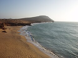
La Guajira is characterized by a diverse and often extreme topography. The region is dominated by the Guajira Peninsula, where the landscape transitions from coastal plains to rugged hills.
Serranía de Macuira
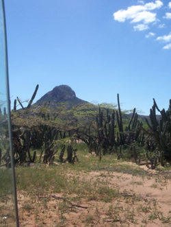
The Serranía de Macuira is a unique mountain range covering 35,000 hectares. It acts as an isolated ecosystem within the La Guajira Desert, functioning as a barrier to humid trade winds from the northeast. A significant portion of this range is protected within the Macuira National Park.
Cerro Pintao and High Altitudes
The Cerro Pintao (Painted Hill) reaches altitudes between 1,600 and 3,688 meters. This area forms a Páramo ecosystem—a high-altitude tundra—and is the source of approximately 13 Colombian rivers.
History and Colonial Legacy
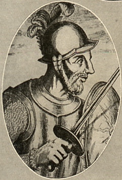
The history of La Guajira is marked by the struggle between colonial ambitions and indigenous resistance. The first colonial village, Nuestra Señora Santa María de los Remedios del Cabo de la Vela, was founded by Martin Fernandez de Enciso. However, constant attacks by the Wayuu people forced the settlement to be refounded as Riohacha in 1535, eventually moving to its current site in 1544.
The Guajira Rebellion
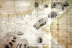
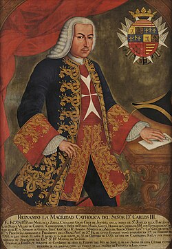
In 1769, tensions peaked when the Spanish captured 22 Wayuu to work on the fortifications of Cartagena. This sparked a massive revolt. At its height, an estimated 20,000 indigenous fighters, some armed with firearms from English and Dutch smugglers, captured and burned nearly all regional settlements. While Spanish reinforcements eventually quelled the rebellion, the Wayuu successfully regained much of their territory.
Modern Evolution
The region's administrative status shifted several times, moving from a national territory in 1871 to an intendencia and commissary, before finally becoming the Department of La Guajira in 1964. In the 1930s, the city of Maicao became a hub for immigrants from the Middle East, including Maronites, Christian Arabs, and Shi'i Muslims from Lebanon, Syria, Palestine, and Jordan.
Demographics and Culture
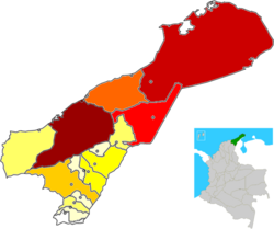
La Guajira possesses the largest indigenous population of any Colombian department. According to 2005 data, 44.9% of the population is indigenous, primarily belonging to the Wayuu, Arhuaco, Koguis, and Wiwa tribes.
The Wayuu People
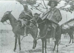
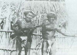
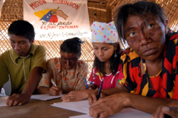
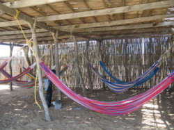
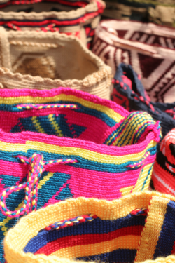
The Wayuu are the most prominent group, particularly in municipalities like Uribia and Manaure. They are known for their nomadic nature, often traveling between Colombia and Venezuela. Their culture is preserved through the Wayuunaiki language and traditional crafts, such as the mochila (woolen bags) and chinchorros (hammocks).
Economy and Infrastructure
The economy of La Guajira is driven by a mix of traditional agriculture and large-scale natural resource extraction.
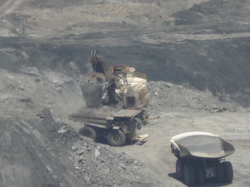
- Mining: The Cerrejón coal mine is one of the region's most significant industrial operations.
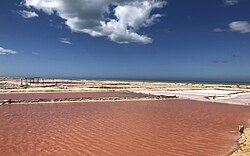
- Salt Production: The Manaure salt evaporation ponds provide approximately 80% of the Colombian salt market.
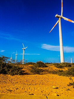
- Energy: The region is embracing renewables, exemplified by the Jepírachi wind farm.
- Agriculture: Key crops include tobacco, coffee, yuca, plantain, and oil palm.
Regional Overview
| Category | Detail |
|---|---|
| Total Area | 20,848 km² |
| Population (2018) | 880,560 |
| GDP | COP 22,263 billion (US$ 5.2 billion) |
| HDI Rank | 30th of 33 Colombian departments |
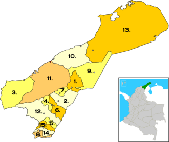
| Number of Municipalities | 15 |
Frequently Asked Questions
What is the origin of the name "Guajira"?
The name comes from Cariban languages and is the Spanish pronunciation of Wajiira or Wahiira. Historically, it was used to describe indigenous families in the Riohacha region known for herding goats.
Which is the most populous city in the department?
Riohacha is the capital and the most populous municipality, accounting for approximately 27.2% of the population based on 2005 census data.
What are the primary languages spoken in La Guajira?
While Spanish is the dominant language for the mestizo population, Wayuunaiki is widely spoken by the Wayuu people. Other indigenous languages include Koguian, Dámana, and Ikan.
How does the region contribute to Colombia's economy?
La Guajira is a critical economic hub due to its massive coal exports from Cerrejón, its dominance in the national salt market via Manaure, and its growing capacity for wind energy production.
What is the climate like in Riohacha?
Riohacha experiences a tropical climate with high temperatures, often peaking near 39°C. Rainfall is seasonal, with the heaviest precipitation occurring between September and November.