Green River: The Mighty Tributary of the American West
Flowing through the rugged landscapes of Wyoming, Colorado, and Utah, the Green River is a vital artery of the American West. As the primary tributary of the Colorado River, it plays a crucial role in the hydrology of the arid Colorado Plateau, carving spectacular canyons and sustaining diverse ecosystems along its 730-mile journey.
Known to the Shoshone people as Seeds-kee-dee-Agie (meaning "Prairie Hen River"), this waterway is more than just a geographic feature; it is a historical corridor that has shaped human migration, industry, and the very identity of the region's river systems.
Key Facts
- Total Length: 730 miles (1,170 km).
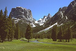
- Source: Wind River Range, Wyoming.
- Mouth: Confluence with the Colorado River in Canyonlands National Park, Utah.
- States Traversed: Wyoming, Colorado, and Utah.
- Primary Basin: The Green River Basin, covering 48,100 square miles.
- Status: Designated as a National Wild and Scenic River in 2019.
Geography and Hydrology
The Green River begins its descent from the Wind River Range in western Wyoming. From its headwaters, it travels through the Upper Green River Valley before meeting the Big Sandy River. As it moves south, the river is shaped by significant geological features, including the Fontenelle and Flaming Gorge reservoirs.
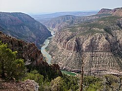
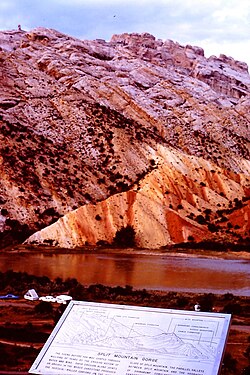
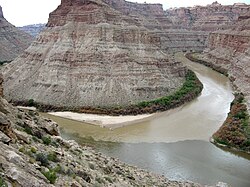
The river's path is dictated by the dramatic uplift of the Uinta Mountains, which forces the water to loop around the range and enter northwestern Colorado. Eventually, it winds through the Dinosaur National Monument, passing through the famous Canyon of the Lodore (the Gates of Lodore) before re-entering Utah and meandering through the Yampa Plateau.
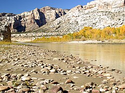
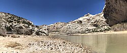
In its lower reaches, the river carves through the Roan Cliffs, flowing through the Desolation and Gray canyons. Its journey concludes in the heart of Canyonlands National Park, where it merges with the Colorado River. While the Colorado is often considered the primary river, the Green River typically carries a larger load of silt at their confluence.
River Dimensions and Flow
The river's scale varies significantly depending on its location. In the upper course, it ranges from 30 to 100 feet wide, expanding to between 300 and 1,500 feet in the lower course. Depth varies from 3 to 50 feet, making it navigable by small craft throughout its length.
At Green River, Utah, the average yearly mean flow is approximately 6,121 cubic feet per second (cu ft/s), though discharge can fluctuate wildly from a minimum of 380 cu ft/s to a maximum of 68,100 cu ft/s.
A Complex Naming History
The identity of the river was once a subject of political debate. Historically, the river that we now call the Colorado was known as the Grand River. The Green River was considered its primary tributary. However, in 1921, U.S. Representative Edward T. Taylor successfully petitioned to rename the Grand River to the Colorado River.
This change occurred despite objections from the U.S. Geological Survey and officials in Wyoming and Utah. The USGS noted that the Green River's drainage basin was actually more extensive than that of the Grand River, even though the Grand typically carried a higher volume of water at the point of confluence.
Historical Significance
Indigenous Cultures and Early Exploration
Long before European arrival, the river valley was home to the Fremont Culture (7th to 13th centuries), known for their pithouses and intricate rock art. Later, the Shoshone and Ute peoples inhabited the region, with the Shoshone residing north of the Uinta Mountains and the Utes to the south.
European exploration brought various names to the river. Spanish friars in 1776 named it Rio de San Buenaventura, though early maps erroneously suggested it flowed into the Great Salt Lake or the Pacific Ocean. By the early 19th century, American trappers used names like "Spanish River" and "Seedskeedee" interchangeably before the name "Green River" became standard.
The Era of Emigration and Mapping
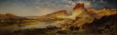
During the mid-19th century, the Green River became a critical landmark for travelers on the Oregon, California, and Mormon emigration trails. Because the river was too deep and wide to ford easily, it became one of the most dangerous obstacles on the Oregon Trail, necessitating the use of various ferries to transport pioneers westward.
The river's true geography was eventually clarified by explorers like John C. Fremont and John Wesley Powell. During his expeditions in 1869 and 1871, Powell mapped the canyons and provided many of the geographic names used today, including "Bowknot Bend."
Natural Resources and Industry
The Green River Basin is a powerhouse of natural resources. The region is home to significant petroleum and natural gas production, particularly in the La Barge and Ashley fields. Additionally, the basin contains the world's largest known deposit of trona ore near Green River, Wyoming, which is essential for the production of soda ash.
While the Green River Formation contains massive deposits of oil shale (kerogen), the technology required to convert this solid rock into liquid oil remains economically challenging and environmentally controversial due to high energy requirements and potential ecological impacts.
Summary of River Characteristics
| Feature | Details |
|---|---|
| Total Length | 730 miles (1,170 km) |
| Basin Size | 48,100 sq mi (125,000 km²) |
| Average Discharge (Utah) | 6,121 cu ft/s |
| Primary Tributaries | Yampa, White, Duchesne, Price, and San Rafael Rivers |
| Major Reservoirs | Fontenelle Reservoir, Flaming Gorge Reservoir |
Frequently Asked Questions
What is the source of the Green River?
The Green River originates in the Wind River Range located in western Wyoming.
Why was the river's name changed in 1921?
The name change was largely political. The "Grand River" was renamed the "Colorado River" to align the name with the river's confluence with the Green River, despite the Green River having a larger drainage basin.
Is the Green River navigable?
Yes, the river is navigable by small craft throughout its course, and large motorboats can travel upstream as far as the Flaming Gorge Dam.
What are the main natural resources found in the Green River Basin?
The basin is known for petroleum, natural gas, uranium, and the world's largest deposits of trona ore used for soda ash production.
How did the river impact westward expansion?
The Green River was a major obstacle for emigrants on the Oregon, California, and Mormon trails. Because it was too deep to ford, travelers relied on ferries to cross the river safely.