Gaza StripPalestineGaza CityHamasIsraeli occupation

Gaza Strip: History, Geography, and Political Status

Gaza Strip The Gaza Strip is a small coastal territory located on the eastern coast of the Mediterranean Sea. Recognized by 157 UN member states as part of the State of Palestine, it is o...

Gaza Strip

The Gaza Strip is a small coastal territory located on the eastern coast of the Mediterranean Sea. Recognized by 157 UN member states as part of the State of Palestine, it is one of the most densely populated areas in the world. The region is characterized by a complex political status, currently consisting of approximately 70% Israeli military occupation, with the remainder under the de facto control of Hamas. Under UNSC Resolution 2803, it falls under the temporary mandate of the National Committee for the Administration of Gaza.

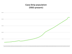
With its capital and largest city, Gaza City, the strip serves as a focal point of regional geopolitical tension and humanitarian concern. Its population, estimated at approximately 2,050,000 as of 2025, lives within a total area of just 365 square kilometers.
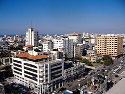
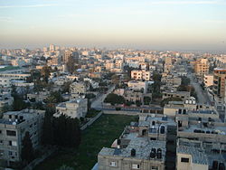
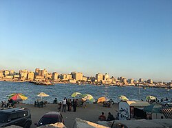
Gaza City skyline, 2007

Key Facts

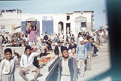
Palestinians in an outdoor market in the Gaza Strip in 1956
  • Total Area: 365 km² (141 sq mi).
  • Population Density: 5,967.5 people per km².
  • Official Language: Arabic.
  • Primary Religion: Sunni Islam (99%), with a small Christian minority (<1%).
  • Currency: Israeli new shekel and Egyptian pound.
  • Administrative Center: Gaza City.

Historical Timeline
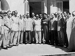
Che Guevara visiting Gaza in 1959

Early Conflict and Displacement (1948–1967)

The modern history of the Gaza Strip is deeply tied to the 1948 war, which saw a massive influx of Palestine refugees into the territory.
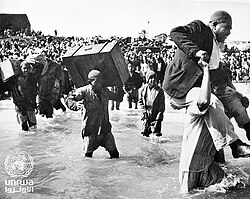
Palestine refugees initially displaced to Beach camp in Gaza board boats to Lebanon or Egypt during the 1948 war

Following the 1948 war, the region saw various periods of administration. Between 1948 and 1959, it was associated with the All-Palestine government. This was followed by a brief Israeli occupation from 1956 to 1957, and subsequently an Egyptian occupation that lasted from 1959 until 1967.
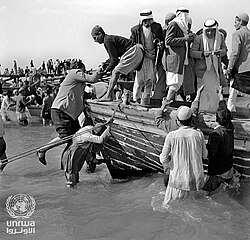
Palestine refugees leave the Gaza Strip on fishing boats in the wake of the war in 1948

Israeli Occupation and the Intifadas (1967–2005)

In 1967, Israel occupied the Gaza Strip. This period was marked by the establishment of Israeli settlements and increasing friction between the military administration and the local population.
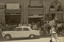
Gaza City in 1967
Gaza City in 1967

The First Intifada (a Palestinian uprising) began in 1987, followed by the Second Intifada in 2000. Both periods were characterized by widespread protests and violent clashes.
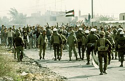
Israeli soldiers opposite Palestinian protesters in the strip during the First Intifada in 1987

In 2005, Israel implemented a unilateral disengagement, removing its permanent military presence and settlements from the interior of the strip.
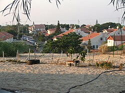
Neve Dekalim was Gush Katif's urban center and its largest community

Hamas Takeover and Blockade (2006–Present)

Following elections in 2006, Hamas took control of the Gaza Strip, leading to a conflict with the Fatah party in 2007. This political shift resulted in a strict blockade imposed by Israel and Egypt, limiting the movement of people and goods.
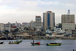
Gaza City in 2007
Gaza City in 2007

The region has since endured multiple wars and crises, including the 2008-2009 Gaza War, the 2014 Gaza War, and the Great March of Return protests in 2018-2019. Most recently, the period from 2023 to 2025 has been marked by an intense war, followed by the introduction of a Gaza peace plan in 2025.
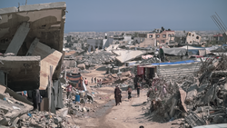
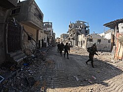
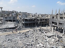
The ruins of Gaza after Israeli airstrikes

Geography and Administration

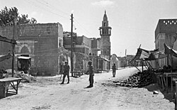
Israeli soldiers in Gaza in 1969

Territorial Divisions

The Gaza Strip is divided into five governorates for administrative purposes:

  • Gaza Governorate
  • North Gaza Governorate
  • Deir al-Balah Governorate
  • Khan Yunis Governorate
  • Rafah Governorate

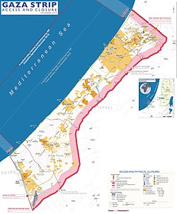
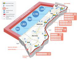
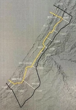
Gaza Strip with Israeli-controlled borders and limited fishing zone, as of December 2012

Environmental and Economic Challenges

The economy of Gaza is heavily impacted by the blockade, with many residents relying on international aid. The territory faces significant environmental issues, including limited access to clean water and restricted fishing zones.
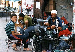
Backyard industry
Backyard industry

Demographics and Culture

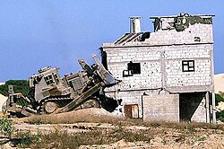
An IDF Caterpillar D9 armored bulldozer demolishing a house in the Gaza Strip during the Second Intifada

Society and Religion

The population is predominantly Palestinian Arab. While Sunni Islam is the official and dominant religion (98-99%), there is a historic Christian community (approximately 1%) that has faced significant challenges in recent years.
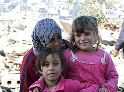
Palestinian girls in Jabalia in 2009

Education and Health

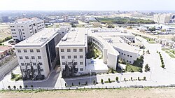
Despite the conflict, Gaza has maintained educational institutions such as the University College of Applied Sciences. Healthcare is provided through various facilities, including the Turkish-Palestinian Friendship Hospital, though the system is often strained by war and resource shortages.
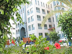
University College of Applied Sciences, the largest college in Gaza

Archaeology and Heritage

Gaza possesses a rich archaeological history spanning several eras. Notable sites include:

  • The Great Mosque of Gaza: A Mamluk-period mosque dating back to the 7th century CE.
  • Church of Saint Porphyrius: Featuring elements from the Crusader period.
  • Tell el-Ajjul: A Bronze Age tell (archaeological mound).
  • Al-Moghraqa: A Bronze Age settlement.

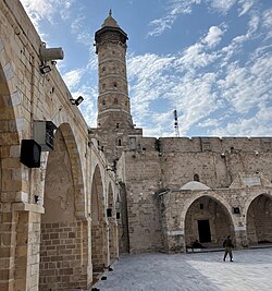
View of the Great Mosque of Gaza, the oldest mosque in Gaza dating to the 7th century CE, which was destroyed by Israeli airstrikes during the Gaza war

Summary Table

Gaza in January 2009
Overview of the Gaza Strip
Category Details
Area 365 km²
Estimated Population (2025) ~2,050,000
Capital Gaza City
Official Language Arabic
Primary Religions Sunni Islam (99%), Christianity (<1%)
Administrative Status Mixed Israeli military occupation and Hamas control

Frequently Asked Questions
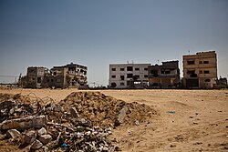
Buildings damaged during the 2008-2009 Gaza war
Gaza City in 2012
Gaza City in 2012
UN OCHA map of the Great March of Return protests, 31 May 2018
2018 Gaza border protests, Bureij refugee camp in Gaza
Israeli soldiers in the Gaza Strip on 31 October 2023
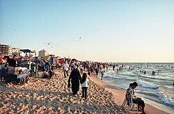
Palestinians on the Gaza beach in 2006
Gaza City in 2018
Gaza City in 2018
Gaza Strip territorial control since 10 October 2025
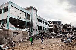
Damaged UN school and remnants of the Ministry of Interior in Gaza City, December 2012
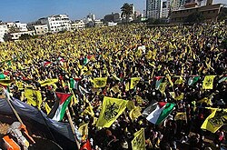
A rally in support of Fatah in Gaza City in January 2013
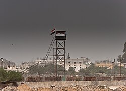
A watchtower on the border between Rafah and Egypt
Beit Hanoun region of Gaza in August 2014, after Israeli bombardments
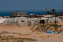
Tent camp, April 2009, after Operation Cast Lead
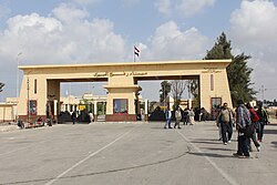
Rafah Border Crossing in 2012
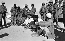
Israeli soldiers check Palestinian men in Gaza in 1969
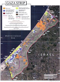
Map of the Gaza Strip in March 1999. The major settlement blocs were the blue-shaded regions of this map.
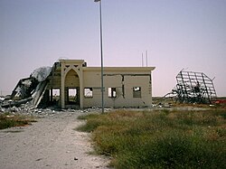
A damaged part of the Yasser Arafat International Airport, 2002
Population of the Gaza Strip from 1950 to present.
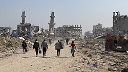
Destroyed mosque in Gaza in 2023
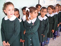
Schoolgirls in Gaza City lining up for class, 2009
The Turkish-Palestinian Friendship Hospital and the IUG Faculty of Medicine buildings
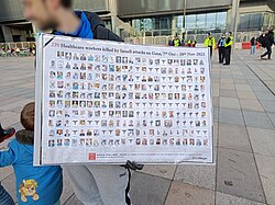
Photos of healthcare workers in Gaza killed during the Gaza war, 25 November 2023
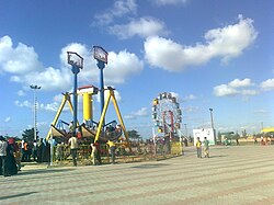
Gaza amusement park
Gaza amusement park
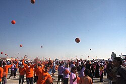
Gaza Summer Games 2010, a children's event organized by the UN Agency for Palestinian Refugees UNRWA

What is the current political status of the Gaza Strip?

As of 2025, approximately 70% of the Gaza Strip is under Israeli military occupation, while the remainder is de facto controlled by Hamas. It is also under the temporary mandate of the National Committee for the Administration of Gaza per UNSC Resolution 2803.

Who are the primary ethnic and religious groups in Gaza?

The population consists almost entirely of Palestinian Arabs. Religiously, the vast majority (99%) are Sunni Muslims, with a small minority (less than 1%) identifying as Christian.

What are the main administrative divisions of the territory?

The Gaza Strip is divided into five governorates: Gaza, North Gaza, Deir al-Balah, Khan Yunis, and Rafah.

What is the significance of the Great Mosque of Gaza?

The Great Mosque of Gaza is the oldest mosque in the city, dating back to the 7th century CE. It is a significant historical site from the Mamluk period, though it has suffered destruction during recent conflicts.

How does the population density of Gaza compare to other areas?

Gaza is one of the most densely populated places on Earth, with approximately 5,967.5 people per square kilometer.

References

  1. Although Israel withdrew from the Gaza Strip in 2005, the United Nations, international human rights organizations and many legal scholars regard the Gaza Strip to still be under military occupation by Israel,[2] as Israel still maintains direct control over Gaza's air and maritime space, most of Gaza's land crossings, a no-go buffer zone within the territory, and the Palestinian population registry. While the majority argues that the Gaza Strip is still occupied,[3] Israel and other legal scholars dispute this noting the lack of effective control.[3][4]
  2. /ˈɡɑːzə/ ;[8] Arabic: قِطَاعُ غَزَّةَ Qiṭāʿ Ḡazza [qɪˈtˤɑːʕ ˈɣaz.za]
  3. Blackburn, Gavin (6 July 2026). "Hamas announces dissolution of Gaza governing body, paves way for technocratic committee". Euro News.
  4. Sanger, Andrew (2011). "The Contemporary Law of Blockade and the Gaza Freedom Flotilla". In Schmitt, M. N.; Arimatsu, Louise; McCormack, Tim (eds.). Yearbook of International Humanitarian Law - 2010. Vol. 13. Springer Science & Business Media. p. 429. doi:10.1007/978-90-6704-811-8_14. ISBN 978-90-6704-811-8. Israel claims it no longer occupies the Gaza Strip, maintaining that it is neither a State nor a territory occupied or controlled by Israel, but rather it has 'sui generis' status. Pursuant to the Disengagement Plan, Israel dismantled all military institutions and settlements in Gaza and there is no longer a permanent Israeli military or civilian presence in the territory. However, the Plan also provided that Israel will guard and monitor the external land perimeter of the Gaza Strip, will continue to maintain exclusive authority in Gaza air space, and will continue to exercise security activity in the sea off the coast of the Gaza Strip as well as maintaining an Israeli military presence on the Egyptian-Gaza border, and reserving the right to reenter Gaza at will. Israel continues to control all of Gaza's seven land crossings, its maritime borders and airspace and the movement of goods and persons in and out of the territory. Egypt controls one of Gaza's land crossings. Gaza is also dependent on Israel for water, electricity, telecommunications and other utilities, currency, issuing IDs, and permits to enter and leave the territory. Israel also has sole control of the Palestinian Population Registry through which the Israeli Army regulates who is classified as a Palestinian and who is a Gazan or West Banker. Since 2000 aside from a limited number of exceptions Israel has refused to add people to the Palestinian Population Registry. It is this direct external control over Gaza and indirect control over life within Gaza that has led the United Nations, the UN General Assembly, the UN Fact Finding Mission to Gaza, International human rights organisations, US Government websites, the UK Foreign and Commonwealth Office and a significant number of legal commentators, to reject the argument that Gaza is no longer occupied.* Scobbie, Iain (2012). Elizabeth Wilmshurst (ed.). International Law and the Classification of Conflicts. Oxford University Press. p. 295. ISBN 978-0-19-965775-9. Even after the accession to power of Hamas, Israel's claim that it no longer occupies Gaza has not been accepted by UN bodies, most States, nor the majority of academic commentators because of its exclusive control of its border with Gaza and crossing points including the effective control it exerted over the Rafah crossing until at least May 2011, its control of Gaza's maritime zones and airspace which constitute what Aronson terms the 'security envelope' around Gaza, as well as its ability to intervene forcibly at will in Gaza.* Gawerc, Michelle (2012). Prefiguring Peace: Israeli-Palestinian Peacebuilding Partnerships. Lexington Books. p. 44. ISBN 9780739166109. Archived from the original on 28 February 2023. Retrieved 8 November 2016. While Israel withdrew from the immediate territory, it remained in control of all access to and from Gaza through the border crossings, as well as through the coastline and the airspace. In addition, Gaza was dependent upon Israel for water, electricity sewage communication networks and for its trade (Gisha 2007. Dowty 2008). In other words, while Israel maintained that its occupation of Gaza ended with its unilateral disengagement Palestinians – as well as many human rights organizations and international bodies – argued that Gaza was by all intents and purposes still occupied.
  5. Cuyckens, Hanne (1 October 2016). "Is Israel Still an Occupying Power in Gaza?". Netherlands International Law Review. 63 (3): 275–295. doi:10.1007/s40802-016-0070-1. ISSN 0165-070X.