Earth's Geographical Extremes: The World's Most Remote and Extreme Locations
Our planet is defined by its superlatives. From the crushing depths of the Pacific Ocean to the thin air of the Himalayas, Earth's geography is a study in extremes. These records are not merely trivia; they define the physical limits of our environment and the challenges of human exploration.
Key Facts
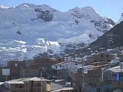
- Highest Elevation: Mount Everest reaches 8,848.86 m above sea level.
- Deepest Point: Challenger Deep in the Mariana Trench descends to 10,928 m.
- Most Remote Land: The continental poles of inaccessibility in Asia are over 2,500 km from any ocean.
- Extreme Temperature: Vostok Station, Antarctica, recorded a low of −89.2 °C.
- Deepest Human Reach: The Kola Superdeep Borehole reached 12,262 m underground.
The Geometry of the Globe: Longest Distances
Measuring the longest continuous lines across the Earth reveals the vast scale of our continents and oceans. These distances are measured along constant latitudes (east-west) and longitudes (north-south).
East-West Extremes
The longest continuous east-west distance on land spans 10,726 km (6,665 mi) along the latitude 48°24'53"N. This line begins at Pointe de Corsen on the west coast of France and stretches through Central Europe, Ukraine, Russia, Kazakhstan, Mongolia, and China, ending on the east coast of Russia.
At sea, the distances are even more staggering. The longest continuous east-west stretch is 22,471 km (13,963 mi) south of Cape Horn. Between two continents, the longest stretch is 15,409 km (9,575 mi) along 18°39'12"N, connecting Hainan, China, to Michoacán, Mexico.
North-South Extremes
The longest continuous north-south land distance is 7,590 km (4,720 mi) along the meridian 99°1'30"E, running from northern Siberia through Mongolia, China, and Myanmar to the south coast of Thailand.
Other significant continental meridians include Africa (7,417 km along 20°12'E), South America (7,098 km along 70°2'W), and North America (5,813 km along 97°52'30"W). In the oceans, the longest north-south distance is 15,986 km along the 34°45'45"W meridian, from Eastern Greenland to the Filchner-Ronne Ice Shelf in Antarctica.
Elevation and Depth: From Peaks to Trenches
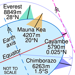
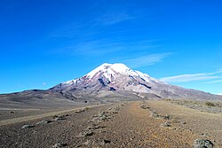
When discussing the "highest" point on Earth, the answer depends on the measurement method. While Mount Everest holds the record for the highest elevation above sea level at 8,848.86 m, Mauna Kea is the tallest mountain when measured from its base to its peak, with a dry prominence of 9,330 m.
Other geophysical records include the Rupal Face of Nanga Parbat, the world's greatest mountain face at 4,600 m, and Mount Thor in Canada, which boasts the greatest purely vertical drop of 1,200 m.
The Lowest Points
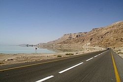
The lowest natural point on land is the Dead Sea, located between Israel, Jordan, and Palestine, sitting at 424 m below sea level.
In the oceans, the Challenger Deep in the Mariana Trench is the deepest known point at 10,928 m. Interestingly, the point on the ocean surface farthest below the global mean sea level is the Indian Ocean Geoid Low, which sits approximately 106 m below the average.
Subterranean Extremes
Humans have pushed deep into the crust. The deepest artificial point ever reached was the Kola Superdeep Borehole at 12,262 m. In terms of mining, the Mponeng Gold Mine in South Africa is the deepest below ground level at 4,000 m.
Remoteness and Inaccessibility

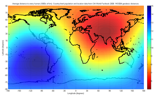
The Pole of Inaccessibility is the location farthest from any coastline. On land, the Eurasian poles (EPIA1 and EPIA2) are approximately 2,510 to 2,514 km from the nearest ocean.
![Map of distance to the nearest coastline[69] (including oceanic islands, but not lakes) with red spots marking the poles of inaccessibility of main landmasses, Great Britain, and the Iberian Peninsula, and a blue dot marking the oceanic pole of inaccessibility. Thin isolines are 250 km (160 mi) apart; thick lines 1,000 km (620 mi). Mollweide projection.](/images/f6/9d/f69df72b7116d5b2abd89f44aa234c60ec0d182dced2d45e5f2f91a494ddf552.png)
Urban remoteness is also measured by the distance between major population centers. Auckland, New Zealand, is the most remote city with over one million people, with its nearest comparable neighbor, Sydney, located 2,168.9 km away.
Continental Extremes Summary
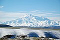
The following table summarizes the highest and lowest elevations and the recorded temperature extremes across the world's continents.
| Continent | Highest Elevation | Lowest Elevation | Highest Temp | Lowest Temp |
|---|---|---|---|---|
| Africa | 5,893 m (Kilimanjaro) | −155 m (Lake Assal) | 55 °C (disputed) | −23.9 °C |
| Antarctica | 4,892 m (Vinson Massif) | −50 m (Deep Lake) | 20.75 °C | −89.2 °C |
| Asia | 8,848.86 m (Everest) | −424 m (Dead Sea) | 54 °C | −71.2 °C (extrapolated) |
| Europe | 5,642 m (Elbrus) | −28 m (Caspian Sea) | 48.8 °C | −58.1 °C |
| North America | 6,190.5 m (Denali) | −85 m (Badwater Basin) | N/A | −69.6 °C |
| Oceania | N/A | −15 m (Lake Eyre) | N/A | −25.6 °C |
| South America | 6,962 m (Aconcagua) | −105 m (Laguna del Carbón) | 48.9 °C | −32.8 °C |
Frequently Asked Questions



What is the difference between the highest mountain and the tallest mountain?
The highest mountain, Mount Everest, is measured by its elevation above sea level. The tallest mountain, Mauna Kea, is measured from its base on the ocean floor to its peak, making it taller overall despite having a lower summit elevation.
Where is the most remote place on land?
The continental poles of inaccessibility in Central Asia (EPIA1 and EPIA2) are the most remote, located roughly 2,510 to 2,514 km away from the nearest ocean.
What is the deepest point in the world's oceans?
The deepest point is the Challenger Deep, located in the Mariana Trench in the Pacific Ocean, reaching a depth of 10,928 m.
Which city is considered the most remote major city?
Auckland, New Zealand, is the most remote city with a population exceeding one million, as the nearest city of similar size (Sydney) is 2,168.9 km away.
What is the lowest point on the Earth's surface accessible to humans?
The surface of the Arctic Ocean at the Geographic North Pole is the point on the atmospheric surface closest to the Earth's centre, at 6,356.77 km.