Dead Sea: Geography, Geology, and Environmental Challenges
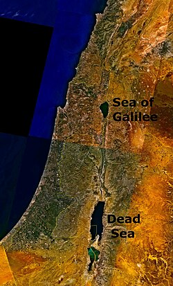
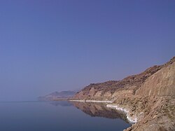
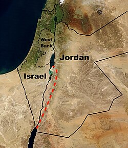
The Dead Sea is one of the most unique bodies of water on Earth. Located in West Asia, this hypersaline lake is bordered by Jordan to the east, and Israel and the West Bank to the west. Known for its extreme salinity and its position as the lowest land-based elevation on the planet, it serves as a critical site for geological study, historical discovery, and wellness tourism.
As an endorheic lake—a closed basin that retains water and allows no outflow—the Dead Sea collects minerals and salts over millennia, resulting in a chemical composition that makes it nearly impossible for most aquatic life to survive.
Key Facts
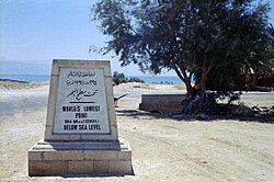
- Lowest Point: The surface elevation is approximately 439.78 meters (1,443 ft) below sea level as of 2025.
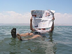
- Extreme Salinity: The water is hypersaline, creating a high density (around 1.25 g/cm) that allows humans to float effortlessly.
- Rapid Recession: The surface area has shrunk from 1,050 km² in 1930 to 605 km² by 2016.
- Primary Inflow: The Jordan River is the main source of water feeding the basin.
- Historical Significance: The area near Qumran is where the famous Dead Sea Scrolls were discovered.
Geography and Hydrology
The Dead Sea basin is fed by several sources, though the Jordan River is the primary inflow from the north. Other contributing water sources include the Arava Stream from the south, as well as various wadis (seasonal riverbeds) such as Wadi Mujib, Wadi al-Hasa, and Nahal Arugot. Groundwater seepage and direct rainfall also contribute to the water volume.
The lake is characterized by its extreme depth and narrow width, with a maximum depth of 298 meters (978 ft). However, the most striking geographic feature is its elevation; the deepest point of the basin reaches 728 meters (2,388 ft) below sea level.
Geology and Chemical Composition
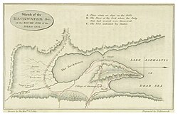
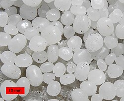
The geology of the Dead Sea is defined by massive salt deposits. Halite (rock salt) is prevalent along the shores, forming unique "teepee" structures and cementing pebbles together near areas like Ein Gedi.
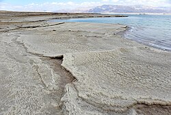
The water's chemistry has evolved over time. In the 19th century, the surface layers were less salty, with a salinity of around 19% and a density between 1.15 and 1.17 g/cm. Today, the density has increased to approximately 1.25 g/cm, significantly increasing the buoyancy of objects and people in the water.
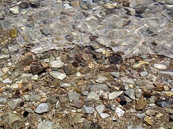
Beyond the shoreline, the region features salt mounts, such as Mount Sodom, which is composed largely of halite. This mountain is home to the famous "Lot's Wife" pillar, a natural salt formation.
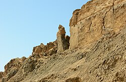
Summary of Dead Sea Physical Characteristics
| Feature | Detail |
|---|---|
| Lake Type | Endorheic / Hypersaline |
| Surface Area (2016) | 605 km² (234 sq mi) |
| Max Depth | 298 m (978 ft) |
| Surface Elevation (2025) | −439.78 m (−1,443 ft) |
| Primary Inflow | Jordan River |
| Catchment Area | 41,650 km² |
Climate and Wellness
The Dead Sea region experiences a harsh climate with very low annual precipitation and high summer temperatures, sometimes reaching record highs of 47°C (116.6°F). Despite the heat, the unique environment is used for various putative therapies:
- Heliotherapy: Treatment utilizing the biological effects of solar radiation.
- Thalassotherapy: Treatment involving bathing in the mineral-rich, hypersaline waters.
Human History and Tourism
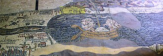
The region has been inhabited for millennia. In the late 1940s and early 1950s, the Dead Sea Scrolls—Jewish religious documents dating from 150 BCE to 70 CE—were discovered in caves near Qumran. Ancient maps, such as the 6th-century Madaba Map, depict cargo boats on the sea, indicating its historical role in trade.
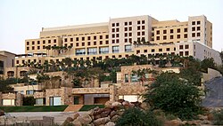
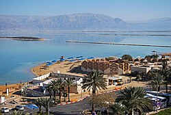
Today, the Dead Sea is a major tourist destination. Israel and Jordan both host numerous resorts, such as Ein Bokek in Israel and the Kempinski Hotel in Jordan, catering to visitors seeking the health benefits of the salt-rich environment.
Environmental Crisis and Recession
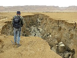
The Dead Sea is receding at an alarming rate. Between 1930 and 2016, its surface area dropped from 1,050 km² to 605 km². This recession is evidenced by the appearance of salt deposits where water once stood and the formation of dangerous sinkholes caused by the dissolution of underground salt layers.
To combat this, several projects have been proposed. In 2013, Israel, Jordan, and the Palestinian Authority signed an agreement for the Red Sea–Dead Sea Water Conveyance, a proposed 180 km pipeline designed to pump water from the Red Sea to replenish the Dead Sea. However, this project has faced significant delays and was eventually reported as scrapped.
Frequently Asked Questions
![Views in 1972, 1989, and 2011 compared[90]](/images/4f/91/4f9157dd91f63c384b8c8e099bbaef25d86298e28ba6cc68997a42cc59a92166.jpg)
Why is it called the Dead Sea?
It is named the Dead Sea because its extreme salinity and bitterness make it impossible for fish or other aquatic plants and animals to survive in its waters.
Why do people float in the Dead Sea?
The high concentration of dissolved salts increases the water's density to approximately 1.25 g/cm, which provides significantly more buoyancy than freshwater or standard seawater.
What are the Dead Sea Scrolls?
They are a collection of ancient Jewish religious documents dating between 150 BCE and 70 CE, discovered in caves near Qumran in the mid-20th century.
How fast is the Dead Sea shrinking?
The sea has seen a dramatic decline in surface area, dropping from 1,050 km² in 1930 to 605 km² by 2016, with water levels reported to drop by approximately 1 meter per year in some periods.
What is the lowest point on Earth?
The shores of the Dead Sea represent the lowest dry point on Earth's surface, with elevations reaching nearly 440 meters below sea level.