County Route 533
County Route 533 (CR 533) is a significant county highway in New Jersey, spanning 32.7 miles (52.6 km) across Mercer and Somerset counties. From its southern origin at the White Horse Circle in Hamilton to its northern terminus at the border of Bound Brook and Middlesex Borough, the route serves as a vital link for local commuters and history enthusiasts alike.
Beyond its utility as a roadway, CR 533 is steeped in American history. George Washington utilized this path during his strategic march from Trenton to Princeton during the American Revolution, a legacy marked today by several small stone pillars placed along the route.
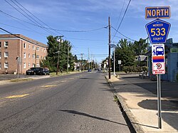
Key Facts
- Total Length: 32.7 miles (52.6 km).
- Counties Served: Mercer and Somerset.
- Scenic Designation: Portions in Somerset County are part of the Millstone River Valley Scenic Byway.
- Historic Significance: Follows the path taken by George Washington during the American Revolution.
- Major Concurrency: Shares a 6.5-mile stretch with US 206.
Route Description
White Horse to Princeton
The southern segment of CR 533 provides a direct alternative between two sections of US 206. Starting at the White Horse Circle in Hamilton, the route begins as White Horse Avenue and White Horse-Mercerville Road. In this initial stretch, it provides critical access to I-295 (exit 61) and I-195 (exit 2) via Arena Drive (CR 620).
As it progresses through Mercerville, the road intersects Route 33 and later meets a five-point intersection with CR 535 and CR 618, continuing north as Quakerbridge Road. This section marks the beginning of the historic trail used by Washington. The road widens to four lanes near the intersection of CR 649, which offers further access to I-295 at exit 65.
Continuing along the border of Lawrence and West Windsor, the route crosses the Amtrak Northeast Corridor and passes the Quaker Bridge Mall before reaching a cloverleaf interchange with US 1. After briefly becoming Province Line Road and passing the Nassau Park shopping center, it becomes the unsigned Quaker Road. It eventually crosses the Delaware and Raritan Canal at Port Mercer and enters Princeton, crossing Stony Brook via Quaker Bridge before meeting US 206.
Concurrency with US 206
For approximately 6.5 miles (10.5 km), CR 533 runs concurrently with US 206. During this stretch, the route is not signed as CR 533. Key landmarks along this shared path include Drumthwacket, the southern terminus of Route 27 at Nassau Street in downtown Princeton, and the Princeton Airport in Montgomery. The concurrency concludes after crossing the Beden Brook.
Montgomery to Bound Brook
After splitting from US 206 in northern Montgomery, CR 533 becomes River Road (northbound) and Orchard Road (southbound), running parallel to the Millstone River and the Delaware and Raritan Canal. This scenic stretch leads into the borough of Millstone, where the road becomes Main Street and intersects with CR 514.
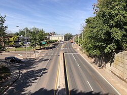
After passing the Central Jersey Regional Airport, the route enters Manville as South and North Main Street. It then crosses the Raritan River via Van Veghten's Bridge into Bridgewater, where it becomes Finderne Avenue. The final leg of the journey takes the route east through Finderne, passing TD Bank Ballpark and the Bridgewater railroad station.
In Bound Brook, the road becomes Talmage Avenue and eventually forms a concurrency with CR 527 through the downtown area. The route concludes on a bridge connecting Bound Brook to Middlesex Borough, where it terminates at Lincoln Boulevard (CR 607).
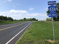
CR 533 Spur (Bypass)
The CR 533 Spur, also signed as the CR 533 Bypass, is a short 0.4-mile (0.64 km) connector known as Somerset Courthouse Road. It links the Millstone Bypass (CR 514) in Millstone to River Road (CR 533) in Hillsborough, with a single intersection at Hamilton Road.
Route Summary Table
| Feature | Detail |
|---|---|
| Total Distance | 32.7 miles (52.6 km) |
| Southern Terminus | US 206 / CR 524 (Hamilton) |
| Northern Terminus | CR 607 (Bound Brook/Middlesex line) |
| Major Concurrencies | US 206, CR 527 |
| Scenic Byway | Millstone River Valley Scenic Byway |
Frequently Asked Questions
What is the historical significance of CR 533?
CR 533 follows the path George Washington took during his march from Trenton to Princeton during the American Revolution, which is commemorated by stone pillars along the road.
Where is CR 533 not signed?
The route is not signed during its 6.5-mile concurrency with US 206 through Princeton and Montgomery, nor is it signed as Quaker Road in certain sections.
What is the CR 533 Bypass?
The CR 533 Bypass, also known as the CR 533 Spur or Somerset Courthouse Road, is a 0.4-mile stretch connecting CR 514 in Millstone to CR 533 in Hillsborough.
Which major landmarks are located along CR 533?
Notable landmarks include the Quaker Bridge Mall, Drumthwacket, Princeton Airport, TD Bank Ballpark, and the Delaware and Raritan Canal.
How does CR 533 connect to major interstates?
In southern Hamilton, CR 533 provides access to I-295 (exit 61) and I-195 (exit 2) via Arena Drive, as well as I-295 (exit 65) via Sloan Avenue/Flock Road.