County Route 526
County Route 526 (CR 526) is a significant county highway in New Jersey, spanning 35.56 miles (57.23 km) across the heart of the state. Connecting West Windsor Township to Lakewood Township, this route serves as a vital artery through Mercer, Monmouth, and Ocean counties, blending residential neighborhoods, industrial zones, and scenic agricultural landscapes.
While the official western terminus is located at the intersection of Princeton–Hightstown Road (CR 571) in West Windsor, motorists will often find signage indicating that the route continues northwest along CR 571, extending all the way to Route 27 in Princeton.
Key Facts
- Total Length: 35.56 miles (57.23 km).
- Counties Served: Mercer, Monmouth, and Ocean.
- Major Termini: Starts at CR 571 (West Windsor) and ends at CR 549 (Lakewood).
- Tourist Designation: Part of the Upper Freehold Historic Farmland Byway.
- Key Intersections: US 130, Route 33, I-195, and US 9.
Route Description and Path
Mercer County Segment
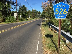
Beginning in West Windsor Township, CR 526 starts as the two-lane undivided South Mill Road. The route transitions through various jurisdictions, moving from county to municipal maintenance at Woodmere Way on New Edinburg Road, before returning to county control after crossing CR 644. As it progresses south, the road intersects CR 535 and CR 641, briefly joining CR 535 on Old Trenton Road before continuing south on Robbinsville Road.
Upon entering Robbinsville Township, the landscape shifts toward a mix of farms, woodlands, and residential subdivisions. The route briefly joins Route 33 before following Robbinsville–Allentown Road, where it crosses an abandoned railroad line and meets U.S. Route 130. After a short concurrency with US 130 on a four-lane divided highway, it resumes as the two-lane Robbinsville Bypass. This section passes over the New Jersey Turnpike (I-95) and concludes its Mercer County stretch at an interchange with I-195.
Monmouth County Segment
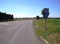
Entering Allentown in Monmouth County, CR 526 forms a short concurrency with CR 524 and CR 539 on Main Street. Continuing east via Waker Avenue, the route enters Upper Freehold Township. Here, it intersects the CR 526 Spur and crosses several landmarks, including Sharon Station Road (CR 539 Alt.), the Union Transportation Trail (a former railroad line), and CR 43.
As the road passes Red Valley Lake and enters Millstone Township, it becomes Trenton–Lakewood Road. After crossing over I-195 and intersecting CR 571, the route turns south to run concurrently with CR 571 through forested areas.
Ocean County Segment
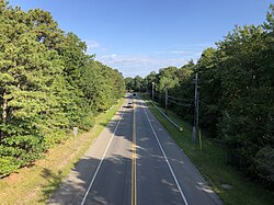
The route enters Jackson Township upon crossing CR 537. After passing under I-195, CR 526 splits from CR 571 and turns east onto West Commodore Boulevard. It eventually becomes East Commodore Boulevard and briefly joins CR 638 as Jackson Mills Road, later changing its name to County Line Road.
As it approaches the CR 636 junction, the road widens into a four-lane divided highway with jughandles. It then serves as the border between Jackson Township and Lakewood Township. After intersecting CR 641, it becomes a four-lane undivided road. The route eventually narrows back to two lanes after the US 9 junction, crossing the Southern Secondary railroad line before turning southeast to meet CR 623. The final stretch, known as Lanes Mill Road, ends at the intersection with CR 549.
The CR 526 Spur
The CR 526 Spur, also known as the Allentown Bypass, is a 0.44-mile (0.71 km) connector completed in 2003. Located entirely within Upper Freehold Township, it allows through traffic to bypass the Borough of Allentown, connecting Allentown-Red Valley Road (CR 526) to Old York Road (CR 524 and CR 539). The road is two lanes wide and provides access to the Reed Recreation Area.
Route Summary Table
| Feature | Details |
|---|---|
| Total Distance | 35.56 miles (57.23 km) |
| Western Terminus | CR 571, West Windsor Township |
| Eastern Terminus | CR 549, Lakewood Township |
| Counties | Mercer, Monmouth, Ocean |
| Key Byway | Upper Freehold Historic Farmland Byway |
| Spur Length | 0.44 miles (0.71 km) |
History
The origins of CR 526 date back to the 19th century. The section west of Imlaystown was originally composed of two separate turnpikes: the Trenton and Allentown Turnpike and the Allentown and Imlayston Turnpike, both of which were chartered in 1858 to establish a connection between those two points.
Frequently Asked Questions
Where does County Route 526 officially begin and end?
CR 526 officially begins at the intersection of CR 571 in West Windsor Township (Mercer County) and ends at CR 549 in Lakewood Township (Ocean County).
What is the purpose of the CR 526 Spur?
The CR 526 Spur, also known as the Allentown Bypass, was completed in 2003 to allow through traffic to bypass the Borough of Allentown, reducing congestion in the town center.
Which major highways does CR 526 intersect?
The route has several major junctions, including US 130, Route 33, I-195, and US 9.
Is CR 526 part of any scenic or tourist routes?
Yes, CR 526 is part of the Upper Freehold Historic Farmland Byway, highlighting the agricultural heritage of the region.
Does CR 526 extend beyond its official western terminus?
While it officially starts at CR 571 in West Windsor, signage typically indicates that the route continues northwest along CR 571 until it reaches Route 27 in Princeton.