Chile Geography and Environmental Profile
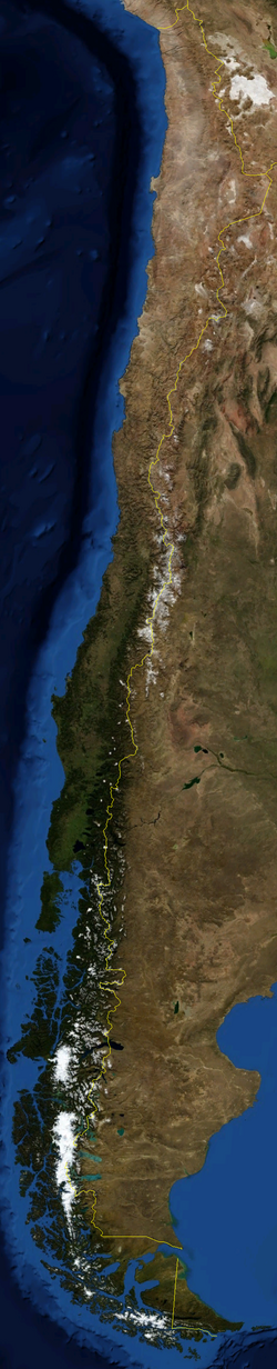
Located in the Southern Cone of South America, Chile is a distinctive nation characterized by its extreme longitudinal stretch. Situated in both the Southern and Western Hemispheres, this Latin American country is defined by a diverse landscape that ranges from the arid north to the glacial south.
Chile's strategic position provides it with a vast coastline and a complex relationship with its neighbors, making it a key geographic study in the region.
Key Facts
- Highest Point: Ojos del Salado at 6,893 meters (22,615 ft).
- Total Area: 756,950 km² (292,260 sq mi), ranking as the 38th largest country.
- Coastline: 6,435 km (3,999 mi).
- Population: 16,763,470 (as of 2008), the 63rd most populous country.
- Capital: Santiago.
Geographic Boundaries and Extremes
Chile shares land boundaries totaling 6,339 km (3,939 mi). Its longest border is with Argentina (5,308 km), followed by Bolivia (860 km) and Peru (171 km). To the north, the country meets a tripartite border where Bolivia and Peru also converge.
The country's extreme points vary depending on whether territorial claims in Antarctica are included:
- North: The tripartite border with Bolivia and Peru.
- South: Águila Islet in the Diego Ramírez Islands (mainland) or the South Pole (including Antarctica).
- West: Motu Nui, located off the coast of Easter Island.
- East: Nueva Island (mainland) or the 53rd meridian west over Antarctica.
Environmental and Geological Profile
The geology of Chile is marked by intense tectonic activity, leading to frequent earthquakes and significant volcanism. These forces have shaped the country's dramatic topography, creating towering mountains and deep valleys.
Natural Features and Biodiversity
Chile's environment is a mosaic of ecoregions, supporting a wide array of flora and fauna, including specialized bird and mammal species. The landscape is further defined by its glaciers, lakes, and rivers, many of which are protected within national parks and biosphere reserves.
Climate and Energy
The climate varies drastically from north to south, influencing the distribution of wildlife and human settlement. In response to its natural resources, Chile has integrated renewable energy into its infrastructure to manage its environmental impact.
Administrative and Demographic Structure
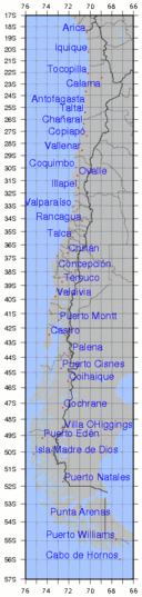
Chile is organized into a hierarchical system of administrative divisions to manage its elongated territory. This structure consists of regions, which are further divided into provinces and communes.
The population is concentrated in various cities, with the capital, Santiago, serving as the primary urban and political hub. Demographically, the country maintains a diverse population spread across these varied geographic zones.
| Category | Detail |
|---|---|
| Total Area | 756,950 km² |
| Coastline Length | 6,435 km |
| Highest Elevation | 6,893 m (Ojos del Salado) |
| Land Borders | Argentina, Bolivia, Peru |
| Population (2008) | 16,763,470 |
| Capital City | Santiago |
Frequently Asked Questions
What are the time zones used in Chile?
Chile uses multiple time zones: Easter Island is UTC-06 (UTC-05 in October–March), the Magallanes Region is UTC-03, and the rest of the country is UTC-04 (UTC-03 in October–March).
Which is the highest point in Chile?
The highest point is Ojos del Salado, reaching an elevation of 6,893 meters (22,615 ft).
What are the land borders of Chile?
Chile shares borders with Argentina (5,308 km), Bolivia (860 km), and Peru (171 km).
How is Chile administratively divided?
Chile is divided into regions, which are then subdivided into provinces and communes.
What is the southernmost point of Chile?
On the mainland, the southernmost point is Águila Islet in the Diego Ramírez Islands; however, including Antarctic claims, it extends to the South Pole.